

Directions
Anna Creek Cabin is located 30 miles from Hungry Horse, MT on the West Side Hungry Horse Reservoir Road (895). From Hungry Horse, turn south on Road 895, cross the Hungry Horse Dam and continue 29 miles on the west side of Hungry Horse Reservoir to the cabin. The cabin is located on the west side of the road between mile marker 28 and 29, accessed via a short driveway. Be sure to close the gate behind you on your way up to the cabin.
Phone
406-387-3800
Activities
BOATING, CAMPING, FISHING, HIKING, WILDLIFE VIEWING
Keywords
Related Link(s)
Overview
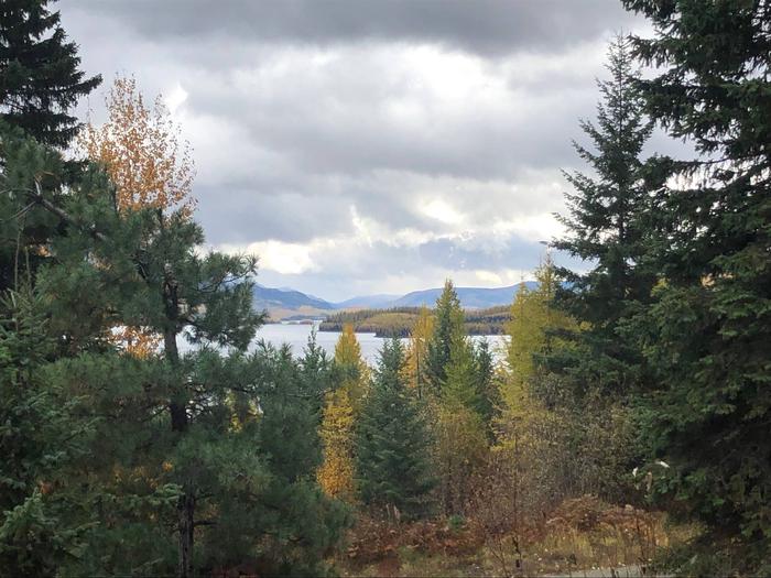
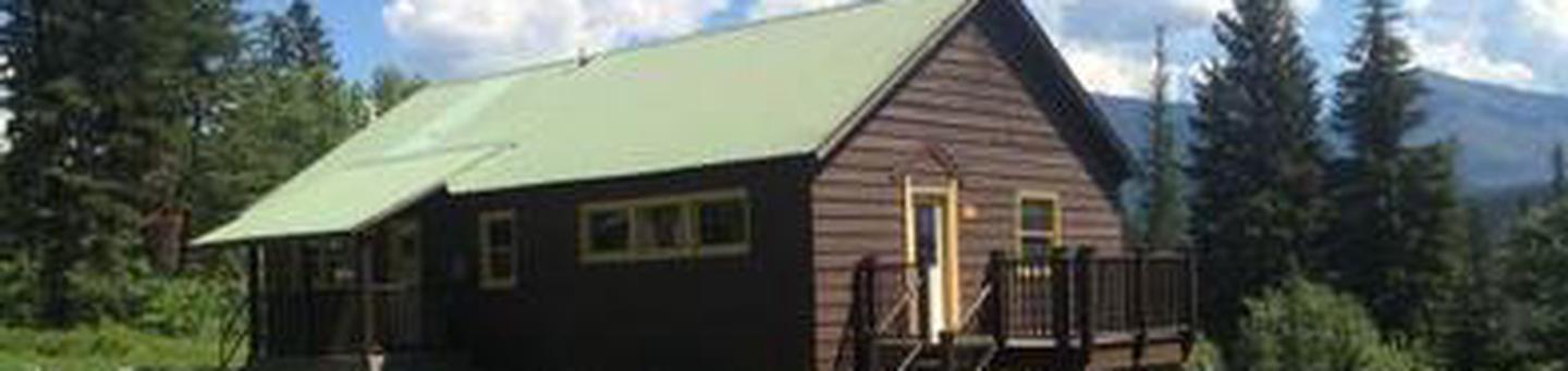
Anna Creek Cabin is located 30 miles south of the town of Hungry Horse, perched above Hungry Horse Reservoir with sweeping views of the reservoir and the Great Bear Wilderness. The cabin provides a private setting to enjoy the recreation opportunities along the west side of Hungry Horse Reservoir. Located half way down the reservoir, the cabin provides a delightful setting for viewing wildlife and enjoying the peaceful surrounding.
Recreation
The cabin location provides a base to explore the numerous recreation opportunities along the west side of Hungry Horse Reservoir. Visitors can access the water within a short drive to Graves Bay, Graves Creek or Handkerchief Lake for fishing, swimming or boating. Access to hiking trails along pioneer ridge or the east side of Jewel Basin are in close proximity to the cabin. Other popular activities such as driving for pleasure, berry picking, wildlife watching, and fishing are abundant in the area around the cabin.
Facilities
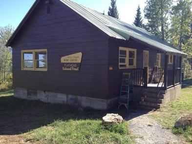
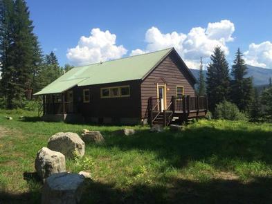
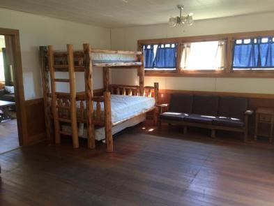
This single story cabin is equipped with a propane cook stove, heater, lights and accessible vault toilet. Indoor accommodations sleep up to 12 people on one double bed, two twin beds, two double/twin bunk beds, plus two twin roll out trundle beds. Outside, enjoy the campfire pit with barbecue grate and the deck on the south side of the cabin.
No drinking water or electricity are available. Guests should bring plenty of water, bedding, food, flashlights, basic camping gear, tools to gather outdoor firewood, among other necessities.
Natural Features
The cabin is set up above the West Side Hungry Horse Reservoir road providing privacy and scenic views. The west side of the cabin and large parking area backs up to the forest with Anna creek flowing through. The east side of the cabin offers open views of the Great Bear Wilderness. The site offers a nice mix of shade and sun.
Nearby Attractions
Water access to Hungry Horse Reservoir, Graves Creek and Handkerchief Lake are a short drive away.