BACKBONE ROCK RECREATION AREA PAVILIONS, TENNESSEE Campground Reservation, Info, Images, Map, Directions

BACKBONE ROCK RECREATION AREA PAVILIONS, Tennessee Campground Images, Info & Reservations

Listen

Directions

From Bristol, TN take US 421 south for 20 miles to Shady Valley. Turn left onto TN 133 for eight miles to the recreation area. From Abingdon, VA, take US 58 east for 15 miles to Damascus. Turn right onto VA 716 for five miles to the recreation area (VA 178 becomes TN 133 at the state line).

Phone

423-735-1500

Activities

FISHING, HIKING, WILDLIFE VIEWING, SWIMMING, STAR GAZING, WATER ACCESS, SCENIC DRIVE

Keywords

BACKBONE ROCK RECREATION AREA PAVILIONS,BACKBONE ROCK,BACKBONE

Related Link(s)

Rec Area Info & Images

Overview

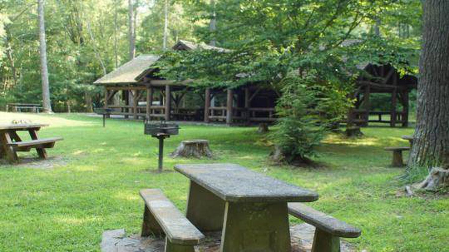
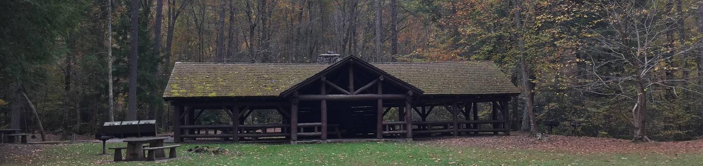
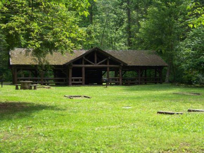
The pavilion at Backbone Rock Recreation Area is a popular location for family reunions, weddings and other types of group gatherings. The pavilion is large and adjacent to an expansive field, Beaverdam Creek and a large parking area. The area includes accessible grills, picnic tables, trash cans, and vault toilets. Backbone Rock Recreation Area Pavilion #1 will close for the season on Tuesday, November 26, 2019. 

Recreation

There is a trail that will take you to the top of Backbone Rock, following a stone-step wooded path. The trail crosses the rock and leads to Beaverdam Creek or Backbone Rock Falls. The Appalachian National Scenic Trail adjoins Backbone Rock Trail. Beaverdam Creek is known for its excellent fishing.

Facilities

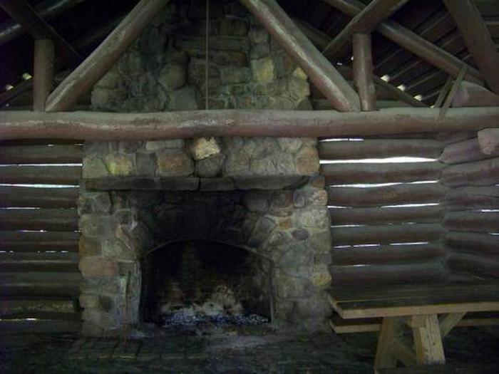
There is a Civilian Conservation Corps (CCC) -era pavilion, picnic tables and grills. The pavilion includes a stone fireplace and four large picnic tables with additional tables and grills nearby. Vault toilets are located within the parking area.

Natural Features

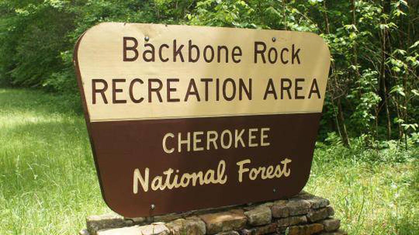
Backbone Rock Recreation Area is located along Beaverdam Creek in northern Johnson County. Backbone Rock gets its name from a spur ridge on Holston Mountain that ends abruptly at a bend in Beaverdam Creek. A tunnel was drilled through the rock in 1901 to allow railroad access between Shady Valley, TN and Damascus, VA. Motorists pass through what is locally known as “The shortest tunnel in the world” as they travel along TN 133. 

Nearby Attractions

Damascus, Virginia is five miles north of Backbone Rock for any in-town needs.

Reservation

More from CampingHiking.net:

ROCK CREEK (SIERRA NATL FORES), California Campground Images, Info & Reservations

Listen Directions From Fresno, California, take Highway 41 north. Turn east on Forest Road 200 and pass through North Fork. Take Minarets Road east for 22 miles to Rock Creek Campground. Phone 559-642-3212 Activities BOATING, CAMPING, FISHING, HIKING, SWIMMING SITE Keywords ROCK,ROCK CREEK SIERRA NAT L FORES,SIERRA NF – FS,Rock,rock,rock

GUN CREEK, Illinois Campground Images, Info & Reservations

Listen Directions From I-57 take exit 77 and turn west on Route 154. Turn left onto Gun Creek Trail/Larry Foster Parkway, then right onto Golf Course Road. Continue 1/2 mile to park entrance. Phone 618-724-2493 Activities BIKING, BOATING, HISTORIC & CULTURAL SITE, CAMPING, FISHING, HIKING, PICNICKING, WILDLIFE VIEWING, KAYAKING Keywords

MILLERS FERRY CAMPGROUND, Alabama Campground Images, Info & Reservations

Listen Directions From Camden, Alabama, take State Route 28 northwest for 12 miles. Turn right before the Lee Long Bridge and follow signs into the campground. Phone 334-682-4191 Activities BOATING, CAMPING, FISHING, HUNTING, SWIMMING SITE Keywords MILF,EAST BANK,ALABAMA RIVERS,MILLERS FERRY LAKE,WILLIAM DANNELLY,ALABAMA RIV. – DAN Related Link(s) Rec Area Info

HALLSTED, California Campground Images, Info & Reservations

Listen Directions From Oroville, travel east on Highway 70 for about 65 miles. From Quincy, travel west on Highway 70 for 17 miles. Phone 530-283-0555 Activities CAMPING Keywords HALL,TWAIN,FEATHER RIVER CANYON,PLUMAS NF – FS Related Link(s) Rec Area Info & Images California State Road Conditions California State Tourism Forest Service

FLAT CANYON, Utah Campground Images, Info & Reservations

Listen Directions From Fairview, Utah, travel east on Highway 31 to Highway 264, then continue east on Highway 264 for four miles. Phone (435)283-4151 Activities BIKING, BOATING, CAMPING, FISHING, HIKING Keywords FLAC,MANTI-LASAL NF -FS Related Link(s) Rec Area Info & Images Utah State Tourism Utah State Road Conditions Overview Flat