FLAT CANYON, UT Campground Reservation, Info, Images, Map, Directions

FLAT CANYON, Utah Campground Images, Info & Reservations

Listen

Directions

From Fairview, Utah, travel east on Highway 31 to Highway 264, then continue east on Highway 264 for four miles.

Phone

(435)283-4151

Activities

BIKING, BOATING, CAMPING, FISHING, HIKING

Keywords

FLAC,MANTI-LASAL NF -FS

Related Link(s)

Rec Area Info & Images

Utah State Tourism

Utah State Road Conditions

Overview

Flat Canyon Campground is located high on the Wasatch Plateau, at an elevation of 8,800 feet. The site is conveniently located near Electric Lake, where visitors enjoy boating and fishing.

Recreation

A trail leads from the campground to small Boulger Reservoir, directly below the site. Electric Lake is approximately one mile away. Boating, fishing, hiking, biking and scenic driving are popular activities in the area.

Facilities

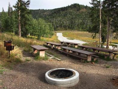
The campground contains one group site that can accommodate up to 50 people. Several single-family campsites are available within the campground as well. Picnic tables and fire rings are provided, as are vault toilets.

Natural Features

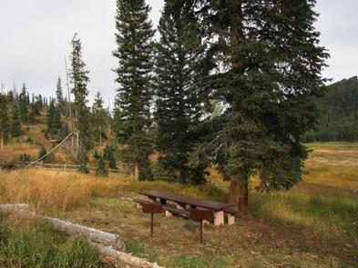
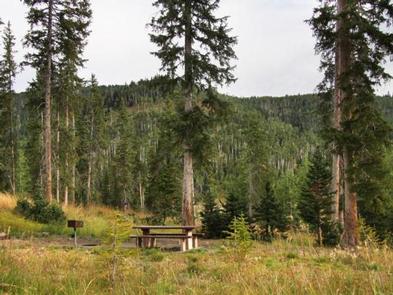
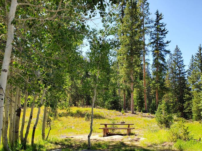
The campground is situated on a hillside above the highway. Hundreds of hazardous trees have been removed from the site, opening up the canopy and reducing shade to a minimum. Several large spruce trees remain, however, and grasses and summer wildflowers are abundant in the area.

Reservation

More from CampingHiking.net:

STILLHOUSE, Texas Campground Images, Info & Reservations

Listen Directions From Interstate 35 in Belton, Texas take State Highway 190 west to the Simmons Road exit. Exit and turn left under 190 onto Simmons Road. Proceed about three miles to the park. Phone 254-939-6741 Activities BOATING, CAMPING, FISHING, SWIMMING SITE Keywords STIL,STILLHOUSE HOLLOW PARK,STILLHOUSE HOLLOW Related Link(s) Rec

RATCLIFF LAKE RECREATION AREA, Texas Campground Images, Info & Reservations

Listen Directions From Crockett, take State Highway 7 east for 15 miles. The recreation area is on the left between the towns of Ratcliff and Kennard. Phone 936-655-2299 Activities BOATING, HISTORIC & CULTURAL SITE, CAMPING, FISHING, HIKING, DAY USE AREA, SWIMMING SITE, KAYAKING, CANOEING Keywords RATC,NFs IN TEXAS -FS Related

South Shore, Oregon Campground Images, Info & Reservations

Listen Directions From Sisters, Oregon, take Highway 20/126 northwest for about 12 miles. Turn left onto Forest Service Road 2070 toward Suttle Lake Campgrounds. Travel just less than a half-mile to the South Shore entrance on the right. Phone 541-323-1746 Activities BOATING, CAMPING, FISHING, HIKING, SWIMMING SITE Keywords SOUH,SUTTLE LAKE

FISHERMENS BEND, Oregon Campground Images, Info & Reservations

Listen Directions Fishermen’s Bend is located 29 miles east of Salem on Hwy 22, and 1.5 miles west of Mill City. Phone 503-897-2406 Activities BIKING, BOATING, CAMPING, INTERPRETIVE PROGRAMS, FISHING, HIKING, PICNICKING, VISITOR CENTER, WILDLIFE VIEWING Keywords FIBE,FISHERMEN S BEND REC SITE,FISHERMAN’S BEND Related Link(s) Rec Area Info & Images

UMPQUA SAND CAMPING, Oregon Campground Images, Info & Reservations

Listen Directions From Reedsport Oregon, travel 2 miles south on Highway 101 to Winchester Bay. Turn right on Salmon Harbor Drive. Proceed 4 miles to the Oregon Dunes National Recreation Area. Access the sand either at boundary, 2nd Beach Parking Sand Access, or 3rd Beach Parking Sand Access. Phone 541-271-6000