ALBION BASIN, UT Campground Reservation, Info, Images, Map, Directions

ALBION BASIN, Utah Campground Images, Info & Reservations

Listen

Directions

From I-215, take the 6200 South exit and travel a mile east to Wasatch Blvd. Take Wasatch Blvd 3 miles south to the junction with Little Cottonwood Canyon/Highway 210. Take a left at the junction and travel up Little Cottonwood Canyon 10.2 miles to the campground. The last 2.4 miles are on a maintained gravel road which has an information booth operated in partnership with the Ski Area; the hosts will direct you up the road to the campground.

Phone

801-999-2103

Activities

BIKING, CAMPING, FISHING, HIKING, WILDLIFE VIEWING

Keywords

ALBI,WASATCH-CACHE NF – FS

Related Link(s)

Rec Area Info & Images

Forest Service Concessionaire

Utah State Tourism

Utah State Road Conditions

Overview

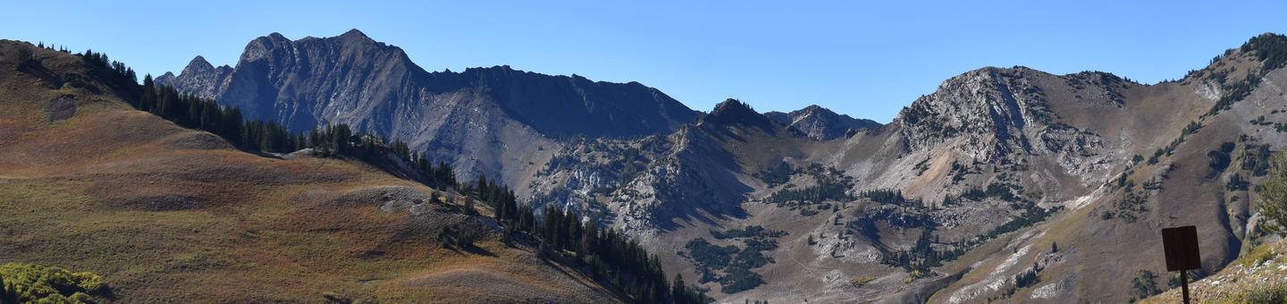
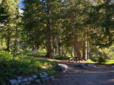
Albion Basin Campground, just 15 miles from Sandy, Utah, is set among shady white pines and aspens in its beautiful namesake basin in Little Cottonwood Canyon at an elevation of 9,500 feet.

Recreation

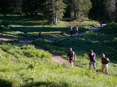
Hiking and mountain biking are very popular activities. Hikers enjoy the path to Cecret Lake, which begins at the campground, as well as the Catherine Pass/Sunset Peak Trail just down the road.

Mountain bikers often ride the Albion Basin Road and the trail to Germania Pass. Other trails include the Albion Meadows Trail and Cardiff Pass/Twin Lake Pass.

Facilities

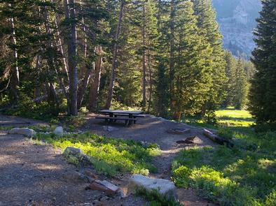
The campground contains 18 “reservation” sites (16 single sites, one double and one triple site) as well as 6 single “first come-first served” sites. All come with picnic tables and campfire rings. Vault toilets are provided. Roads and parking spurs are dirt.

Natural Features

Albion Basin is renowned for its vivid summer wildflowers. The basin hosts the Wasatch Wildflower Festival annually in late July or early August, complete with guided nature walks.

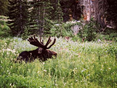
Moose and deer frequent the basin and mountain goats can often be seen on the precipitous face of Devils Castle, just south of the campground. A small stream runs through the basin.

Nearby Attractions

Little Cottonwood Canyon is a beautiful area known for its soaring peaks, unique geology, pristine hidden lakes and cascading streams. Numerous additional hiking and mountain biking trails are found throughout the canyon. Rock climbing and fly-fishing are popular activities as well.

Snowbird Resort is just a few miles down-canyon, offering scenic tram rides, hiking, mountain biking, restaurants, groceries, an Alpine Slide, zip line rides, concerts and various festivals.

Reservation

More from CampingHiking.net:

LADYBIRD LANDING, Oklahoma Campground Images, Info & Reservations

Listen Directions From Porum, Oklahoma, take Highway 71 west for 8 miles, then follow signs to the campground. Phone 918-799-5843 Activities BOATING, CAMPING, FISHING, HIKING, SWIMMING SITE Keywords Dam Site South Related Link(s) Rec Area Info & Images Oklahoma State Road Conditions Oklahoma State Tourism Overview Ladybird Landing Campground sits

BURNT RANCHERIA, California Campground Images, Info & Reservations

Listen Directions Located 50 miles east of San Diego, California. From I-8 take the Sunrise exit. Go approximately 11 miles to Milepost 23. Stop at entrance for campground information and site location. Phone 619-473-0120 Activities CAMPING, INTERPRETIVE PROGRAMS, VISITOR CENTER, DAY USE AREA Keywords BURN,CLEVELAND NF – FS Related Link(s)

BIG SPRINGS – CARIBOU, Idaho Campground Images, Info & Reservations

Listen Directions Just east of Lava Hot Springs, Idaho, look for "Pebble Area" sign and turn left onto Blaser Highway/Old Highway 30. Go north on the paved highway 9 miles to Pebble Creek Road, known locally as Mike’s Place or Whiskey Mike’s. Turn left across railroad tracks on gravel Forest

CHALLENGE CABIN, Montana Campground Images, Info & Reservations

Listen Directions From Hungry Horse, travel east on Highway 2 for 51 miles, then 8 miles south on Skyland Road 569. Park in the plowed area along Highway 2, then hike, snowmobile, ski or snowshoe approximately 8 miles along the groomed trail. The cabin is not accessible by car. Phone

THUNDER RIDGE, Colorado Campground Images, Info & Reservations

Listen Directions From the I-25 and Hwy 24 intersection in Colorado Springs, Colorado, travel west on Highway 24 for 17.4 miles to Baldwin St. in Woodland Park. Turn right (north) on Baldwin (which turns into Rampart Range Road). Travel approximately 3 miles to Loy Creek Road, turn right at the

DAWSON CABIN, Colorado Campground Images, Info & Reservations

Listen Directions From Buena Vista, Colorado, go about 15 miles north on Highway 24 towards Leadville. Turn left on County Road 390 at Clear Creek Reservoir. Go about 6 miles west on County Road 390, then turn right (north) onto the cabin driveway. The cabin is about 100 yards from