MOUNT ROSE (NV), CA Campground Reservation, Info, Images, Map, Directions

MOUNT ROSE (NV), California Campground Images, Info & Reservations

Listen

Directions

From Highway 395 south of Reno, travel 17 miles west on State Route 431, following signs to the campground.

The Actual Mailing Address is: PO Box 104, Markleeville, CA 96120.

The Physical Address is: Mt. Rose Hwy, State Route 431, Reno, NV 89511.

Phone

530-694-1002

Activities

BIKING, CLIMBING, CAMPING, HIKING

Keywords

MOUNT ROSE (NV),MOUR,HUMBOLDT-TOIYABE NF-FS,MT ROSE,Mt. Rose,Mt Rose

Related Link(s)

Rec Area Info & Images

California State Road Conditions

Forest Service Concessionaire

California State Tourism

Overview

Mount Rose Campground is conveniently located between Reno and Lake Tahoe just off scenic Mount Rose Highway. Visitors love the campground for its proximity to excellent hiking trails and recreational opportunities at Lake Tahoe.

Recreation

Hiking is the most popular pastime at Mount Rose. Several trails, including the Tahoe Meadows, Tahoe Rim, Mount Rose Wilderness and Mount Rose Summit Trails, begin very close to the campground.

Facilities

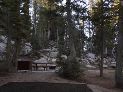
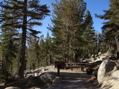
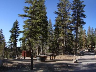
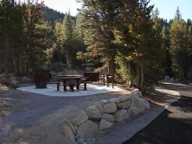
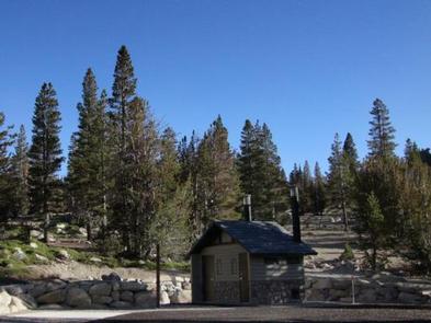
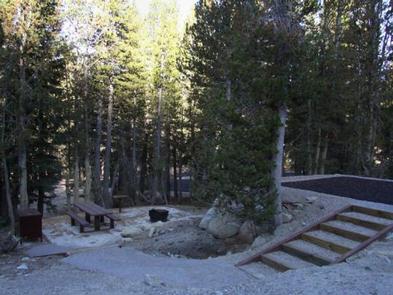
Mount Rose contains single and double-family sites, as well as one triple-family site. Six of the single sites are for tent camping only. Picnic and utility tables, campfire rings, grills and food storage lockers are provided, as are vault toilets and drinking water. Roads and parking spurs throughout the site are paved.

Natural Features

The campground is situated high on the western slope of Mount Rose at an elevation of 9,300 feet. A scenic forest of lodgepole pine, Jeffrey pine, white pine and red fir covers the campground, offering pleasant shade in most sites.

Nearby Attractions

Mount Rose is conveniently close to beautiful Lake Tahoe, less than 30 minutes away. Tahoe offers excellent boating, kayaking, fishing, hiking and scenic driving opportunities.

Reservation

More from CampingHiking.net:

COLD RIVER, New Hampshire Campground Images, Info & Reservations

Listen Directions From Fryeburg, Maine, take Highway 113 north 15 miles to the campground. Phone 603-447-2166 Activities BIKING, BOATING, CAMPING, FISHING, HIKING, PICNICKING Keywords COLD,WHITE MOUNTAIN NF -FS Related Link(s) Rec Area Info & Images Forest Service Concessionaire New Hampshire State Road Conditions New Hampshire State Tourism Overview Cold River

SERRANO, California Campground Images, Info & Reservations

Listen Directions From I-10 in Redlands, take Highway 330 to Highway 18 in Running Springs. Continue east on Highway 18 at Big Bear Lake Dam, but do not cross the dam. Turn left onto highway 38 Continue on Highway 38 to North Shore Lane. Campground is 1/2 mile on left

WEST PARK (OR), Oregon Campground Images, Info & Reservations

Listen Directions From Highway 730 turn north on Devore Road, at the stop sign turn left and continue down the hill, turn right onto Third Street and West Park will be about a half a mile down on your left. Phone 541-922-2268 Activities PICNICKING, DAY USE AREA Keywords Related Link(s)

FISH CREEK CAMPGROUND, Montana Campground Images, Info & Reservations

Listen Directions Important: Please do not rely on GPS for directions to Fish Creek Campground. Please use these directions: Fish Creek is located four miles northwest of the west park entrance near West Glacier, Montana. Access is from U.S. Highway 2, approximately 32 miles northeast of Kalispell, Montana. Phone 406-888-7800

HUNTERS SPRING CABIN, Montana Campground Images, Info & Reservations

Listen Directions From the south: From Hwy 12 take Forest Road 274 north for approximately 11 miles to Forest Road 6429 tturn right on 6479 just past Whitetail Campground. Go approximately .5 mies on road 6429 to the Hunter Springs Cabin turn off on the right. and the sign pointing