CRAIGS CREEK GROUP AREA, KY Campground Reservation, Info, Images, Map, Directions

CRAIGS CREEK GROUP AREA, Kentucky Campground Images, Info & Reservations

Directions

From London, Kentucky, take Exit 38 from I-75. Take Kentucky 192 west for 12.2 miles. Turn left onto Forest Road 62 and drive 2 miles to the Craig’s Creek site.

Phone

606-528-6156

Activities

BIKING, CAMPING, FISHING

Keywords

CRAS,CRAIGS CREEK CAMPGROUND,CRAIGS CREEK SHELTER,CRAIGS CREEK PICNIC SHELTER,LAUREL RIVER LAKE,LAUREL LAKE,DANIEL BOONE NF-FS

Related Link(s)

Rec Area Info & Images

Forest Service Concessionaire

Kentucky State Tourism

Kentucky State Road Conditions

Overview

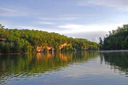
Craigs Creek Group Area is perched near Laurel River Lake in the Daniel Boone National Forest. Here, group campers find hours of fun playing on the sports field, firing up the grills and exploring the beautiful lake.

Daniel Boone National Forest protects 23 species listed as federally threatened or endangered. Species range from the magnificent bald eagle to the small Indiana bat and the Cumberland Sandwort.

Recreation

The hiking and biking trail at Craig’s Creek is an easy, half-mile path that features several views of the lake.

Picnicking, boating and fishing are popular pastimes for visitors. Fish species include crappie, catfish, small and largemouth bass and rainbow trout.

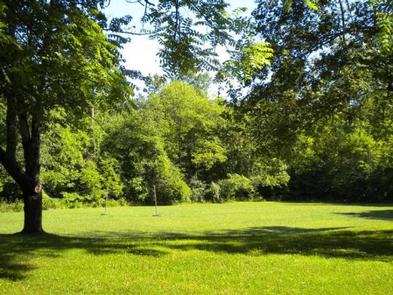
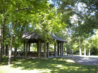
A spacious sports field with a volleyball net and horseshoe pits lies near the picnic shelter.

Facilities

Group sites are for tent camping only and do not have electricity. The day-use picnic shelter fits 60 guests, and the group campsites fit up to 30 and 60 guests, depending on the location.

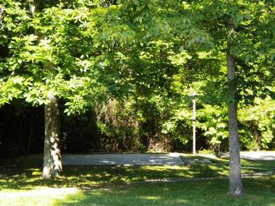
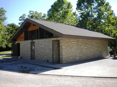
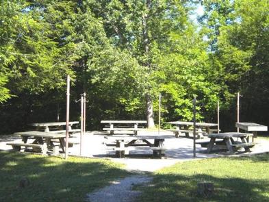
Each group camp area comes with a campfire circle, large grill, picnic tables and a lantern pole. Modern vault toilets and a shower house are available.

Natural Features

The campground sits on Craig’s Creek, which flows into an arm of Laurel River Lake across from Holly Bay Campground. The group site lies in a somewhat open space surrounded by woods.

Set in the Appalachian foothills, plenty of hills and valleys create a beautiful backdrop for the lake area.

Reservation

More from CampingHiking.net:

PAULSON BAY CABIN, Alaska Campground Images, Info & Reservations

Directions To access the cabin by float plane: it is 40 minutes from Anchorage and 60 minutes from Cordova. By boat, the trip is 18 miles from Whittier. Note: the Bay is not obvious because the mouth is partially obscured by five small islands. Beware of submerged rock ledges between

UPPER WOLF CREEK GROUP, Arizona Campground Images, Info & Reservations

Directions From Phoenix, Arizona: Traveling Northbound on I-17 take Exit 262 onto Hwy 69 North to Prescott and cointnue on Hwy 69 for 41 miles. Turn onto South Mt. Vernon Avenue (a.k.a Senator Highway) and drive south for about 6 miles. Pass the entrance to Goldwater Lake and the community

MORAINE PARK CAMPGROUND, Colorado Campground Images, Info & Reservations

Directions Take Highway 36 west from Estes Park, CO or Highway 34 east from Grand Lake, CO. Off the main park road, take the Bear Lake Road, which is near the Beaver Meadows Entrance Station, and follow the signs to the campground. Phone 970-586-1206 Activities CAMPING, FISHING, HIKING, HORSEBACK RIDING,

SHOAL BAY, Arkansas Campground Images, Info & Reservations

Directions From New Blaine, Arkansas, take State Route 197 north for 2 miles. Follow signs into campground. Phone 479-938-7335 Activities BOATING, CAMPING, FISHING, WILDLIFE VIEWING, SWIMMING SITE Keywords SHOA,DARDANELLE LAKE – ARK.RIV.NAV.,DARDANELLE LAKE Related Link(s) Rec Area Info & Images Arkansas State Tourism Arkansas State Road Conditions Overview This shady

CASCADE (COLORADO), Colorado Campground Images, Info & Reservations

Directions From Buena Vista, Colorado, take Highway 285 south to Nathrop. Turn west on County Road 162 and travel 9 miles to the campground. Phone CAMPGROUNDS DO NOT HAVE PHONE SERVICE, CALLING TO CHECK AVAILABILITY PRIOR TO ARRIVAL IS NOT POSSIBLE. FOR RESERVATIONS CALL: 1-877-444-6777 Activities HISTORIC & CULTURAL SITE,