BACKBONE ROCK RECREATION AREA PAVILIONS, TENNESSEE Campground Reservation, Info, Images, Map, Directions

BACKBONE ROCK RECREATION AREA PAVILIONS, Tennessee Campground Images, Info & Reservations

Directions

From Bristol, TN take US 421 south for 20 miles to Shady Valley. Turn left onto TN 133 for eight miles to the recreation area. From Abingdon, VA, take US 58 east for 15 miles to Damascus. Turn right onto VA 716 for five miles to the recreation area (VA 178 becomes TN 133 at the state line).

Phone

423-735-1500

Activities

FISHING, HIKING, WILDLIFE VIEWING, SWIMMING, STAR GAZING, WATER ACCESS, SCENIC DRIVE

Keywords

BACKBONE ROCK RECREATION AREA PAVILIONS,BACKBONE ROCK,BACKBONE

Related Link(s)

Rec Area Info & Images

Overview

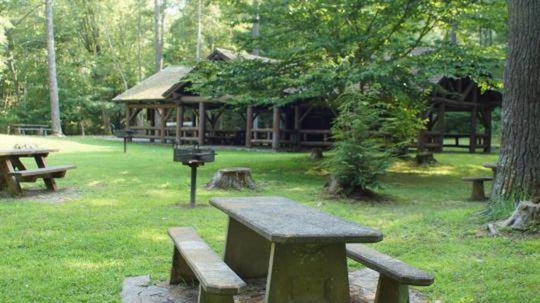
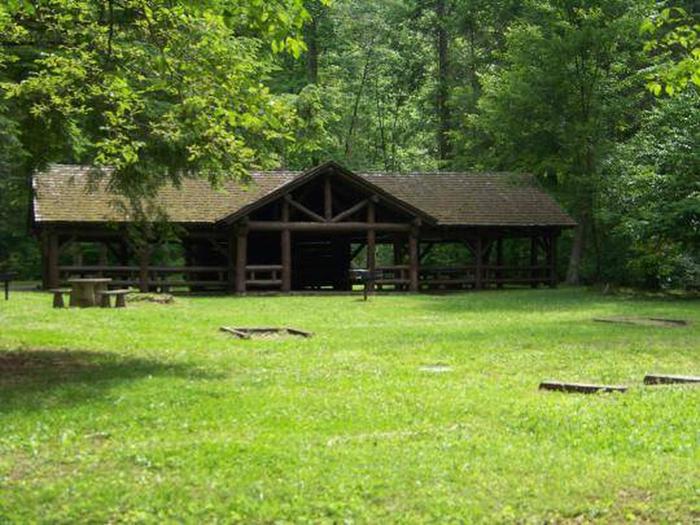
The pavilion at Backbone Rock Recreation Area is a popular location for family reunions, weddings and other types of group gatherings. The pavilion is large and adjacent to an expansive field, Beaverdam Creek and a large parking area. The area includes accessible grills, picnic tables, trash cans, and vault toilets. Backbone Rock Recreation Area Pavilion #1 will close for the season on Tuesday, November 26, 2019. 

Recreation

There is a trail that will take you to the top of Backbone Rock, following a stone-step wooded path. The trail crosses the rock and leads to Beaverdam Creek or Backbone Rock Falls. The Appalachian National Scenic Trail adjoins Backbone Rock Trail. Beaverdam Creek is known for its excellent fishing.

Facilities

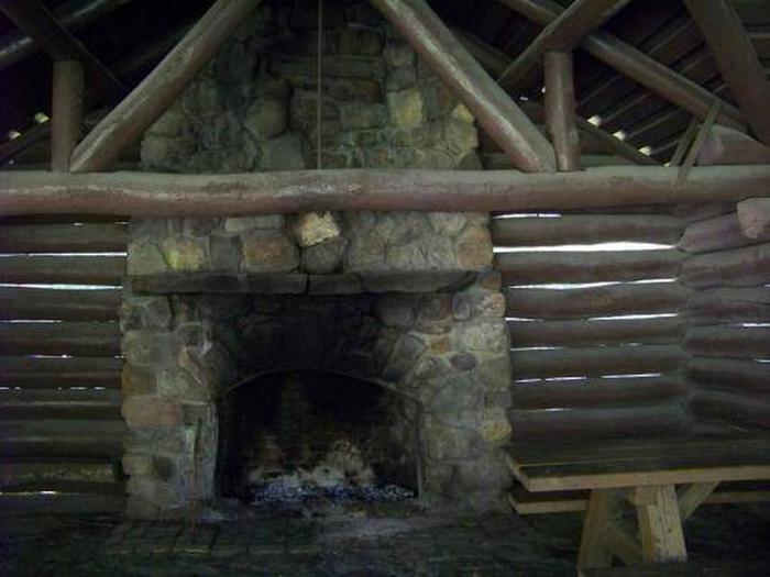
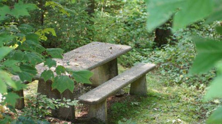
There is a Civilian Conservation Corps (CCC) -era pavilion, picnic tables and grills. The pavilion includes a stone fireplace and four large picnic tables with additional tables and grills nearby. Vault toilets are located within the parking area.

Natural Features

Backbone Rock Recreation Area is located along Beaverdam Creek in northern Johnson County. Backbone Rock gets its name from a spur ridge on Holston Mountain that ends abruptly at a bend in Beaverdam Creek. A tunnel was drilled through the rock in 1901 to allow railroad access between Shady Valley, TN and Damascus, VA. Motorists pass through what is locally known as “The shortest tunnel in the world” as they travel along TN 133. 

Nearby Attractions

Damascus, Virginia is five miles north of Backbone Rock for any in-town needs.

Reservation

More from CampingHiking.net:

WEST CHICAGO CREEK, Colorado Campground Images, Info & Reservations

Directions I-70 westbound, Idaho Springs exit #240 – Hwy 103. Go south for 6.5 miles and turn right on southwest Forest Service Road 188 (West Chicago Creek Road). Go 3 miles to campground. The last mile of dirt/gravel road is one lane with pull over’s and contains two sharp switchbacks.

PINEKNOT, California Campground Images, Info & Reservations

Directions From I-10 in Redlands, take Highway 330 to Highway 18 in Running Springs. Continue east on Highway 18 at Big Bear Lake Dam, go straight at the dam and follow Highway 18. Turn onto Summit Boulevard and continue to a block wall. Turn left into the campground. Phone 909-866-8550

BONAPARTE LAKE CAMPGROUND, Washington Campground Images, Info & Reservations

Directions From Tonasket, Washington, take State Route 20 East for 24 miles. Turn left onto the Bonaparte Recreation Area turnoff (Okanogan County Road 4953). Continue on Okanogan County Road #4953 for approximately 6 miles to the Bonaparte Lake Campground entrance on the left hand side of the road. Phone 509-486-2186

INDIAN CREEK CAMPGROUND (CA), Nevada Campground Images, Info & Reservations

Directions From Woodfords, California, travel Hwy 89 south approximately four (4) miles to Airport Road. Turn left or east on Airport Road and travel another four miles on paved surface to the campground entrance located just south of Indian Creek Reservoir. Phone (775) 885-6000 Activities AUTO TOURING, BIKING, BOATING, CAMPING,

ELLA NARROWS CABIN, Alaska Campground Images, Info & Reservations

Directions The cabin is approximately 24 air miles northeast of Ketchikan on Revillagigedo Island on the north end of Ella Lake. Access is by floatplane or boat. Refer to USGS Ketchikan C-4 and B-4. In fall, winter and early spring, the cabin may be inaccessible due to frozen lake surface

METHODIST COVE, Nebraska Campground Images, Info & Reservations

Directions From U.S. Highway 80, take Highway 183 south to Alma, Nebraska. Turn left on South Street and travel 2.5 miles. The park entrance is on south side of the road. Phone 308-799-2105 Activities BOATING, CAMPING, FISHING, HUNTING Keywords METH,HARLAN COUNTY LAKE,METHODIST,HARLAN COUNTY LAKE Related Link(s) Rec Area Info &