CHAMBERS LAKE, CO Campground Reservation, Info, Images, Map, Directions

CHAMBERS LAKE, Colorado Campground Images, Info & Reservations

Directions

From Interstate 25 at Fort Collins, take Highway 287 north for 10 miles to Ted’s Place, then take Highway 14 west for 50 miles to the campground.

Phone

970-295-6700

Activities

BIKING, BOATING, CAMPING, FISHING, HIKING, WILDLIFE VIEWING, DAY USE AREA, MOUNTAIN BIKING, CANOEING

Keywords

CHAM,ARAPAHO AND ROOSEVELT NF – FS,CHAMBERS

Related Link(s)

Rec Area Info & Images

Colorado State Tourism

Colorado State Road Conditions

Forest Service Concessionaire

Overview

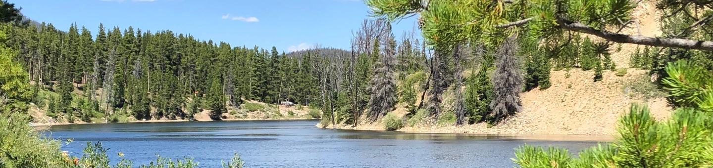
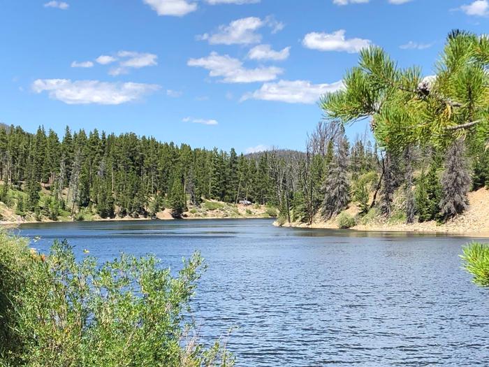
Chambers Lake Campground is located approximately 60 miles north of Fort Collins, Colo., on beautiful Chambers Lake. Visitors enjoy the area for its great fishing and canoeing, as well as abundant trail opportunities and wilderness access.

Recreation

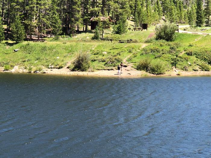
Popular activities included fishing, canoeing and boating on Chambers Lake, which is a no-wake lake. Anglers cast for rainbow, cutthroat and lake trout. A boat ramp is located within the campground. Please note the boat ramp may be unusable in late summer due to low water levels. The lake is a storage reservoir for irrigation water and is drawn down over the course of the summer.

The Blue Lake Trail No. 959 begins nearby. The 7.2-mile trail provides access to the Rawah Wilderness. Several additional hiking and biking trails can be found in the surrounding area.

Facilities

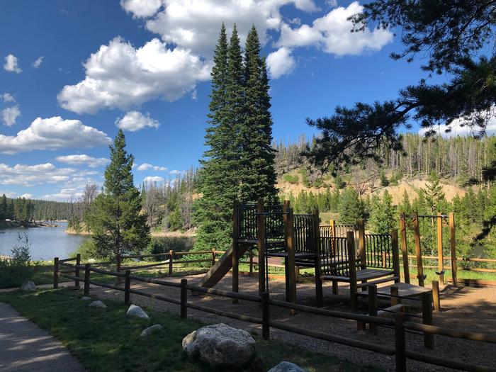
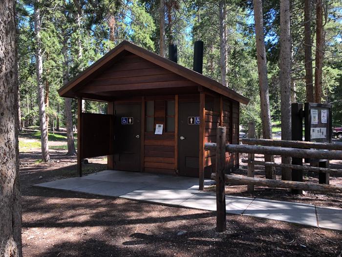
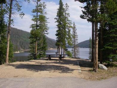
The campground offers single and double family campsites, many of which are accessible. Each site contains a picnic table and campfire ring. Vault toilets and drinking water are provided. A playground area is located within the campground.

Natural Features

The campground is situated in a rustic, mountainous area, at an elevation of 9,200 feet. Some sites have reduced shade because many hazardous lodgepole pine trees have been removed due to the mountain pine beetle epidemic.

Nearby Attractions

Many hiking and horseback riding trails in the area provide access to the Neota and Comanche Peak wilderness areas, which are located nearby.

Reservation

More from CampingHiking.net:

SUNSET COVE CAMPGROUND, Oregon Campground Images, Info & Reservations

Directions From Crescent, OR: Travel 12.2 miles west on County Road 61/ Crescent Cut-Off Road, then 6.2 miles north and west on Highway 58. Phone 541-323-1746 Activities CAMPING Keywords Related Link(s) Rec Area Info & Images Oregon State Road Conditions Oregon State Tourism Overview Located next to Odell Lake, Sunset

MORGAN-CASE HOMESTEAD, Montana Campground Images, Info & Reservations

Directions From Missoula, Montana, travel east on Interstate 90 for about 20 miles to exit 126. Drive south on Rock Creek Road for about 30 miles. Rock Creek Road is a hardened surface for 12 miles and the remainder is a gravel, single-lane road, with intermittent pull-outs. It is not

BIG CREEK CABIN, Montana Campground Images, Info & Reservations

Directions From Livingston, drive south on Highway 89 for approximately 34 miles to Big Creek Road and a sign for Mountain Sky Guest Ranch. Turn right at the sign and follow Big Creek Road for about 5 miles to the cabin. High-clearance, four-wheel drive vehicles are strongly recommended. In winter,

Agua Piedra Campground, New Mexico Campground Images, Info & Reservations

Directions From Las Vegas, New Mexico, take State Highway 518 approximately 51 miles to the Agua Piera Campground. From Penasco, New Mexico, travel east on State Route 75 about 5 miles, to an intersection. Turn right, onto State Route 518 (unmarked) and continue about 7 miles to campground entrance. From

FORT PICKENS CAMPGROUND, Florida Campground Images, Info & Reservations

Directions Physical Address (NO MAIL SERVICE): 1400 Fort Pickens Road, Pensacola Beach, FL 32561 From I-10, take I-110 S to Pensacola. Take U.S. Highway 98S/FL Highway 30 over Pensacola Bay to Gulf Breeze. Follow 98 through Gulf Breeze, turn right onto FL Highway 399 to Pensacola Beach. Pay $1/vehicle at

FLOUR LAKE CAMPGROUND, Minnesota Campground Images, Info & Reservations

Directions From Grand Marais, Minnesota, take Gunflint Trail (County Road 12) 27 miles north, turn right on County Road 22 (previously CR 66) and travel 3 miles to the campground road. Turn right and follow the campground road 1/2 mile to the campground. Phone (218)388-2203 Activities BIKING, BOATING, CAMPING, FISHING,