


Directions
From Buena Vista, Colorado, take Highway 306. At the stoplight, go west for 11 miles toward Cottonwood Pass. Campground is located on the left-hand side of the road. Highway 306 is paved on east side of Cottonwood Pass.
Phone
CAMPGROUNDS DO NOT HAVE PHONE SERVICE, CALLING TO CHECK AVAILABILITY PRIOR TO ARRIVAL IS NOT POSSIBLE. FOR RESERVATIONS CALL: 1-877-444-6777
Activities
CAMPING, FISHING, HIKING, HORSEBACK RIDING
Keywords
COLV,PIKE AND SAN ISABEL NF- FS
Related Link(s)
Colorado State Road Conditions
Overview
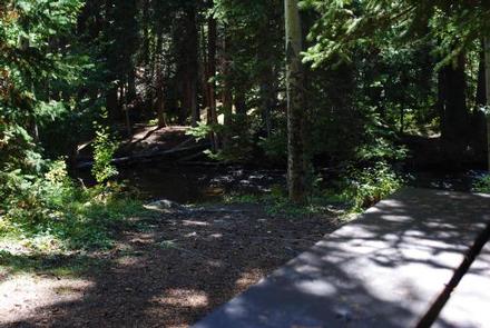
Collegiate Peaks Campground is located 11 miles west of Buena Vista, Colorado, along Middle Cottonwood Creek near the top of Cottonwood Pass. The campground offers well-spaced campsites and scenic views of the surrounding mountains. Visitors enjoy fishing and exploring local trails. A commercial hot springs inn and spa is located about 5 miles east of the campground.
Recreation
Hiking and fishing are among the most popular activities. The Denny Creek Trailhead is less than a mile away and it take hikers through Collegiate Peaks Wilderness Area to destinations such as Kroenke Lake and Mt. Yale. The Ptarmigan Lake Trailhead is less than 3 miles from the campground and boasts views of vivid wildflowers. Middle Cottonwood Creek is small but fairly well-stocked with brook trout. Determined anglers can often pull rainbow and cutthroat trout from the beaver ponds west of the campground.
Facilities
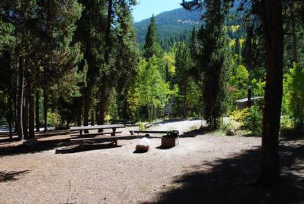
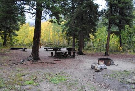
The campground offers several single-family sites on three loops. Each site is equipped with a picnic table, campfire ring and grill. Vault toilets and drinking water are provided. Sites# 1, and 18-30 are first come-first served, also called “Walk-up” sites. All other sites are reservable. Site #2 is used by the host from mid-May through September. After that time it is available as a “walk-up”, first-come, first-served site.
Natural Features
The campground sits at an elevation of 9,800 feet, tucked in a dense stand of mixed conifers and aspen. Some sites sit alongside the creek while others are tucked back in the woods. Afternoon thunderstorms are common during summer months.
Nearby Attractions
Cottonwood Pass is a high mountain pass across the Continental Divide in the Sawatch Range of the Rocky Mountains. The road reaches the divide at an elevation of 12,126 feet. The Collegiate Peaks Wilderness offers challenging trails and prime backcountry fishing lakes. The Town of Buena Vista is only a short drive away where visitors can enjoy distinctive restaurants, unique shops, incredible art galleries and a large selection of antique shops. The area boasts more than 100 miles of Arkansas River to raft, fish, float or kayak in, as well as fifteen 14,000 ft mountains. Visitors can choose from recreational activities like hiking, biking, ATV/UTV riding, kayaking, rafting, fishing, horseback riding, zipping and swimming.