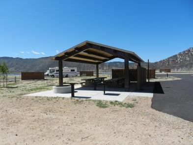
LUCERNE CAMPGROUND, UT Campground Reservation, Info, Images, Map, Directions

LUCERNE CAMPGROUND, Utah Campground Images, Info & Reservations

Directions

From Manila, Utah: Follow Highway 43 for 2.6 miles to the state line, where Highway 43 becomes Wyoming Highway 530. Follow Wyoming 530 for 1.3 miles to Lucerne Valley Road/Forest Road 146. Continue on this road approximately 4 miles to the campground.

Phone

801-226-3564

Activities

BOATING, CAMPING, FISHING, WATER SPORTS, DAY USE AREA, SWIMMING SITE, CANOEING

Keywords

LUCE,LUCERNE,FLAMING GORGE,ASHLEY NF – FS,Flaming Gorge National Recreation Area

Related Link(s)

Rec Area Info & Images

Utah State Road Conditions

Forest Service Concessionaire

Utah State Tourism

Overview

Lucerne Campground is located on the shore of Flaming Gorge Reservoir at an elevation of 6,100 feet. Boating, fishing and water skiing are popular activities.

Recreation

Fishing, boating, canoeing, water skiing and swimming are popular activities on the lake. Campers are offered the convenience of an adjacent boat ramp, marina and fish cleaning station. Lucerne Marina has boat rentals, fuel, slips, fishing licenses, bait and groceries.

Facilities

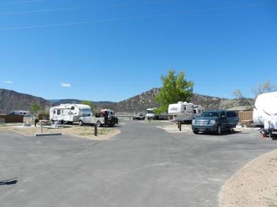
This large, recently renovated campground offers nearly 140 sites campsites, many of which are accessible and have electric hookups. One group site (site B) in the G Loop is available.

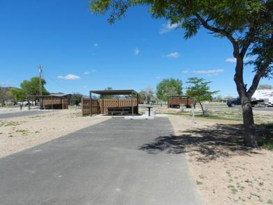
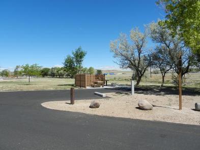
Sites in Loops A through D each have a picnic table, campfire ring (no grill), windbreak, electric hookups and parking spur. Loop D also has tent pads and shade cabanas. Loops E and F have shade cabanas, picnic tables and campfire rings but no electric hookups.

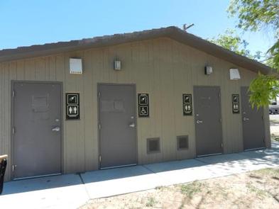
Flush toilets, drinking water and showers are available throughout the campground. A dump station is located on-site.

Natural Features

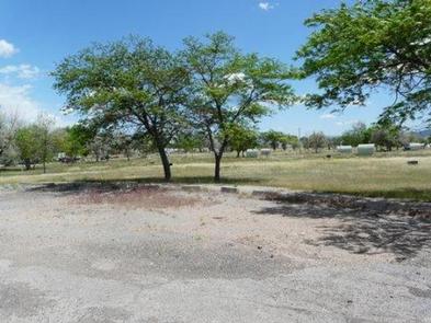
The campground is situated in a high desert landscape with sagebrush and a few scattered trees. Natural shade is minimal. Typical weather ranges from warm days to cool nights.

Nearby Attractions

Flaming Gorge Dam offers guided tours of the working hydroelectric plant and the dam itself; the adjacent visitor center contains area history exhibits.

Reservation

More from CampingHiking.net:

LAKESIDE (TX), Texas Campground Images, Info & Reservations

Directions From Coleman, TX, take Hwy 153 west 8 miles to the main entrance to Hords Creek Lake. Follow signs into the campground. Phone 325-625-2322 Activities BIKING, BOATING, CAMPING, FISHING, RECREATIONAL VEHICLES, SWIMMING SITE, PADDLING, SWIMMING, MOTOR BOAT, MOUNTAIN BIKING, PADDLE BOATING, WATER ACTIVITIES, KAYAKING, CANOEING, NON-MOTORIZED BOATING, WATER ACCESS,

LOST RAPIDS, Oklahoma Campground Images, Info & Reservations

Directions From Broken Bow, OK, take Highway 3 west 22 miles to the park entrance. Turn south at the sign and follow the access road. Phone 580-876-3720 Activities BOATING, CAMPING, FISHING, PICNICKING, CANOEING Keywords LOSR,PINE CREEK LAKE,PINE CREEK LAKE Related Link(s) Rec Area Info & Images Oklahoma State Tourism Oklahoma

WATAUGA POINT RECREATION AREA, Tennessee Campground Images, Info & Reservations

Directions From Elizabethton, take US 19E/321 south for five miles to Hampton. Turn left on US 321/TN 67 south for six miles, then turn left into Watauga Point.  Phone 423-735-1500 Activities BOATING, FISHING, HIKING, KAYAKING, CANOEING, STAR GAZING, NON-MOTORIZED BOATING, WATER ACCESS, SCENIC DRIVE Keywords WATAUGA POINT RECREATION AREA PAVILION

GOOSE MEADOWS, California Campground Images, Info & Reservations

Directions From Truckee, Calif., take Highway 89 south for 5 miles to the campground. Phone (530)587-3558. FOR RESERVATIONS, PLEASE CALL: 1 (877) 444-6777. Activities BIKING, CAMPING, FISHING, HIKING, SWIMMING, WATER ACCESS Keywords GOOM,TAHOE NF – FS Related Link(s) Rec Area Info & Images California State Road Conditions California State Tourism

FALES FLAT CAMPGROUND, Montana Campground Images, Info & Reservations

Directions From Darby, travel south on Highway 93 for about four miles. Turn onto Highway 473 and continue southwest for 14 miles. Turn west onto Forest Road 468 and continue about 12 miles to the campground. Phone 406-821-3269 Activities BIKING, CAMPING, FISHING, HIKING, HUNTING, SCENIC DRIVE, HISTORIC SITES Keywords FFCG,Fales

CADES COVE CAMPGROUND, Tennessee Campground Images, Info & Reservations

Directions From Maryville, TN: Take U.S. 321 North (you’ll actually be driving south!) from Maryville to Townsend, TN (about 22 miles). At the traffic light in Townsend, continue straight on TN 73 and follow signs to Cades Cove. From Pigeon Forge, TN take US 321 South (you’ll be driving westerly)