

Directions
From West Yellowstone, Montana, take Highway 20 south for 27 miles. Turn west at Elk Creek Service Station and travel 2 miles to the campground entrance.
Phone
208-558-7658
Activities
BOATING, CAMPING, FISHING, WATER SPORTS, WILDLIFE VIEWING
Keywords
MCCR,CARIBOU-TARGHEE NF – FS
Related Link(s)
Overview
McCrea Bridge Campground is located on the backwaters of beautiful Island Park Reservoir in Island Park, Idaho at an elevation of 6,200 feet. Visitors love Island Park for its world-class fishing and outstanding scenery and wildlife viewing opportunities.
Recreation
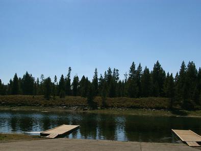
Island Park Reservoir offers boating, water skiing, fishing and canoeing. A boat ramp is located within the campground. The reservoir is used for irrigation so the water level recedes throughout the summer and by August, the reservoir cannot be accessed from McCrea Bridge.
The Island Park area is renowned for its fishing; Henry’s Fork is considered one of the best fly-fishing streams in the nation. Anglers cast for rainbow, cutthroat and brook trout and Kokanee salmon.
Hiking, biking, horseback riding and ATVing are popular activities. Many miles of trails are in the area, including the Continental Divide National Scenic Trail and the Nez Perce Trail.
The Big Springs National Recreation Water Trail offers a roughly three-hour float or canoe trip through beautiful scenery. Wildlife, including moose, bald eagles and Sandhill cranes, are often seen along the trail.
Facilities
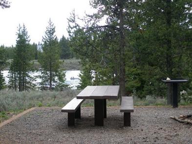
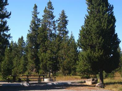
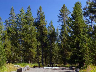
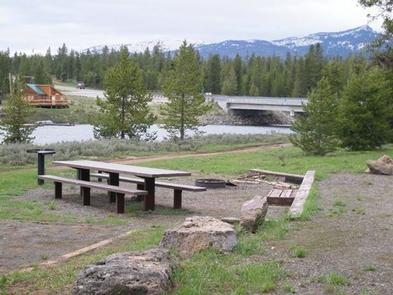
The campground contains single and double sites, each equipped with a picnic table, campfire ring and grill. Some sites have stairs between the parking spur and the site pad. Vault toilets, drinking water and trash collection area provided, but there is no electricity.
A paved road accesses the campground but interior roads and parking spurs are gravel. Firewood is available for purchase from the host.
Natural Features
Island Park is composed of two areas of extinct volcanic activity. The Henry’s Fork Caldera sits inside the larger Island Park Caldera. The area is known for its dense forests of lodgepole pine, broad grassy meadows bursting with summer wildflowers and a wide variety of wildlife, including black and grizzly bears, moose, elk, deer, bald eagles, Sandhill cranes and much, much more.
The campground is situated in a forest of lodgepole pine, which provides partial shade in some sites. Some areas of the campground are more open and sunny than others.
Nearby Attractions
Mesa Falls Scenic Byway is 12 miles south of the campground. This 28-mile road leads to scenic overlooks and trails at 110 foot Upper Mesa Falls and 85 foot Lower Mesa Falls.
Harriman State Park is 14 miles south. The Henry’s Fork meanders through the Harriman, offering excellent fishing. Over 20 miles of trails are available, and wildlife is abundant in this scenic park.
Henry’s Lake State Park is 16 miles north, offering fishing, a fish cleaning station and boat ramp.
Yellowstone National Park’s west entrance is just 29 miles north in the town of West Yellowstone, Montana. Visitors enjoy day-tripping to the park for unparalleled wildlife viewing and the beautiful and unique scenery.