
Directions
From San Luis Obispo, travel north on Highway 1 for approximately 65 miles to the campground. From Monterey, travel south on Highway 1 for approximately 50 miles to the campground.
Phone
805-434-1996
Activities
BIKING, CAMPING, FISHING, HIKING, HUNTING, WILDLIFE VIEWING
Keywords
Plaskett,Plaskett Creek,LOS PADRES NF -FS
Related Link(s)
California State Road Conditions
Overview
Plaskett Creek Campground offers a beautiful location just minutes from Sand Dollar Beach, one of the largest and most popular beaches in central California. The campground gives visitors access to a variety of outdoor activities, including water play and exploration of the surrounding hills and forests. The family-friendly campground offers comfortably equipped sites, allowing anyone to enjoy a relaxing stay in the Los Padres National Forest.
Recreation
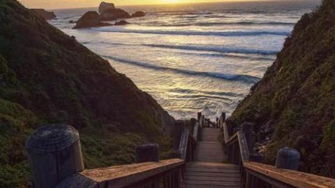
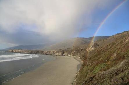
A short walk leads to Sand Dollar Beach, a very popular spot for surfing, fishing, swimming, exploring, sunbathing and more. Fishing permits are required for anyone over age 16. Anglers can expect a catch of yellow perch and other coastal surf fish. The beach is dog-friendly, as long as dogs are leashed and waste is picked up.
A variety of trails exist along the beach, which lead to the bluffs that overlook the beach and coves in the area. Additional hiking, mountain biking and horseback riding trails can be accessed within a short drive from the campground, and offer scenic views of waterfalls, redwood groves and mountain meadows and streams.
Facilities
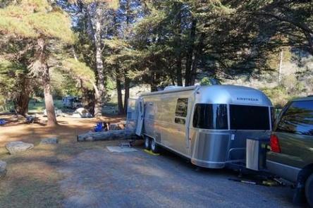
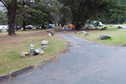
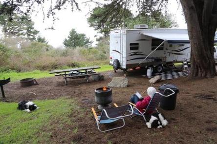
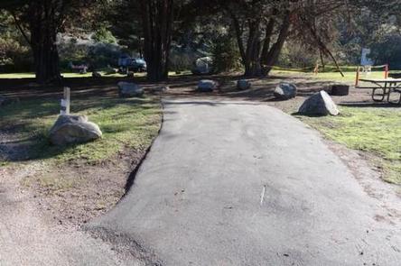
The campground offers single-family sites, as well as three group campsites, for tent and RV camping. Group sites can accommodate up to 40 people and 10 vehicles. Extra vehicles will be charged an additional fee. Utility hookups are not available.
Individual campsites are each equipped with a table and campfire ring with grill. Flush toilets, sinks and drinking water are provided throughout the campground. An accessible flush toilet is located near Site 10. Group sites are equipped with several tables, grills and campfire circles. Vault toilets and drinking water are provided in the group area.
Natural Features
The campground is located in west-central California, on the east side of Highway 1. Sand Dollar Beach, the largest sandy beach in the Big Sur area, is just south of the campground. The Pacific Ocean borders the campground to the west and the surf can be heard at many campsites.
The campground has a park-like setting, under a scattered canopy of mature Monterey pine and cypress trees. Cedar trees provide a fragrant aroma. All sites are grassy. The campground is situated at an elevation of about 200 feet in the Los Padres National Forest.
Wildlife in the area includes fox, bobcat, deer and raccoon. Mountain lions and bears are occasionally seen in the area, although they have never entered the campground.