


Directions
From Eugene, OR, take I-105 east to McKenzie Highway 126 for 55 miles. Look for signs. The campground is located on the right side of the highway.
Phone
801-226-3564
Activities
FISHING, KAYAKING, RAFTING
Keywords
MCKE,WILLAMETTE NF -FS
Related Link(s)
Overview
McKenzie Bridge Campground is located an hour east of Eugene, Oregon. It rests in the shade of a towering grove of Douglas fir and Western red cedar trees along the banks of the McKenzie River.
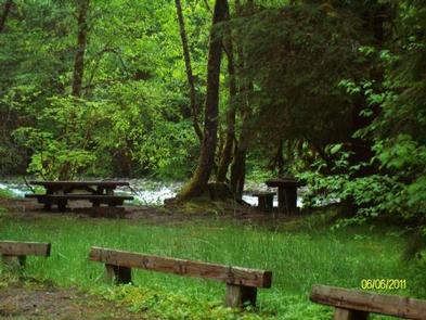
The campground is small and pleasant, providing an ideal atmosphere for relaxation, fishing and bird watching. Feathered residents of the river include osprey, great blue herons and bald eagles.
Recreation
At the campground, the river provides catch-and-release fishing for trout and steelhead. Whitewater kayaking and rafting are also popular activities. A boat ramp is located on-site. The McKenzie River National Recreation Trail begins nearby, offering fun-filled hiking and biking opportunities. The 26-mile trail boasts wonderful scenery along the river and is an easy hike for all ages.
Facilities
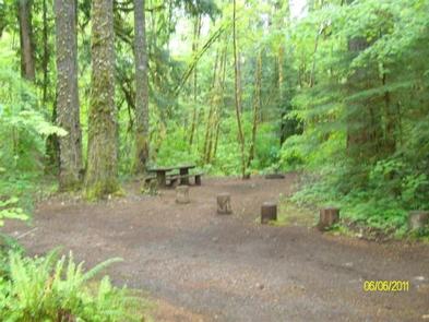
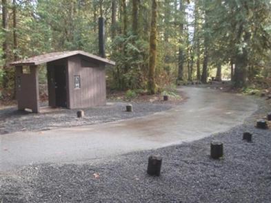
Campsites are nicely spaced and many have riverfront access. Vault toilets and drinking water are provided. Parking areas are gravel surfaced.
Natural Features
McKenzie Bridge sits on the banks of the McKenzie River at an elevation of 1,200 feet. Rapids in various sections of the river are what make McKenzie one of Oregon’s most popular rivers for whitewater rafting.
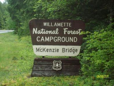
McKenzie Bridge is part of the Willamette National Forest, which stretches for 110 miles along the western slopes of the Cascade Range.
Nearby Attractions
Restaurants and the Tokatee Golf Course are within a few miles of the campground.