

Directions
From Asheville, take I-26 to exit 33. Go south approximately 2 miles on State Route 191 to the Lake Powhatan Recreation Area sign. Turn right and follow signs to the campground.
Phone
828-552-8040
Activities
BIKING, BOATING, CAMPING, INTERPRETIVE PROGRAMS, FISHING, HIKING, PICNICKING, DAY USE AREA, SWIMMING SITE, ENVIRONMENTAL EDUCATION, PHOTOGRAPHY, PADDLING, SWIMMING, MOUNTAIN BIKING, WATER ACTIVITIES, KAYAKING, STAR GAZING, BIRDING, NON-MOTORIZED BOATING, WATER ACCESS, BACKPACKING, MUSHROOM PICKING
Keywords
LAKP,NFs IN NORTH CAROLINA – FS
Related Link(s)
North Carolina State Road Conditions
Overview
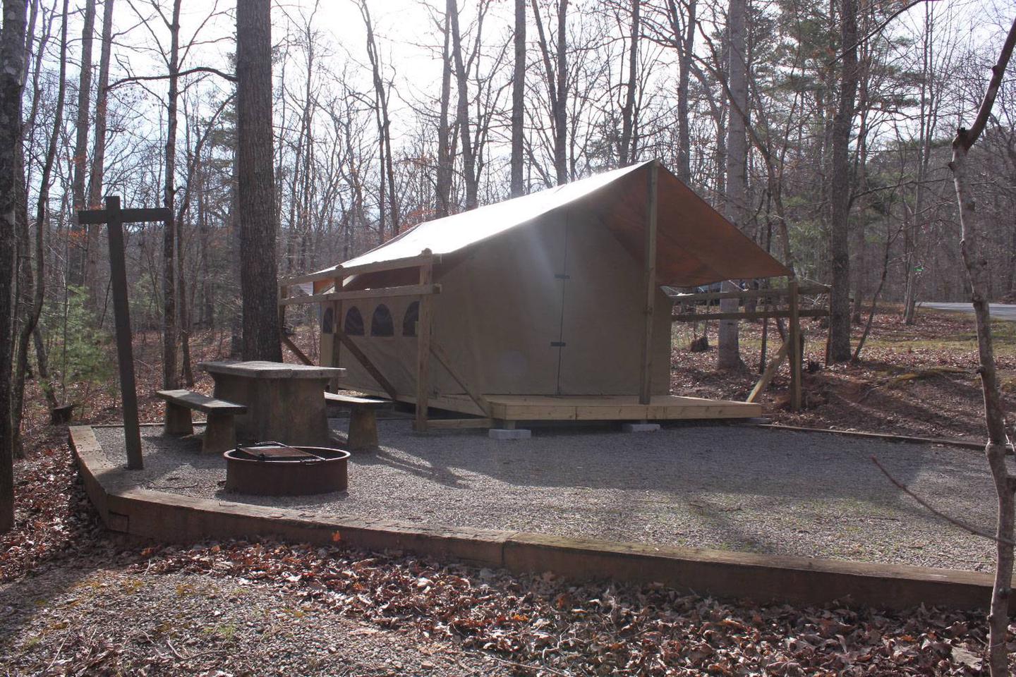
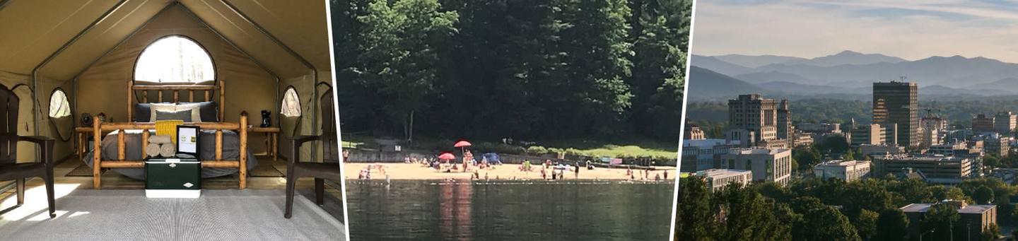
New for 2019: Glamping sites are now available at Lake Powhatan! Experience nature and outdoor recreation without sacrificing the comforts and luxuries of home. Choose one of 12 custom designed, fully furnished canvas platform tents in the heart of the national forest for your next mountain adventure, only 10 minutes from downtown Asheville, NC. Learn more about glamping near Asheville . To book your glamping site, click here.
Located just minutes from the popular city of Asheville, North Carolina, Lake Powhatan has something for everyone. The campground is convenient to a variety of cultural and natural attractions, including art and music venues, shopping and dining in Asheville, scenic driving on the Blue Ridge Parkway, numerous hiking trails and lakeside recreation.
Recreation
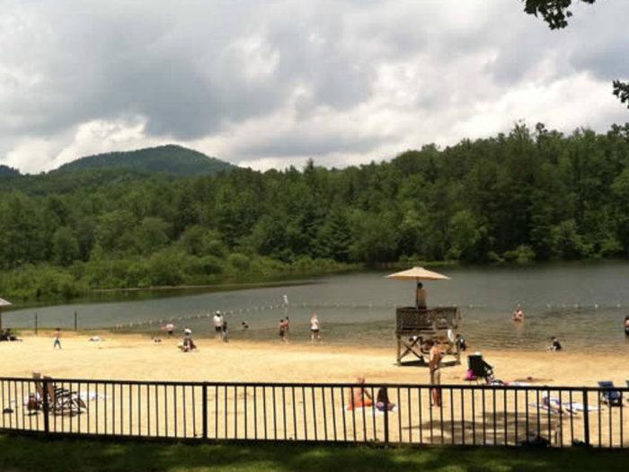
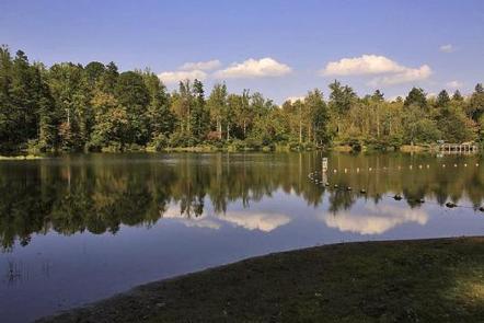
Visitors have a number of different activities to choose from. Kids love the lake’s sandy swimming beach and anglers enjoy the calm waters for trout fishing. The French Broad River, popular for fishing, is also nearby. Lake Powhatan also offers visitors boat rentals during the summer season (Memorial Day to Labor Day) to paddle around the lake. Note that use of personal watercraft is STRICTLY PROHIBITED due to potential introduction of foreign material to the Lake Powhatan riprarian ecosystem. The forest is known for its hiking and mountain biking trails, several of which are located near the campground. Visitors wishing to learn more about the area can attend interpretive programs during the summer.
Facilities
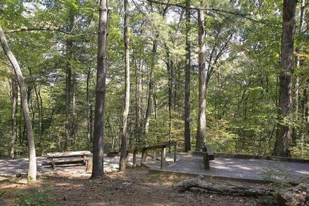
The shaded, private campsites are organized into four loops, all within walking distance of the lake. The facility provides picnic tables, tent pads, lantern posts and campfire rings with grills, in addition to restrooms with hot showers and flush toilets. A few sites have full hookups. 12 glamping tents are available in the upper Hardtimes Loop. Campers can purchase ice, firewood, and other small sundry items from the on-site campground store.
Natural Features
The campground is situated in a heavily wooded area on the banks of Lake Powhatan in the Appalachian Mountains of western North Carolina. The elevation is 2,200 feet. The surrounding land boasts mile-high peaks, cascading waterfalls and slopes thickly forested with hardwoods and conifers.
Nearby Attractions
Among the more popular nearby destinations are Sliding Rock, Looking Glass Falls, the scenic Blue Ridge Parkway, The NC Arboretum and the Biltmore Estate.
Charges & Cancellations
Any cancellations must be taken care of directly with recreation.gov. Note that this facility does not provide refunds for No Shows or incliment weather.