DEWDROP, PA Campground Reservation, Info, Images, Map, Directions

DEWDROP, Pennsylvania Campground Images, Info & Reservations

Directions

From Warren, Pennsylvania, take PA-59 east for 13 miles. Turn onto Longhouse Scenic Byway/Forest Road 262 south and continue 3 miles to the campground. From the east, take PA-59. Just after crossing the Morrison Bridge over the Kinzua Arm of the reservoir, turn left and proceed 3 miles to the campground.

Phone

814-368-4158

Activities

BOATING, CAMPING, FISHING, WATER SPORTS, SWIMMING SITE, MOUNTAIN BIKING

Keywords

DEWD,ALLEGHENY NF – FS

Related Link(s)

Rec Area Info & Images

Pennsylvania State Road Conditions

Forest Service Concessionaire

Pennsylvania State Tourism

Overview

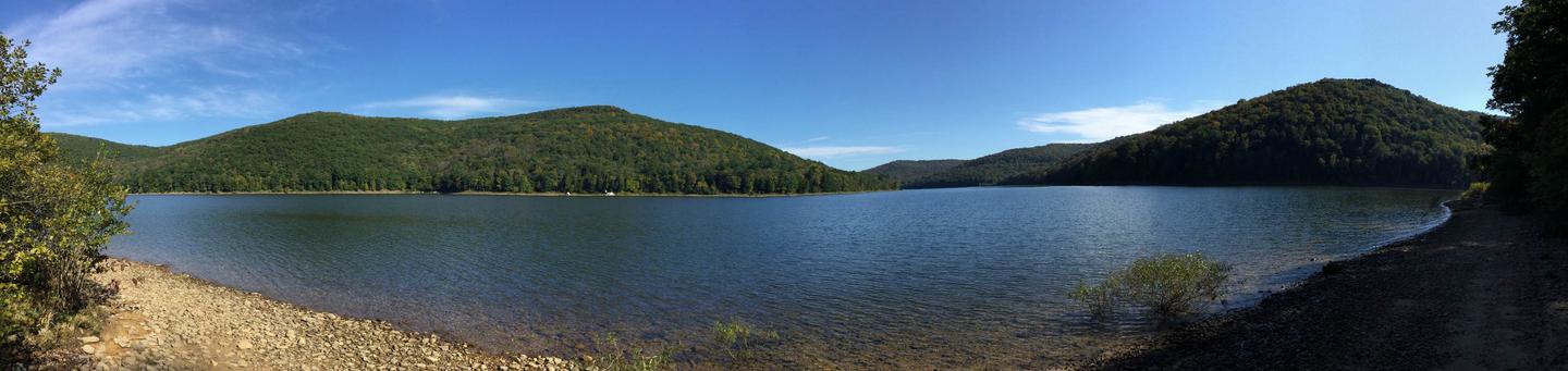
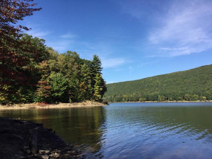
Dewdrop Campground sits on the Kinzua Arm of the Allegheny Reservoir in northwest Pennsylvania, offering a popular getaway for boaters and families.

Recreation

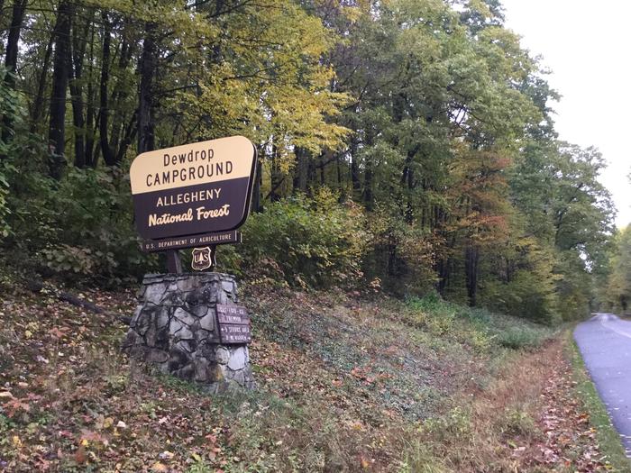
Water activities abound, including lake fishing, boating, and water skiing. A boat launch is available for convenient lake access for campers only. A 2.5 mile trail winds around the campground. Dewdrop is located on the Longhouse Scenic Drive, a winding loop around the Kinzua Arm of the reservoir that includes PA-59, PA-321, and Forest Road 262 (Longhouse Scenic Byway).

Facilities

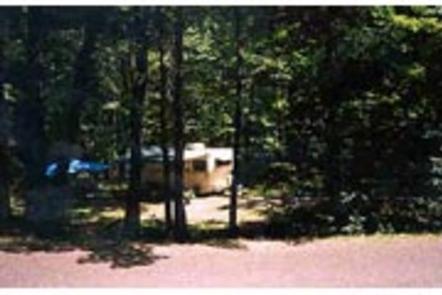
This large campground offers 74 reservable family campsites that include a picnic table, fire ring and tent pad. Flush toilets, drinking water and a dump station are provided.

Amenities such as firewood, ice, interpretive services and 24-hour campground attendants are offered at the site.

Natural Features

The Allegheny National Forest covers nearly half a million acres and is populated primarily with black cherry, maple and other hardwoods. The Kinzua Dam, built in 1965, impounds the Allegheny River to form the 25-mile-long Allegheny Reservoir. Dewdrop clings to the hillside above the water, providing a multi-level tiered campground.

Nearby Attractions

The Kinzua Dam is a short drive to the west on PA-59. The Jakes Rocks Epic Mountain Bike Trail system connects to Dewdrop Campground and consists of trail loops built specifically for mountain biking on the mountain behind the campground. Hikers are also welcome on the trail but remember to keep an eye out for and give way to mountain bike riders. Kinzua Point Information Center is staffed by volunteers on most summer weekends and offers great views up the Allegheny Reservoir.

Reservation

More from CampingHiking.net:

PLEASANT VALLEY CAMPGROUND, Washington Campground Images, Info & Reservations

Directions From Naches, take Highway 410 northwest approximately 42 miles to milepost 80.2. Phone 541-338-7869 Activities BIKING, CAMPING, FISHING, HIKING, WATER SPORTS, SWIMMING SITE Keywords PLVA,OKANOGAN – WENATCHEE NF -FS,PLEASANT VALLEY,PLEASANT VALLEY CAMPGROUND Related Link(s) Rec Area Info & Images Washington State Road Conditions Washington State Tourism Forest Service Concessionaire

ALTURAS LAKE PICNIC AREA (ID), Idaho Campground Images, Info & Reservations

Directions From Stanley, Idaho, take State Highway 75 south for about 22 miles. Turn right on Alturas Creek Road/Forest Road 205 and continue west for about 2.6 miles to the campground. Phone 928-537-8888 Activities BOATING, CAMPING, FISHING, HIKING, WATER SPORTS, SWIMMING SITE Keywords ALTU,SAWTOOTH NF – FS Related Link(s) Rec

LONGHORN, Texas Campground Images, Info & Reservations

Directions From Interstate 20 or 820, take exit 432A for Bryant Irvin Road, and go 3 miles (1.8 km) south to the intersection with Dirks Road / Altabesa Boulevard. Turn right or west and go 1 mile (1.2 km) to the park and Lake Office which will be on the

ASPEN GROUP (INYO), California Campground Images, Info & Reservations

Directions From Bishop, California, take Highway 395 northwest for 25 miles. Turn south at Tom’s Place, and continue driving south for 4 miles onto Rock Creek Road, following signs to the campground. Phone 760-935-4321 Activities CAMPING Keywords ASPR,INYO NF – FS Related Link(s) Rec Area Info & Images Forest Service

NARROWS (AR), Arkansas Campground Images, Info & Reservations

Directions From Greers Ferry, AR, take SR-16 southwest for 2.5 miles. Follow signs to the campground. Phone 501-825-7602 Activities BOATING, CAMPING Keywords NARR,GREERS FERRY LAKE,GREERS FERRY LAKE Related Link(s) Rec Area Info & Images Arkansas State Road Conditions Arkansas State Tourism Overview Narrows Campground is located on Greers Ferry Lake