FRENCH MEADOWS, CA Campground Reservation, Info, Images, Map, Directions

FRENCH MEADOWS, California Campground Images, Info & Reservations

Directions

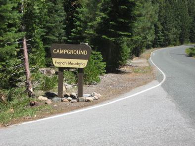
Take Highway 80 to the Foresthill Road, travel 17 miles east to Foresthill. Turn right on Mosquito Ridge Road and travel 34 miles east to French Meadow Reservoir. The campground is on the south shore. Driving from Soda Springs is not recommonded for passanger vehicles without fourwheel drive or high clearence.

Phone

530-367-2224

Activities

AUTO TOURING, BIKING, BOATING, CAMPING, FISHING, HIKING, PHOTOGRAPHY, PADDLING, SWIMMING, CANOEING

Keywords

FREM,TAHOE NF – FS

Related Link(s)

Rec Area Info & Images

California State Road Conditions

California State Tourism

Overview

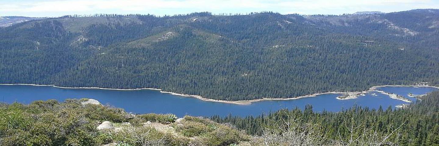
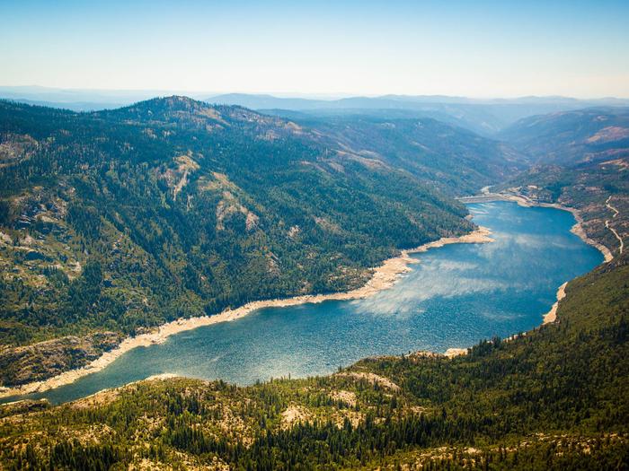
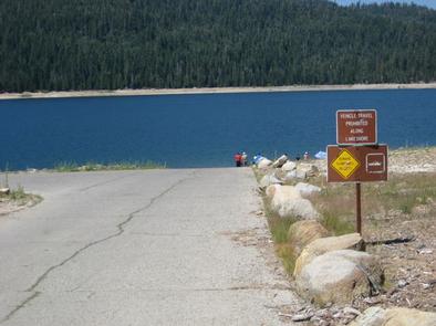
French Meadows Campground is located along the shores French Meadows Reservoir, about 40 miles from the town of Foresthill. Visitors enjoy the area for its fishing, boating and trail opportunities.  This facility is operated and maintained by the Tahoe National Forest.

Recreation

Popular activities on the reservoir include boating, canoeing, fishing and swimming. A boat ramp is located adjacent to the campground. The North Fork American River can be accessed nearby and provides additional opportunities for fishing and swimming. A variety of hiking and biking trails are found in the surrounding area, including some that provide access to the nearby Granite Chief Wilderness and The Western States Trail. Just down the road is the Granite Chief Wilderness which provides amazing hiking opportunities for an adventurous party to explore historic aspen trees and secluded mountain passes and trails. The Western States Trail provides great opporunity for hiking, horse back riding, dirt biking, and for adventurous mountain bikers.

Facilities

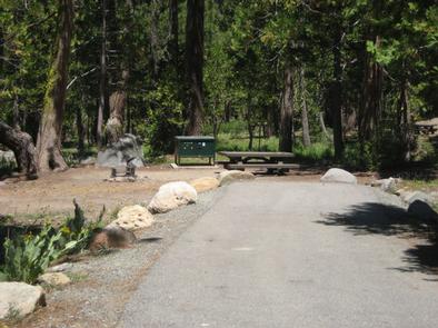
The campground offers single-family campsites, a few of which are wheel chair accessible. Each site is equipped with a picnic table, fire ring and food locker. Flush and vault toilets as well as drinking water are provided. Roads and parking spurs are paved.  Several campsites are available on a first-come, first-served basis.

Natural Features

The campground sits on the southern shore of French Meadows Reservoir, in a pine/fir forest. Summer days can be hot, but evenings are usually cool.

Reservation

More from CampingHiking.net:

CEDAR CREEK (Sam Tobias), New Mexico Campground Images, Info & Reservations

Directions From Ruidoso on Mechem Drive, take Cedar Creek Road west .5 miles. Cedar Creek is the first recreational area located on the right (north). Phone 575-257-4095 Activities BIKING, CAMPING, HIKING, WILDLIFE VIEWING Keywords CEDC,SAM TOBIAS GROUP CAMPGROUND,CEDAR CREEK SAM TOBIAS,LINCOLN NF – FS Related Link(s) Rec Area Info &

CRICKET CREEK, Arkansas Campground Images, Info & Reservations

Directions From Branson, Missouri, take US-65 south for nearly 12 miles. Turn right onto HWY 14 South for 1/4 mile which will turn Left, Stay on 14  South it will take you to the campground. Phone 870-426-3331 Activities BIKING, BOATING, CAMPING, FISHING, HIKING, PICNICKING, WATER SPORTS, WILDLIFE VIEWING, DAY USE

HARDIN RIDGE, Indiana Campground Images, Info & Reservations

Directions From Bedford, go 7 miles east on US 50. Go north on SR 446 for 12 miles and turn west on Chapel Hill Road and travel 2 miles to the Hardin Ridge Recreation Area. From Bloomington, 46 and 446 intersection, go 14 miles south on SR 446. Turn west

RED CANYON, Utah Campground Images, Info & Reservations

Directions Located on Forest Road 095/Red Canyon Road off Highway 44, approximately 40 miles north of Vernal, Utah. Phone 435-784-3445 Activities BIKING, BOATING, CAMPING, FISHING, HIKING, WILDLIFE VIEWING Keywords RECA,RED CANYON COMPLEX,FLAMING GORGE,ASHLEY NF – FS,Flaming Gorge National Recreation Area Related Link(s) Rec Area Info & Images Utah State Tourism

BRIDGEVIEW (RATHBUN LAKE), Iowa Campground Images, Info & Reservations

Directions From Moravia, IA, travel 10 miles west on Highway J18 and follow signs into the campground. Phone FOR CAMPGROUND INQUIRIES DURING MAY-SEPTEMBER PLEASE CALL 641-724-3062. DURING CLOSED SEASON PLEASE CALL 641-647-2464 Activities BIKING, BOATING, CAMPING, FISHING, HIKING, PICNICKING, WILDLIFE VIEWING, DAY USE AREA, INFORMATION SITE, SWIMMING, KAYAKING, CANOEING, WATER

SENECA SHADOWS, West Virginia Campground Images, Info & Reservations

Directions From Elkins WV, take US 33 east 34 miles. Turn right into the campground. From Petersburg, WV, take State Hwy 28 south 22 miles. Turn right into the campground. From Franklin, WV, take US 33 west 24 miles. Turn left into the campground. Phone 304-567-3082 Activities BOATING, CLIMBING, CAMPING,