
Directions
From I-5 north, take exit 194 to Highway 2. Continue for about 48 miles, then turn south at the Money Creek Campground sign. Continue about 3 miles to the campground.
Phone
360-804-1103
Activities
BIKING, CAMPING, FISHING, HIKING, WILDLIFE VIEWING
Keywords
MILR,MT. BAKER-SNOQU NF – FS
Related Link(s)
Washington State Road Conditions
Overview
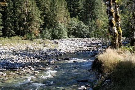
Situated along the banks of the tranquil Miller River in Mt. Baker-Snoqualmie National Forest, the Miller River Group Campground offers some of the most stunning scenery in the northern Cascade Range in Washington.
Nestled in a mixed conifer forest, the sites in this campground are widely spaced and within walking distance to the river, ideal for visitors wanting to enjoy the serenity of an isolated setting.
The campground also a great jumpoff point for a multitude of recreational activities along either the Skykomish River, in the Alpine Lakes Wilderness or near Stevens Pass.
Recreation
In addition to being a prime location for hiking and fishing in summer and early fall, Miller River offers excellent skiing and snowshoeing in the winter months.
The Mt. Baker-Snoqualmie National Forest’s 1,500 miles of trails can entice any hiker to get outdoors. From smooth paths meandering through deep quiet forests to challenging ascents up boulder-studded mountains, opportunities abound for every skill level.
The nearby Dorothy Lake Trail begins in a densely shaded forest for approximately 1.5 miles to the outlet of Dorothy Lake, then continues along the lake’s eastern edge for another 2 miles to its inlet. From here the trail climbs steeply over a ridge and enters the Snoqualmie Ranger District. Permits are needed for both day-use hiking and overnight backpacking and camping in Wilderness Areas.
Facilities
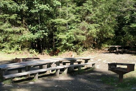
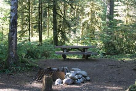
Miller River Group Campground offers one reservable group site and 18 standard sites available on a first-come, first-served basis.
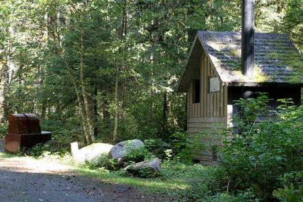
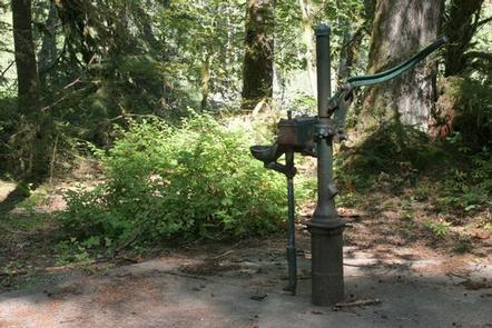
Picnic tables, vault toilets, campfire rings and drinking water are available.
Natural Features
Hemmed in by several designated wilderness areas, the Mt. Baker-Snoqualmie National Forest showcases rugged peaks, sparkling alpine lakes and old-growth forests.
Mt. Baker, the most prominent feature of the Mt. Baker Wilderness Area, dominates the landscape on a clear day. Rising to an elevation of 10,781 feet, the active volcano from which the forest takes its name is perpetually snow-capped and mantled with an extensive network of creeping glaciers. Mt. Baker’s summit, Grant Peak, is actually a 1,300-foot-deep mound of ice, which hides a massive volcanic crater.
More than 700 lakes and mountain ponds dot the glacier-carved terrain of nearby Alpine Lake Wilderness. Tree-covered valleys give way to rocky ridges and rugged peaks along the crest of the Cascades. Many peaks and slopes are permanently cloaked in snowfields.
Congress designated the Alpine Lakes Wilderness in 1976 with a total of 362,789 acres, 117,862 of which lie in the Mt. Baker-Snoqualmie National Forest.
Nearby Attractions
Visitors enjoy the North Cascades and Mt. Rainer National Parks, where interpretive programs and exhibits offer education about the diverse landscape and history of the area.
The Pacific Crest Trail (PCT), one of the world’s premier National Scenic Trails, showcases some of North America’s most fantastic scenery, winding its way its way from Mexico to Canada through California, Oregon and Washington, and is accessible near the campground.