
Directions
From Interstate 17, take Exit 287 for AZ-260 toward Cottonwood/Payson/89-A. Turn right onto AZ-260 and follow for approximately 8 miles to the campsite.
Phone
928-204-0028
Activities
CAMPING, BIRDING
Keywords
CLEG,OAK CREEK CANYON,COCONINO NF – FS
Related Link(s)
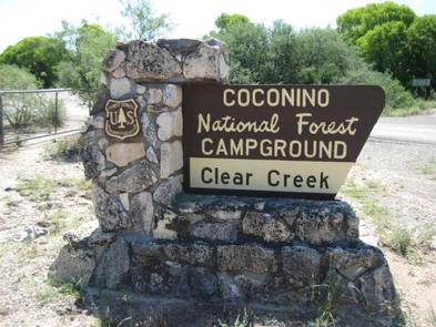
Overview
This cozy group campground is tucked in the Lower Sonoran Desert along the banks of the fresh, chilly Clear Creek. Campers can wade in the creek, fish, or curl up with a book under the umbrella of cottonwood trees. Another popular pastime here is birdwatching, where you might just spot a hawk or bald eagle in flight.
Clear Creek Campground is seven miles southeast of the small ranching town of Camp Verde. It’s part of the Coconino National Forest, one of the most diverse forests in the country. Landscapes range from alpine tundra to desert valleys and red canyons.
Recreation
The campground is part of an oasis that attracts a variety of wildlife. Colorful songbirds and raptors are common birdwatching finds, and cool water species such as smallmouth bass and green sunfish make for enjoyable fishing. Wildlife watching includes black bears, elk, turkey, deer, and bison.
Facilities
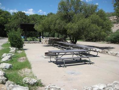
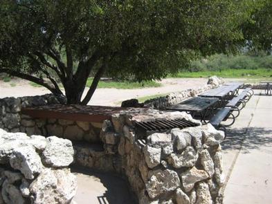
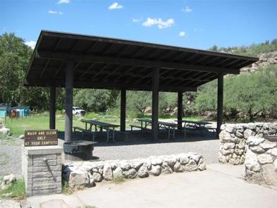
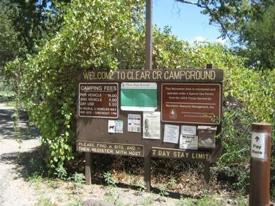
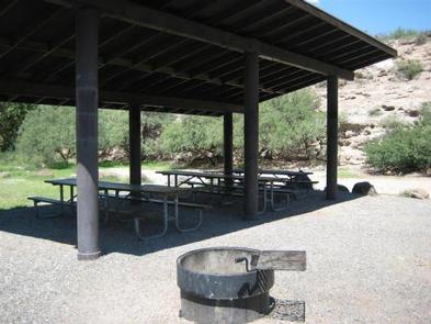
Clear Creek Campground is grassy and flat, with some shade from surrounding cottonwoods. The group campsite holds 80 people with a maximum of 30 vehicles. The campsite is a popular destination, with its relaxed, open atmosphere, so be sure to book early for holiday weekends. This facility also has 18 standard family sites available on a first-come, first-served basis.
Natural Features
Clear Creek sits in the Verde Valley at 3,200 feet elevation. It’s part of the Sonoran desert near the base of Cactus Mountain, and the climate is arid with hot summer days and mild winters.
Nearby Attractions
A must-do day trip is the Montezuma Castle National Monument, where you can marvel at a well-preserved Native American cliff dwelling that dates back 1,000 years. Near the dwelling is the Montezuma Well, which is a naturally-formed well that collects over a million gallons of fresh water a day.
Hot-air ballooning and horseback riding are also fun outings near the campsite.