FOXTAIL GRP PICNIC AREA, NV Campground Reservation, Info, Images, Map, Directions

FOXTAIL GRP PICNIC AREA, Nevada Campground Images, Info & Reservations

Directions

From Las Vegas, Nevada, take Highway 95 north to the junction with Highway 156/Lee Canyon, turn left and travel approximately 19 miles to the picnic area, which is on the left.

Phone

702-872-5486

Activities

BIKING, CAMPING, HIKING

Keywords

FOXT,MOUNT CHARLESTON,LAS VEGAS,SPRING MTNS NAT REC AREA,HUMBOLDT-TOIYABE NF-FS

Related Link(s)

Rec Area Info & Images

Nevada State Tourism

Nevada State Road Conditions

Overview

Foxtail Group Picnic Area is located in the Spring Mountains National Recreation Area, just 47 miles from downtown Las Vegas. Visitors enjoy hiking, mountain biking, scenic driving, and winter snowplay in this forested desert oasis.

Recreation

Hiking and mountain biking are popular activities on the 1.3-mile Sawmill Trail and the 6.2-mile Bristlecone Trail. Both begin just a short drive from Foxtail. When there is at least 12 inches of snow on the ground, Foxtail becomes a winter playground for sledding and tubing.

Facilities

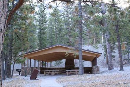
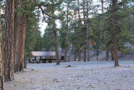
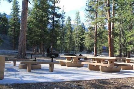
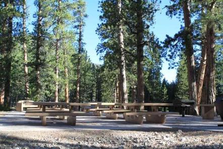
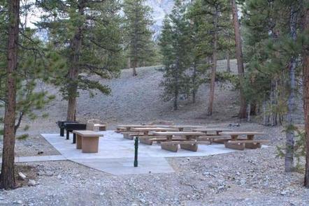
This picnic area is a day-use site only. During the summer, seven group sites are available, each with picnic and serving tables, grills and campfire circles. The two largest have pavilions and fireplaces. Flush toilets and drinking water are provided. During the winter, fees are per vehicle for snowplay. There is a selfpay station. Firerings will be usable. Restrooms will be provided.

Natural Features

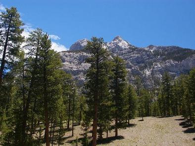
The Spring Mountains National Recreation Area is a beautiful island in the desert, brimming with breathtaking scenery and diverse flora and fauna. The Bristlecone pine, the world’s oldest organism, and the rare Mount Charleston blue butterfly are both found within the Spring Mountains.

More than 100 springs create the namesake for the mountain range, making it the perfect place to escape the heat of the city.

The picnic area is set among a forest of towering ponderosa pine which provides limited shade. The area affords views of the surrounding Spring Mountains.

Nearby Attractions

More than 60 miles of hiking and horseback riding trails crisscross the area; two trails allow mountain biking. Rock climbing, picnicking and scenic driving are popular activities.

Reservation

More from CampingHiking.net:

JUNIPER SPRINGS REC AREA, Florida Campground Images, Info & Reservations

Directions From I-75, take Highway 40 east through Ocala and Silver Springs for approximately 36 miles to the Juniper Springs Recreation Area. From I-95, take the Ocala/Silver Springs Exit (Highway 40) west for approximately 37 miles to the Juniper Springs Recreation Area. From the intersection of Highway 40 and Highway

MINERS GULCH, Utah Campground Images, Info & Reservations

Directions From Duchesne, Utah: Take Highway 87 north for 15 miles to the Mountain Home turnoff. Turn left and continue 2.5 miles north to the Rock Creek Store. Turn left toward Rock Creek Canyon and proceed approximately 15 miles to the campground. You’ll see a sign for Miners Gulch and

LONG POINT (CA), California Campground Images, Info & Reservations

Directions Located 30 miles northeast of Taylorsville, on the Genesee-Antelope Lake Road. From Janesville, take County Road 208 for 4 miles and turn onto Forest Service road 28N01 for 9 miles, then turn right on Forest Service road 28N03 and continue for 2 miles. Phone 530-283-0555 Activities BIKING, CAMPING, FISHING,

TWO COLOR GUARD STATION, Oregon Campground Images, Info & Reservations

Directions From La Grande, Oregon: travel east on Highway 203 to Union. From Union, follow Highway 203 to Medical Springs. Go straight through Medical Springs and take County Road 71 until it turns into Forest Service Road (FSR) 67. Follow until you reach the FSR 77 junction. Take FSR 77

MILL SPRINGS MILL SHELTER, Kentucky Campground Images, Info & Reservations

Directions From downtown Monticello, Kentucky: Head east on South Main Street, cross Hwy 90/Hwy 1275, continue to follow Hwy 1275, approximately 6.6 miles, 14 minutes. Phone 606-679-6337 Activities HISTORIC & CULTURAL SITE Keywords MILL SPRINGS MILL SHELTER,MILL SPRINGS Related Link(s) Rec Area Info & Images Kentucky State Tourism Kentucky State

SLIDE GROUP AREA, New Mexico Campground Images, Info & Reservations

Directions Located in southeast New Mexico, Slide Group Area is approximately 20 miles east of Alamogordo. From Alamogordo, take Highway 82 east 16 miles. Just before Cloudcroft, turn right (south) on Highway 130, go approximatley 2 miles. Turn right (west) on NM 6563, the Sunspot Highway Go approximately 1/4 miles.