MOUNT ROSE (NV), CA Campground Reservation, Info, Images, Map, Directions

MOUNT ROSE (NV), California Campground Images, Info & Reservations

Directions

From Highway 395 south of Reno, travel 17 miles west on State Route 431, following signs to the campground.

The Actual Mailing Address is: PO Box 104, Markleeville, CA 96120.

The Physical Address is: Mt. Rose Hwy, State Route 431, Reno, NV 89511.

Phone

530-694-1002

Activities

BIKING, CLIMBING, CAMPING, HIKING

Keywords

MOUNT ROSE (NV),MOUR,HUMBOLDT-TOIYABE NF-FS,MT ROSE,Mt. Rose,Mt Rose

Related Link(s)

Rec Area Info & Images

California State Road Conditions

Forest Service Concessionaire

California State Tourism

Overview

Mount Rose Campground is conveniently located between Reno and Lake Tahoe just off scenic Mount Rose Highway. Visitors love the campground for its proximity to excellent hiking trails and recreational opportunities at Lake Tahoe.

Recreation

Hiking is the most popular pastime at Mount Rose. Several trails, including the Tahoe Meadows, Tahoe Rim, Mount Rose Wilderness and Mount Rose Summit Trails, begin very close to the campground.

Facilities

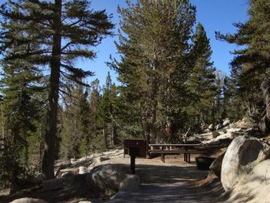
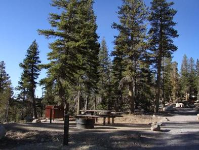
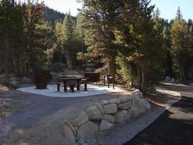
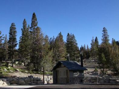
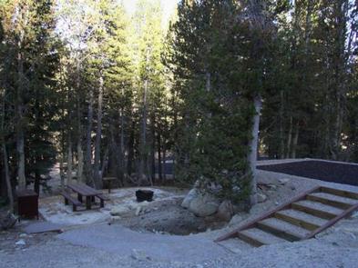
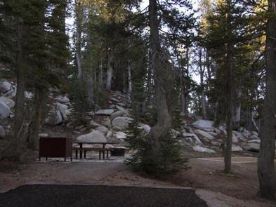
Mount Rose contains single and double-family sites, as well as one triple-family site. Six of the single sites are for tent camping only. Picnic and utility tables, campfire rings, grills and food storage lockers are provided, as are vault toilets and drinking water. Roads and parking spurs throughout the site are paved.

Natural Features

The campground is situated high on the western slope of Mount Rose at an elevation of 9,300 feet. A scenic forest of lodgepole pine, Jeffrey pine, white pine and red fir covers the campground, offering pleasant shade in most sites.

Nearby Attractions

Mount Rose is conveniently close to beautiful Lake Tahoe, less than 30 minutes away. Tahoe offers excellent boating, kayaking, fishing, hiking and scenic driving opportunities.

Reservation

More from CampingHiking.net:

SNAKE CREEK, Oklahoma Campground Images, Info & Reservations

Directions From Gore, OK, go 15 miles northeast on Highway 100, then turn left and go 1/2 mile west on paved access road. Phone 918-487-5252 Activities BOATING, CAMPING, SWIMMING SITE Keywords SANK,TENKILLER LAKE,TENKILLER FERRY LAKE,TENKILLER FERRY Related Link(s) Rec Area Info & Images Oklahoma State Road Conditions Oklahoma State Tourism

MOOSEHORN, Utah Campground Images, Info & Reservations

Directions From Salt Lake City, Utah, take I-80 east for approximately 30 miles to Exit 146 for Highway 40 toward Park City/Heber City/Vernal. Take Exit 4 onto Highway 248 toward Kamas. Take left onto UT 32 then right onto Highway 150 (Mirror Lake Scenic Byway). Go 31 miles to campground.

FURNACE CREEK, California Campground Images, Info & Reservations

Directions Death Valley is in eastern California on the Nevada border, 130 miles west-northwest of Las Vegas, Nevada and 106 miles east of Lone Pine, California. Furnace Creek Campground is a half-mile north of Furnace Creek Visitor Center on State Highway 190. Phone 760-786-2441 Activities BIKING, HISTORIC & CULTURAL SITE,

SUNLIGHT BAY, Arkansas Campground Images, Info & Reservations

Directions From Plainview, Arkansas, take Highway 28 west for a quarter mile, then follow signs to the campground. Phone 479-272-4234 Activities BOATING, CAMPING, FISHING Keywords SUNL,NIMROD LAKE,NIMROD LAKE Related Link(s) Rec Area Info & Images Arkansas State Tourism Arkansas State Road Conditions Overview Sunlight Bay Campground sits along the shores