CAVE SPRING, AZ Campground Reservation, Info, Images, Map, Directions

CAVE SPRING, Arizona Campground Images, Info & Reservations

Listen

Directions

From Phoenix, take I-17 to Highway 179 north toward Sedona. Turn north on Highway 89A and continue for 11 miles into Oak Creek Canyon.

From Flagstaff, take I-17 to Highway 89A south. Follow 89A for 18 miles to Oak Creek Canyon.

Phone

928-282-1629

Activities

CAMPING, FISHING, HIKING, WILDLIFE VIEWING, PHOTOGRAPHY, SWIMMING, BIRDING

Keywords

CAVE,CAVS,OAK CREEK CANYON,COCONINO NF – FS

Related Link(s)

Rec Area Info & Images

Arizona State Tourism

Arizona State Road Conditions

Forest Service Concessionaire

Overview

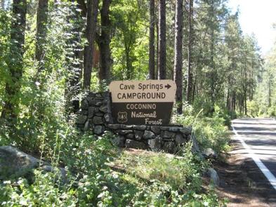
Cave Springs sits in the scenic Oak Creek Canyon and is one of Coconino National Forest’s most popular campgrounds.

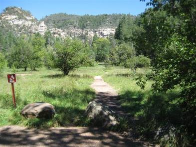
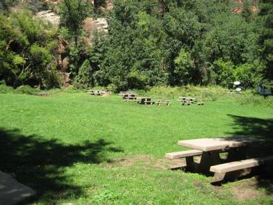
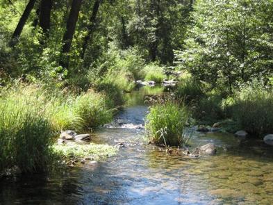
The campground is nestled in a forested canyon near the town of Sedona, Arizona, and its famous red rock cliffs. The scenery is unmatched, the stream is stocked with trout, and swimming, hiking and birding spots are nearby.

Recreation

There are several hiking trails in the vicinity. Some lead up the canyon slopes to offer good views of the surrounding scenery. The creek is bordered with paths that lead along its picturesque course, offering great bird watching and fishing.

Facilities

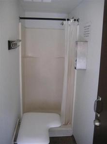
Cave Spring is a large campground with 84 campsites, including one tent-only site. All sites have picnic tables, campfire rings and cooking grills. Token-operated showers, drinking water and vault restrooms are provided for convenience. The facility can host RVs, trailers and motor homes up to 36-ft.

Natural Features

The area is a heavily wooded, lush riparian zone. Campsites are located in a shady stand of ponderosa pines in the upper reaches of the canyon. Many of the campsites are located right on the banks of Oak Creek. The creek has crystal clear, cool water that is refreshing on hot summer days.

Nearby Attractions

The nearest town is Sedona, popular for its red rock vistas, resorts and shopping. One of Arizona’s best swimming spots, Slide Rock State Park, is down the road.

Campers can also explore the 1.8-million acre Coconino National Forest, which boasts a spectacular variety of scenery and outdoor activities.

Reservation

More from CampingHiking.net:

CURRANT CREEK, Utah Campground Images, Info & Reservations

Listen Directions From Heber City, Utah, take Highway 40 east for 45 miles to the Currant Creek Junction. Turn off the highway and travel in a northwest direction approximately 17 miles to the campground. The road from the highway is paved for 10 miles and graded gravel for 7 miles.

CLEAR LAKE (TX), Texas Campground Images, Info & Reservations

Listen Directions While traveling on US Highway 380 in Princeton, TX, take South 2nd Street (County Road 982) South. County Road 982 changes into County Road 735. At the 4 way stop sign (just past the Lavon Lake Camp and Conference Center), take a right on County Road 436. Watch

COUGAR ROCK GROUP CAMPGROUND, Washington Campground Images, Info & Reservations

Listen Directions Cougar Rock Campground is located 14 miles east of Ashford, Washington, on State Route 706/Paradise Road. Phone 360-569-2211 Activities CAMPING, INTERPRETIVE PROGRAMS, HIKING, PICNICKING, VISITOR CENTER, DAY USE AREA Keywords CG82,Mount Rainier National Park Related Link(s) Rec Area Info & Images Washington State Tourism Washington State Road Conditions

PALISADES RANGER RESIDENCE CABIN, Arizona Campground Images, Info & Reservations

Listen Directions Driving Directions: From northeast Tucson, take East Tanque Verde Road to East Catalina Highway. Turn left (north) on East Catalina Highway, which becomes the General Hitchcock Highway, for approximately 23 miles to Organization Ridge Road and turn left (just before Palisades Visitor Center). The cabin is located approximately

SILVER CREEK CAMPGROUND, Idaho Campground Images, Info & Reservations

Listen Directions From Boise, travel north on Highway 55 to Banks. Turn east on the Banks-Lowman Highway and continue east for 8 miles toward Garden Valley. Turn north on Middle Fork Road (Forest Road 698) and pass through Crouch, continuing north on the Middle Fork Road approximately 16 miles to