RAINBOW (AZ), AZ Campground Reservation, Info, Images, Map, Directions

RAINBOW (AZ), Arizona Campground Images, Info & Reservations

Directions

From Pinetop, Arizona, take Highway 260 east about 60 miles to Highway 261. Turn right (south) onto Highway 261 and follow for about 20 miles to Forest Road 115. Take Highway 115 for 3 miles east, turn right, and go 1 mile to the campground.

Phone

928-537-8888

Activities

BIKING, BOATING, CAMPING, FISHING, HIKING

Keywords

RAIN,BIG LAKE,APACHE-SITGREAVES NF-FS

Related Link(s)

Rec Area Info & Images

Arizona State Road Conditions

Arizona State Tourism

Forest Service Concessionaire

Overview

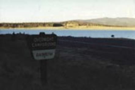
Rainbow is the largest campground in the Big Lake Recreation Area in eastern Arizona. Because of its proximity to the lake, size and the many amenities it offers, Rainbow is a favorite for families. Popular activities include hiking, horseback riding and fishing.

Recreation

The campground is adjacent to 450-acre Big Lake, one of Arizona’s top fishing lakes. The lake is known for its trout fishing, with rainbow, cutthroat, brook and Apache being the most sought-after species.

The recreation area is also popular for hiking, mountain biking, birding and wildlife viewing. Curious campers can attend educational programs at the recreation area’s visitor center.

Facilities

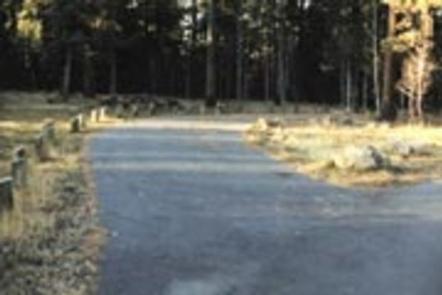
The facility boasts 165 campsites organized into six loops. Four double sites are available for up to 16 people each, which is convenient for larger families, and two single unit accessible sites are also available.

A small store nearby sells gas, food, boat rentals and firewood. A campground host is available on-site for visitor assistance.

Natural Features

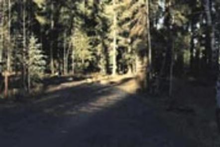
Rainbow Campground sits at an elevation of 9,000 feet in the White Mountains. It is a very scenic area, forested with ponderosa pine, Douglas fir, spruce and aspen trees, which provide ample shade.

Summer temperatures are pleasant and cool, a nice respite from the heat of the lower desert. Visitors should come prepared for cool nighttime temperatures and occasional summer thunderstorms.

Nearby Attractions

Visitors can explore endless vistas and take part in many outdoor activities in the surrounding Apache-Sitgreaves National Forest, which encompasses 2 million acres of magnificent mountain country in east-central Arizona and New Mexico. Springerville, Arizona is the closest town to the campground.

Reservation

More from CampingHiking.net:

PICKETT BUTTE LOOKOUT, Oregon Campground Images, Info & Reservations

Directions Important note regarding GPS use: please be advised that GPS units can, and have sent guests down the wrong roads to access the lookout. Please consider following the directions below rather than your GPS unit. Directions: From Canyonville take West 1st Street and turn onto SE 3rd St/OR-227. Continue

KOKNUK CABIN, Alaska Campground Images, Info & Reservations

Directions Koknuk Cabin is located on the west side of Sergief Island, on the Stikine River delta. The cabin is accessible by shallow draft boat only, 10 miles from Wrangell or 8 miles from the boat ramp on the south end of Mitkof Island. Tides affect access. Boat access requires

LEWIS CANYON, Arizona Campground Images, Info & Reservations

Directions Drive to Pinedale, Arizona, on State Highway 260, approximately 14 miles northwest of Show Low. Turn south on Forest Road 130 and continue approximately 2.3 miles to Junction 130A. Turn right to the group site, following the signs.  Phone 928-368-2100 Activities BIKING, CAMPING, HIKING Keywords LEWI,APACHE-SITGREAVES NF-FS Related Link(s)

LONE POINT, Illinois Campground Images, Info & Reservations

Directions From Shelbyville, Illinois, go 4.5 miles north on State Route 128 to County Road 1750 N. Turn right and drive 0.9 miles to County Road 1900 E, then make a left and go 0.35 mile. Turn right onto County Road 1785 N and continue 2.5 miles to County Road

MILLER CABIN, Montana Campground Images, Info & Reservations

Directions From Townsend, Montana: Turn east from US Highway 287 onto US Highway 12 for approximately 3 miles. Turn north on State Highway 284 for approximately 15 miles. Turn northeast onto Forest Road 287, Confederate Gulch, travel on Forest Rd 287 for approximately 8 miles. Arrived at location. Junction of

THE NARROWS, Kentucky Campground Images, Info & Reservations

Directions From Glasgow, KY: Take 31-E south for 10 miles, turn right on 1318. Follow signs into campground entrance. Phone 270-646-3094 Activities CAMPING, HIKING, DAY USE AREA Keywords NARROWS,THE NARROWS,THEN,BARREN RIVER LAKE,BARREN RIVER,BARREN LAKE Related Link(s) Rec Area Info & Images Kentucky State Tourism Kentucky State Road Conditions Overview The