


Directions
From West Yellowstone, Montana, take U.S. Highway 20 south for 26 miles.
From Ashton, Idaho: Take U.S. Highway 20 north for 25 miles. The campground entrance is .25 miles north of Ponds Lodge on the east side of the highway.
Phone
208-558-7658 OR 208-270-0094
Activities
BIKING, BOATING, CAMPING, FISHING, HIKING, HUNTING, WILDLIFE VIEWING, DAY USE AREA
Keywords
BUF2,BUFFALO IDAHO,CARIBOU-TARGHEE NF – FS
Related Link(s)
Overview
Buffalo Campground is located 26 miles south of West Yellowstone, Montana and 25 miles north of Ashton, Idaho in beautiful Island Park, Idaho.
Buffalo is a large campground just off U.S. Highway 20 on the banks of the Buffalo River at an elevation of 6,200 feet. Visitors love Island Park for its world-class fishing and outstanding scenery and wildlife viewing opportunities.
Recreation
The Island Park area is renowned for its fishing; the Henry’s Fork is known as one of the nation’s best fly-fishing streams. Anglers cast for rainbow, cutthroat and brook trout and Kokanee salmon. Island Park Reservoir and Henry’s Lake are nearby, both offering boating, water skiing and excellent fishing opportunities.
Hiking, biking, horseback riding and ATVing are popular activities. Many miles of trails are in the area, including the Continental Divide National Scenic Trail and the Nez Perce Trail.
The Big Springs National Recreation Water Trail offers an approximately three-hour float or canoe trip through beautiful scenery. Wildlife, including moose, bald eagles and Sandhill cranes, are often seen along the trail.
Facilities
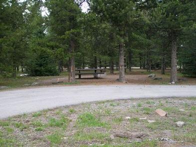
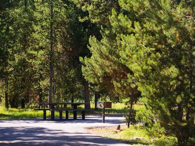
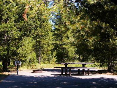
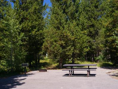
The campground offers has six loops of single family sites and one loop for group camping, for a total of 127 sites, 50 of which are reservable. The large group site can accommodate 150 people. One loop has electric hook-ups and all loops are paved.
Accessible flush and vault toilets are provided, as is drinking water and trash collection. A separate parking area is located at the accessible fishing dock and viewing platforms on the east end of the campground.
Ponds Lodge is just across the highway and has fuel, groceries and other amenities.
Natural Features
Island Park is composed of two areas of extinct volcanic activity. The Henry’s Fork Caldera sits inside the larger Island Park Caldera. The area is known for its dense forests of lodgepole pine, broad grassy meadows bursting with summer wildflowers and a wide variety of wildlife, including black and grizzly bears, moose, elk, deer, bald eagles, Sandhill cranes and much, much more.
The campground lies alongside the Buffalo River, created by a large spring just 4.5 miles away. The Buffalo is a tributary of the Henry’s Fork, and flows into it just 2 miles east of the campground. Brook and rainbow trout are plentiful in the Buffalo and a variety of waterfowl and wildlife frequents the river corridor.
Nearby Attractions
Mesa Falls Scenic Byway is 7 miles south of the campground. This 28-mile road leads to scenic overlooks and trails at 110 foot Upper Mesa Falls and 85 foot Lower Mesa Falls.
Harriman State Park is 8 miles south. The Henry’s Fork meanders through the Harriman, offering excellent fishing. Over 20 miles of trails are available, and wildlife is abundant in this scenic park.
Henry’s Lake State Park is 11 miles north, offering fishing, a fish cleaning station and boat ramp.
Yellowstone National Park’s west entrance is just 26 miles north in the town of West Yellowstone, Montana. Visitors enjoy day-tripping to the park for unparalleled wildlife viewing and the beautiful and unique scenery.