HOLLY BAY, KY Campground Reservation, Info, Images, Map, Directions

HOLLY BAY, Kentucky Campground Images, Info & Reservations

Directions

From London, Kentucky, take Exit 38 off I-75. Turn west on KY 192, then go 14.2 miles and turn south (left) on KY 1193. Follow signs to Holly Bay Campground entrance (3 miles).

Phone

606-528-6156

Activities

BIKING, BOATING, CAMPING, INTERPRETIVE PROGRAMS, FISHING, DAY USE AREA, SWIMMING SITE

Keywords

HOLL,LAUREL LAKE,LAUREL RIVER LAKE,HOLLY BAY RECREATION AREA,DANIEL BOONE NF-FS

Related Link(s)

Rec Area Info & Images

Kentucky State Tourism

Kentucky State Road Conditions

Forest Service Concessionaire

Overview

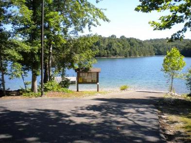
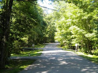
Holly Bay, located two miles north of the Laurel River Dam, sits on the west side of Laurel River Lake. Visitors enjoy the campground for its proximity to the water and beautifully forested location. Plus, Holly Bay is ideal for activities like power boating, canoeing and fishing.

The forest was named after Daniel Boone, a famous frontiersman and explorer who settled in Kentucky in the late 18th century.

Recreation

Boating and water skiing are a big hit. A boat ramp and fish cleaning station are located a short distance from the campground.

Hikers take pleasure in the 4.2-mile Sheltowee Trace Trail that leads from the campground to the dam.
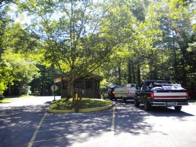
Facilities

The campground offers single and double-family campsites, some of which have 20, 30 or 50-amp electric hookups. Some campsites overlook the lake.

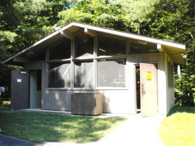
Flush toilets (one is accessible), two shower houses, drinking water and a dump station are provided. Firewood and ice are available for purchase. Educational programs are held during the summer.

AmericanLL.com 

Natural Features

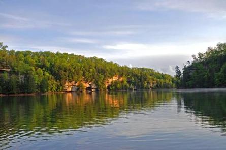
Most campsites are surrounded by a mixture of hardwood trees that provide picture-perfect colors in autumn. Laurel River Lake spans 5,600 acres of deep, clear water and 192 miles of cliff-lined shore. Bountiful hills from the Appalachian foothills create a backdrop for the lake area.

Nearby Attractions

Head to the Cumberland Falls Trail that begins at Cumberland Falls and ends at the mouth of the Laurel River. This trail is a 30-45 minute drive from the campground.

Reservation

More from CampingHiking.net:

HOGAN CABIN, Montana Campground Images, Info & Reservations

Directions Travel west on Highway 43 from Wisdom, Montana for approximately 20 miles. Turn north on the Trail Creek Road #106, travel for approximately 6 miles to the cabin. It will be located on the left (west) side of the road. Access 1 This route takes off from the Chief

Frisco Campground, North Carolina Campground Images, Info & Reservations

Directions North (From Richmond, VA) Follow I-95 South to Richmond, VA. Take I-64 East toward Norfolk/Virginia Beach, VA. Take I-64 or I-664 to Chesapeake, VA. From I-64, take Exit 291B to Route 168, the Chesapeake Expressway (a toll-road costing $3.00 – $6.00 each way). Once in North Carolina, Route 168

BEAVER LAKE, Wisconsin Campground Images, Info & Reservations

Directions 61324 Beaver Lake Rd. (FR 199) From Mellen, Wisconsin, take County Highway GG west for about 8 miles. Turn right onto Forest Service Road 187/Mineral Lake Road and follow it about 3 miles to the intersection with Forest Service Road 198/Pine Stump Corner. Continue straight onto Forest Service Road

LAGUNA, California Campground Images, Info & Reservations

Directions Located 50 miles east of San Diego, California. Take I-8 to Sunrise Highway exit. Go approximately 15 miles to Laguna/El Prado Campground, just beyond the 26 mile marker. Stop at the entrance station for campground information and site location. Phone 619-473-2082 Activities BIKING, CAMPING, HIKING, DAY USE AREA Keywords

LOUELLA CABIN, Washington Campground Images, Info & Reservations

Directions From Sequim east, for approximately 3 miles. Just past John Wayne Marina Road, turn right onto the Palo Alto Road and travel approximately 8 miles. The access drive to Louella Cabin is by an information kiosk on the right. Turn into the driveway, go past the first building, and