
Directions
333 Red Rock Crossing Rd. Sedona, AZ 86336 From Phoenix, take I-17 north to State Highway 179. Go north on 179 for 13 miles to Sedona, then turn left on Highway 89A and continue south for 4 miles. Turn left on Upper Red Rock Loop Road and proceed another 4 miles to Crescent Moon.
Phone
928-204-0028
Activities
BIKING, FISHING, HIKING, PICNICKING, PHOTOGRAPHY, SWIMMING
Keywords
CREM,COCONINO NF – FS
Related Link(s)
Overview
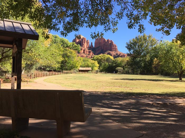
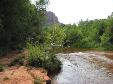
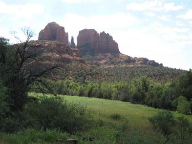
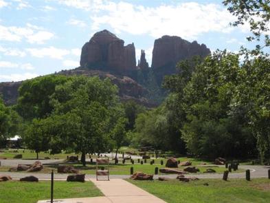
Crescent Moon sits beneath the towering Cathedral Rock, one of the most photographed scenes in the Southwest. This day-use area (group shelter also known as Ramada) is as popular as it is beautiful. Visitors will marvel at the reflection of the red cliffs in the waters of Oak Creek at Red Rock Crossing.
Recreation
Visitors enjoy picnicking, fishing and wading in the crystal clear waters of Oak Creek. Flora, fauna and rock formations in the surrounding area offer excellent photography opportunities.
Within a few minutes, visitors can access hiking, biking and scenic driving through Oak Creek Canyon to view majestic red-hued cliffs, buttes and canyons. The site is also conveniently close to developed entertainment like golf courses and stylish restaurants in the resort town of Sedona.
Facilities
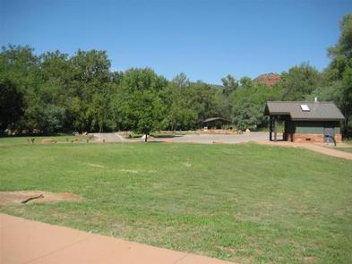
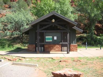
The scenery is the biggest draw to the facility. The group picnic shelter (also known as ramada) has picnic tables and grills and can accommodate up to 50 guests. There is ample parking around the site. Drinking fountains are provided.
Natural Features
Placed beside a tree-lined creek, the picnic area’s location offers a serene place to enjoy nature, with Sedona’s famous red rock cliffs setting the backdrop.
Crescent Moon lies in a high desert region situated at the base of the Mogollon Rim, a 200-mile long slope that ranges between 5,000 and 7,000 feet in elevation. The unique landscape creates erosion that has shaped spectacular canyons and buttes that make the region an appealing attraction.
Nearby Attractions
The towns of Sedona and Oak Creek offer plenty of lodging, camping, shopping and dining to entertain guests.
A variety of hiking trails and swimming holes are a short drive away. The Red Rock/Secret Mountain Wilderness area in the heart of Oak Creek Canyon is a popular destination, where visitors will find abandoned dwellings and rock art from early inhabitants.