
Directions
From Poteau, OK, take U.S. Highway 59 south approximately 22 miles to Holson Valley Road (10 miles south of Heavener). Turn right (west) onto Holson Valley Road and travel approximately 2.5 miles. Turn right (north) onto Cedar Lake Road and travel 1 mile to the camp boundary.
From Talihina, OK, take U.S. Highway 271 east toward Poteau for 11 miles. Turn right (east) onto Holson Valley Road and travel 19 miles to Cedar Lake Road. Turn left onto Cedar Lake Road.
Phone
918-653-2991
Activities
BOATING, CAMPING, FISHING, HIKING, VISITOR CENTER, SWIMMING SITE
Keywords
CED3,CEDAR LAKE HORSE CAMP,CEDAR LAKE EQUESTRIAN CAMP,CEDAR LAKE SHADY LANE,SOUTH SHORE,THE BOTTOMS,CEDAR LAKE OKLAHOMA,OUACHITA NF – FS
Related Link(s)
Oklahoma State Road Conditions
Overview
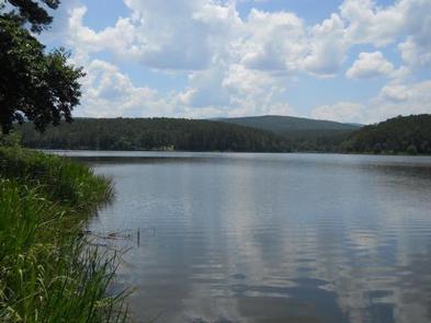
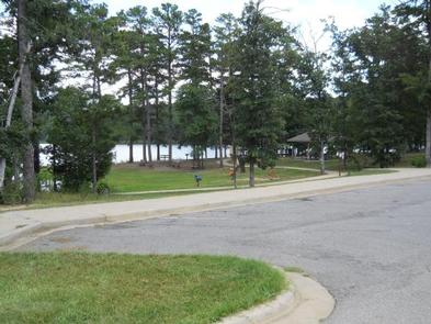
Cedar Lake is located in southeast Oklahoma, in the pine and hardwood-forested mountains of the Ouachita National Forest. The campground is situated on the shores of the scenic lake, a popular destination for boating, fishing, horseback riding and hiking.
Recreation
The campground is a popular starting point for the Winding Stair Mountain Equestrian Trails, a system of over 70 miles of marked horseback riding trails.
Swimming, boating and fishing on Cedar Lake are popular activities. Swimming areas, a boat ramp and fishing piers are available within the recreation area.
Playgrounds, a volleyball court and hiking trails are also available. Talimena Scenic Drive is within 10 miles of the campground.
Facilities
The campground offers a variety of sites, including equestrian, group and family sites. Shady Lane (SHRV) sites have electric, sewer and water hookups; Sandy Beach sites have electric hookups only; North Shore family sites are primitive without hookups. Most equestrian sites have electric hookups.
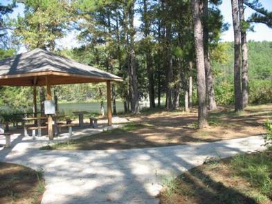
Picnic tables, grills, campfire rings and lantern posts are provided, as are flush toilets, warm showers and drinking water. Picnic pavilions are on-site. Horse corrals are located within the equestrian area.
Natural Features
Cedar Lake covers 86 acres and is situated at an elevation of 900 feet. Fall foliage season usually occurs from the last two weeks in October to the first two weeks in November.
The Ouachita National Forest covers 1.8 million acres in central Arkansas and southeastern Oklahoma. The forest encompasses 700 miles of trails, 43 vistas, six wilderness areas and the highest elevations between the Blue Ridge Mountains and the Rockies.