Directions
Travel east from Boise, Idaho on I-84 to Mountain Home. At I-84/Highway 20 junction, take Highway 20 east for 35 miles to Pine/Featherville turnoff. Travel north on Forest Highway 61 for 29 miles to Forest Road 172. Travel 15 miles northwest to Forest Road 129. Travel 3 miles to the Guard Station junction. The roadway is paved up to the junction of Forest Road 172. Forest Road 172 is native material (dirt) and trailer traffic is not recommended. There are signs noting each of the junctions.
Phone
208-587-7961
Activities
BIKING, CAMPING, FISHING, HIKING, WILDLIFE VIEWING, CANOEING, NON-MOTORIZED BOATING
Keywords
BTRC,TRINITY CABIN,TRINITY GUARD STATION,BOISE NF – FS
Related Link(s)
Overview
Big Trinity Cabin offers a quiet retreat in a beautiful high alpine landscape. The cabin is situated within a popular summer recreation area with many activities to enjoy. The cabin has a limited season due to late snow melt, but is accessible by vehicles with reasonable ground clearance. Many creature comforts are provided; however, guests may want to bring some supplies and gear to make their experience more comfortable and enjoyable.
Recreation
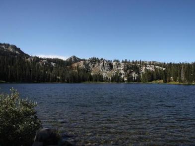
The 4- mile Rainbow Basin Trail system for pedestrain travel only, offers access to several lakes, hikers can access the trail System from the trailhead located within Big Trinity Lake campground. Other trails within the area Roaring River trail 045, and Lava Mountain trail 125, these are motorized motorcycle trails. Click here for an Idaho OHV Safety Message. Anglers can fish in any of the nearby lakes for rainbow and cutthroat trout. The lakes are also ideal for exploring by canoe or kayak.
Facilities
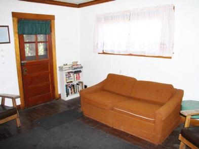
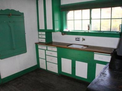
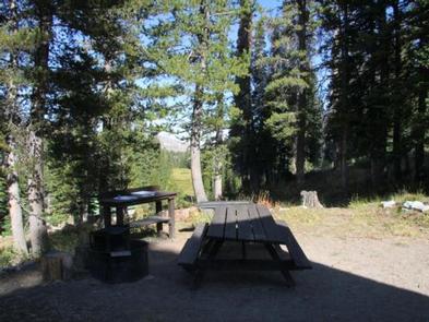
The cabin sleeps six and is equipped with one double bed, a sofa bed, side tables, a drop-down kitchen table, cleaning supplies, dishes and tableware, chairs and a dining table, cookware and a fire extinguisher. A wood stove is available for heating and cooking. A picnic table and campfire ring with grill are provided outside. Drinking water is available from a nearby hand pump. A shed located behind the cabin is stocked with seasoned wood, a splitting maul, axe and hatchet. A vault restroom is located outside. No electricity or propane is available. Guests must bring garbage bags to pack out their trash. Bedding, lighting and emergency supplies are not provided. Guests are responsible for cleaning the cabin before leaving.
Natural Features
The cabin is located in a dense lodgepole pine forest close to the East Fork Roaring River at an elevation of 7,900 feet. It’s nestled among four subalpine lakes: Big Roaring River Lake, Little Roaring River Lake, Big Trinity Lake and Little Trinity Lake. The peaks of the Boise Mountains surround the cabins, and Trinity Mountain, the tallest in the range at 9,451 feet, is just to the south. Snow can make this area inaccessible until early July, but soon afterward, the land is blanketed by colorful summer wildflowers. This area is a haven for elk and deer, but wildlife watchers may also spot an occasional black bear.
Nearby Attractions
The summit of Trinity Mountain is the highest drivable point in Idaho, although the road may be blocked by snow until early July. A short, steep hike takes visitors to the lookout tower for panoramic views of several subalpine lakes and other mountains in the Boise Range.


