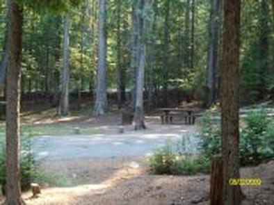
BEAVER CREEK (IDAHO), ID Campground Reservation, Info, Images, Map, Directions

BEAVER CREEK (IDAHO), Idaho Campground Images, Info & Reservations

Directions

From Priest River, Idaho, take Highway 57 north to Nordman, then turn right on Reeder Bay Road and continue for 12 miles into the campground.

Phone

435-245-6521

Activities

BIKING, BOATING, CLIMBING, CAMPING, FISHING, HIKING, WILDLIFE VIEWING, SWIMMING SITE, BIRDING

Keywords

Beaver Creek,beavercreek,BEC4,BEAVER CREEK IDAHO,IDAHO PANHANDLE NF – FS

Related Link(s)

Rec Area Info & Images

Forest Service Concessionaire

Idaho State Road Conditions

Idaho State Tourism

Overview

Beaver Creek Campground sits in the Idaho Panhandle National Forest, offering phenomenal views of the Selkirk Mountains across the reflective waters of Priest Lake.

Recreation

A local beach is easily accessible, where swimming and boating are available.

Visitors enjoy kayaking, canoeing or power boating up a 2.5-mile channel called Thoroughfare that leads to the Upper Priest Lake Scenic Area, where birding is a popular activity.

Beaver Creek has two trailheads, one for the 9-mile Navigation Trail that heads north, and one for the 8-mile Lakeshore Trail that heads south. Both trails offer sweeping mountain views and are enjoyed by both hikers and horseback riders.

Anglers find an abundance of trout fishing in Beaver Creek and in Upper and Lower Priest Lake.

Facilities

Beaver Creek offers approximately 42 spacious, reservable campsites, including one large group site that can accommodate up to 35 guests. Amenities include drinking water, vault toilets and picnic tables. A boat ramp is just outside the campground entrance for boats 20 feet long or shorter.

Natural Features

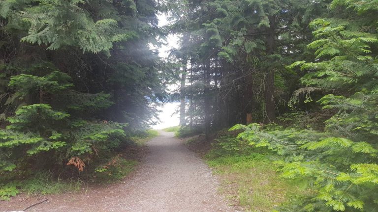
The campground is situated on the shores of Priest Lake at an elevation of 2,500 feet, shaded by hemlock and cedar.

Priest Lake consists of the main lake, where most water recreation takes place, and the smaller Upper Priest Lake to the north. The two lakes are divided by a narrow channel.

Nearby Attractions

Cross country skiing and snow shoeing are excellent in the Kaniksu Forest Region of Priest Lake.

Reservation

More from CampingHiking.net:

BOULDER DAY USE, Illinois Campground Images, Info & Reservations

Directions (Address: 25501 Boulder Access RD, Shattuc, IL 62231). From I-57, take Old U.S. Highway 50 west. Continue for 19 miles through Salem, Odin and Sandoval. Turn north on Boulder Road and follow 7 miles to the day use and recreation area. Phone 618-226-3586 Activities BIKING, BOATING, CAMPING, FISHING, HIKING,

SAILOR LAKE, Wisconsin Campground Images, Info & Reservations

Directions From Fifield, follow State Highway 70 east for about 7 miles and turn right (south) on Forest Road 139 and continue for 3 miles. Phone 715-762-2461 Activities BOATING, CAMPING, FISHING, HIKING, HUNTING, WILDLIFE VIEWING, CANOEING, HISTORIC SITES Keywords SAIL,CHEQUAMEGON-NICOLET NF – FS Related Link(s) Rec Area Info & Images

MIDWAY, Texas Campground Images, Info & Reservations

Directions From I-35, take the exit for Hwy 6 N toward Meridian (330B) for about 5 miles. Immediately before crossing the lake, exit right at Midway Park Exit. At the exit, drive under the bridge and the park is a quarter-mile down the east-bound service road. Phone 254-756-5359 Activities BOATING,

EASTSIDE, Idaho Campground Images, Info & Reservations

Directions From Horseshoe Bend, Idaho, take Highway 52 for 9 miles west to the junction with the Sweet/Ola Highway. Turn north and travel 16 miles to Ola, Idaho. Travel north through Ola and follow 10 miles northeast on FS Rd 618, then make a right on FS Rd 626 and

STEEL CREEK GROUP CAMPGROUND, Idaho Campground Images, Info & Reservations

Directions From Dubois, Idaho: Travel north on I-15 to the Stoddard Creek Exit (Exit 184). Go east on West Camas-Miners Creek Road (FR 006) for approximately 14 miles to Steel Creek Road (FR 478), turn right and continue 0.75 miles to the campground entrance. From the Kilgore Store: Travel west/northwest

OCONEE POINT, Georgia Campground Images, Info & Reservations

Directions From Interstate 85 in South Carolina, take exit 11 onto State Highway 24 towards Townville. About 1.5 miles past Townville, turn right onto Coneross Creek Road. Proceed 2.5 miles and turn RIGHT onto South Friendship Road. Drive 3 miles to park entrance on LEFT. 200 OCONEE POINT RD, Seneca,