

Directions
Take Highway 50 east of Placerville for 21 miles to Icehouse Road turnoff. Turn left and go 25 miles north to a fork in the road. Take the right fork 6 miles. Pass the Loon Lake Campground turn-off, then go 3/4 of a mile to the chalet.
Phone
530-644-2324
Activities
BIKING, CAMPING, FISHING, HIKING, WINTER SPORTS
Keywords
LOOC,Crystal Basin,Icehouse Road,Loon Lake,ELDORADO NF – FS
Related Link(s)
California State Road Conditions
Overview
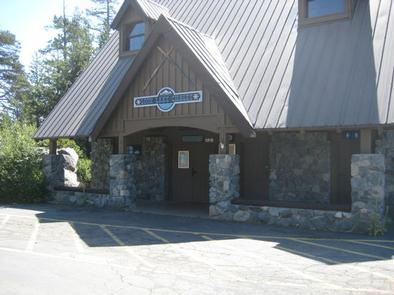
Loon Lake Chalet is situated next to Loon Lake in a granite bowl, and offers year-round, drive-to access for excellent backcountry skiing and hiking. The three-story chalet boasts excellent views of the Sierras and the lake. Though the chalet looks fancy, guests should not not expect hotel luxuries, but rather a semi-rustic experience.
The Sacramento Municipal Utility District built the chalet in 1989, originally intended as a day-use winter facility. Due to public demand, the second floor warming room was made available for overnight rental, and a third floor was soon added.
Recreation
Popular summer activities include hiking, backpacking in Desolation Wilderness, fishing, mountain biking, horseback riding and off-road driving on the 22-mile Rubicon 4WD Trail. Anglers delight in rainbow and brown trout, while boaters head out for thrilling water skiing on Loon Lake. In winter, the chalet is the focal point of the Loon Lake Winter Recreation Area, which offers many miles of non-groomed backcountry skiing trails.
Facilities
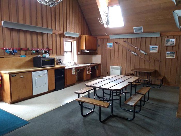
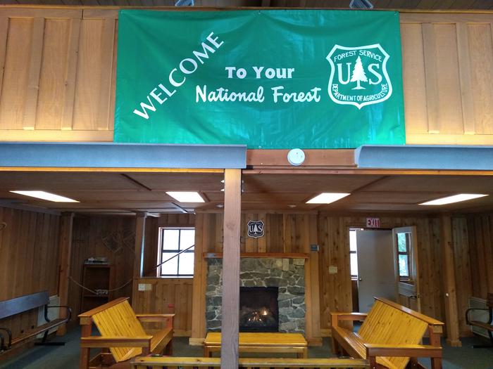
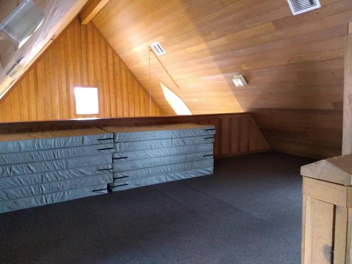
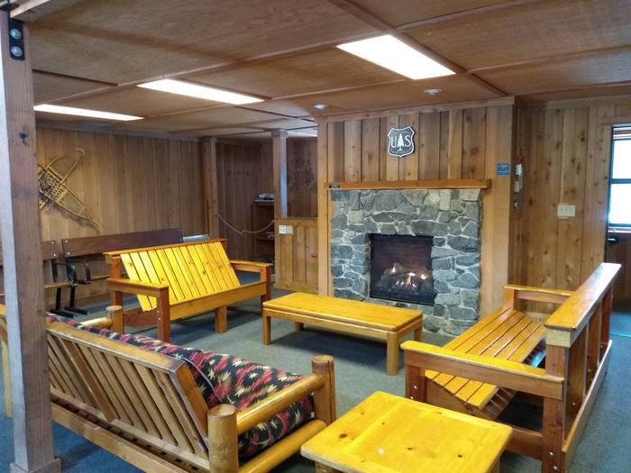
The chalet has three levels and can accommodate up to 20 guests. It features a large deck off the second floor with a wide stairway accessing the parking area. Vault toilets are attached to the building but are accessed from outside. The bottom floor is the ski patrol room(no public use), the second floor is the common liviing room and the third floor is the sleeping loft. The sleeping loft is equipped with 12 twin size sleeping pads to be placed on the floor when used and stacked up neatly upon check out.
Electricity plus hot and cold water are provided. Garbage service is offered in summer months. The warming room has electric heat and is equipped with picnic tables, benches, a queen-sized futon couch, two wood couches, a gas fireplace and small dryer. The kitchen contains a double sink, hot and cold water, a range top stove, microwave oven and a small under-the-counter refrigerator. Miscellaneous pots and pans are provided but guests are encouraged to bring their own. Additional tables and benches are outside on the deck.
No showers are available. Guests should bring food, sleeping bags, plates, drinking glasses and utensils, garbage bags, flashlights, maps and a compass, first aid supplies and tire chains. Electrical outlets may be used for crock pots, microwaves, coffeemakers, electric frying pans and similar small appliances. Click here for more information about the chalet.
Natural Features
The chalet is nestled in the forest on the western edge of Loon Lake at an elevation of 6,348 feet. The lake spans 76,200 acres. Sub-alpine red fir and lodgepole forests, granite bowls and a spectacular view of the Crystal Range of the Sierra Nevada Mountains characterize the area.
Nearby Attractions
The nearest general store is an hour away at Ice House Reservoir. In winter, the nearest town with a general store is about two hours away in Pollock Pines.