


Directions
From Yakima, Washington, travel 25 miles on Highway 12 to the junction with Highway 410. Travel 29 miles on Highway 410 (Chinook Pass Highway) to milepost 88.4. Take Forest Road 18 (Bumping River Road) for 11.7 miles to campground.
Phone
541-338-7869
Activities
BIKING, BOATING, CAMPING, FISHING, HIKING, WATER SPORTS
Keywords
BUML,Lower Bumping Lake,Upper Bumping Lake,Lower Bumping,Upper Bumping,OKANOGAN – WENATCHEE NF -FS
Related Link(s)
Washington State Road Conditions
Overview
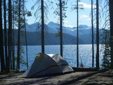
Bumping Lake Campground sits just off the forested shore of Bumping Lake in the Cascade Mountains east of Mount Rainier National Park, about 45 miles northwest of Naches, Washington. Fantastic peaks, high-country lakes and old-growth forests provide visitors with unique and surprising landscapes, making the campground an ideal setting for both individual and family camping excursions.
Recreation
In addition to being a prime location for hiking, boating, fishing, hunting, horseback riding and mountain biking in summer and early fall, visitors can take advantage of skiing, snowshoeing and snowmobiling in the winter months.
Bumping Lake is a popular destination for boating, water skiing, fishing and swimming. A boat ramp is located in the lower section of the campground.
The American Ridge Trail is a popular among hikers and equestrians, meandering through more than 26 miles of towering forests, mountain meadows and past high elevation lakes from the Bumping River to the Pacific Crest Trail.
Facilities
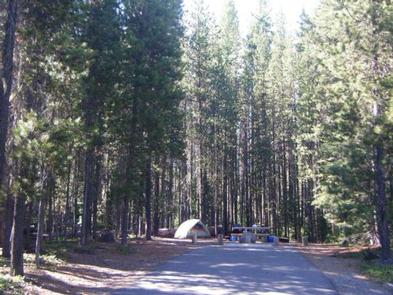
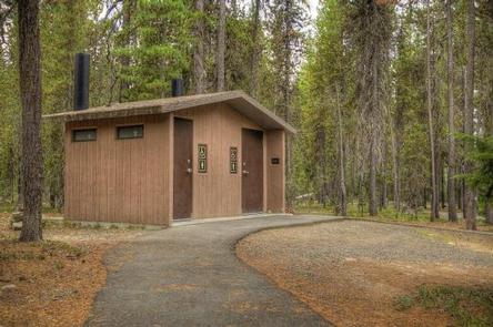
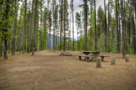
This campground has an upper and lower section, offering sites that accommodate both tent and RV camping. Each site is equipped with a table and campfire ring with grill. Vault toilets and drinking water are provided, but no hookups are available.
Natural Features
Bumping Lake was created naturally by glaciers and is fed by snowmelt. It is surrounded by rugged mountain terrain, wetlands and old-growth conifer forests.
The area supports wildlife such as deer, porcupine, native fish and migratory birds. Endangered and threatened species, including the Northern Bald Eagle, the Northern Spotted Owl, gray wolves and grizzly bears also find havens in nearby ecosystems.
Nearby Attractions
Visitors enjoy making a day trip to nearby Mount Rainer National Park, which offers sublime views of glaciers, subalpine ecology and volcanic landscapes.
Hikers may want to traverse a portion of the spectacular Pacific Crest Trail (PCT), one of the world’s premier National Scenic Trails. This trail showcases some of North America’s most fantastic scenery as it winds its way from Mexico to Canada through California, Oregon and Washington.