FAWN, CA Campground Reservation, Info, Images, Map, Directions

FAWN, California Campground Images, Info & Reservations

Directions

From I-5 in Redding, take California State Highway 299 West to State Highway 3 at Weaverville. Go north on Highway 3 for 14.5 miles. Campground is on the right.

Phone

530-275-8113

Activities

BOATING, CAMPING, SWIMMING SITE

Keywords

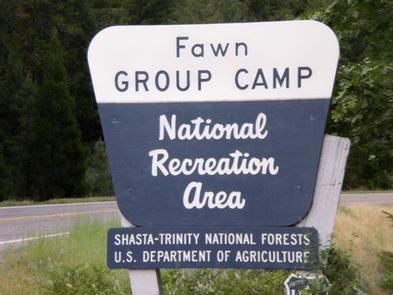
FAWN,SHASTA-TRINITY -FS

Related Link(s)

Rec Area Info & Images

California State Road Conditions

Forest Service Concessionaire

California State Tourism

Overview

Located on the Stuart Fork Arm of Trinity Lake, Fawn Group Campground is the most popular group site in the area. Well-shaded by oaks, Douglas firs and pines, this campground provides direct lake access and is conveniently located near other recreational sites.

Recreation

A boat ramp and marina are 1 mile away. Nearby Stoney Creek Swim Area is popular spot, offering a beach and picnic area.

Popular activities include lakeside camping, hiking, fishing, swimming, boating and other watersports.

Facilities

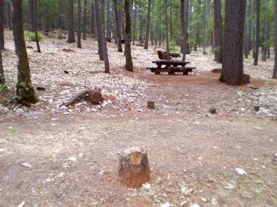
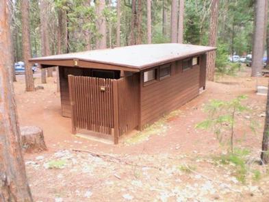
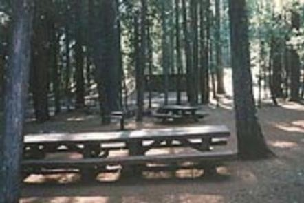
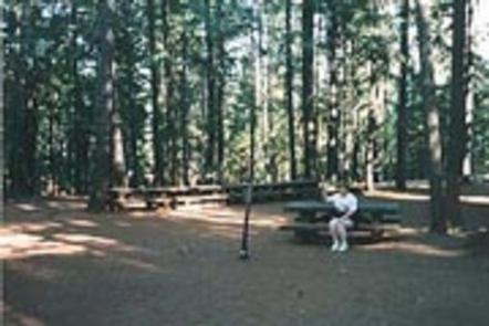
Each group loop is equipped with bear-proof food lockers, several tables and group fire grills. Each loop contains 19 separate campsites with their own tables and grills. Loop B and Loop C accommodate up to 100 people each. The unpaved spurs will handle tents and RVs between 30-40 feet. The campground roads are paved. Flush toilets and drinking water are provided.

Natural Features

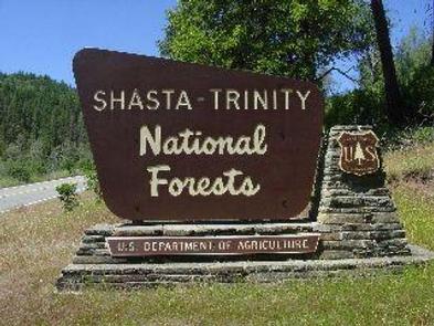
Shasta-Trinity is the largest national forest in California with a diverse landscape encompassing five wilderness areas, hundreds of mountain lakes and 6,278 miles of streams and rivers.

Lake Shasta sits at an elevation of 1,067 feet, with 365 miles of shoreline punctuated by steep mountains blanketed in manzanita and evergreens. A snow-capped Mount Shasta, the second-tallest mountain in the Cascade Range, looms in the distance.

Nearby Attractions

The town of Weaverville is listed on the National Register of Historic Places and is only a 20 minute drive from the campground. This former mining town offers restaurants, shopping and self-guided walking tours.

Reservation

More from CampingHiking.net:

BEAVER CREEK CAMPGROUND, Montana Campground Images, Info & Reservations

Directions From West Yellowstone, drive 8 miles north on Highway 191, then 16 miles west on Highway 287. Phone (406)646-1012 Activities BIKING, CAMPING, FISHING, HIKING, WILDLIFE VIEWING, PHOTOGRAPHY, MOUNTAIN BIKING, STAR GAZING, BIRDING, BACKPACKING, MUSHROOM PICKING Keywords BECC,Beaver Creek,Beaver Creek Campground,Beaver Related Link(s) Rec Area Info & Images Montana State

PAINT CREEK DAM SITE, Ohio Campground Images, Info & Reservations

Directions From Chillicothe Ohio, take Route 50 west for 18 miles to Bainbridge. Ohio. Three miles past Bainbridge, turn right on Rapid Forge Road. Go 2 miles north and turn left into the Paint Creek Dam Site Area. Little Pond Shelter is located on the right just before crossing the

ROCKY POINT (FT GIBSON), Oklahoma Campground Images, Info & Reservations

Directions From Wagoner, Oklahoma: travel 4.5 miles north on Highway 69. Turn right at stoplight on East 690 Road. Travel 3 miles east. Turn left on South 320 Road and travel north for 3/4 mile to park entrance. Phone 918-462-2042 OR 918-682-4314 Activities BOATING, CAMPING, FISHING, HUNTING, SWIMMING SITE Keywords

GERLE CREEK, California Campground Images, Info & Reservations

Directions From Placerville, drive 21 miles east on Highway 50 to the Icehouse Road turnoff. Turn left and go 28 miles north. Take the left fork 3 miles to the campground. Phone 831-245-6891 Activities CAMPING, FISHING, HIKING, SWIMMING SITE Keywords GERL,ELDORADO NF – FS Related Link(s) Rec Area Info &

FREMONT POINT CABIN, Oregon Campground Images, Info & Reservations

Directions Summer Travel: From the Paisley Ranger District Office in Paisley, Oregon: Travel north on State Route 31 for 34.2 miles, between mile posts 64 and 65, turn left (west) onto the graveled Forest Service Road (FSR) 2901. Follow FSR 2901 for 16.1 miles. Turn left (east) on FSR 034