
Directions
From Denver, travel north on Interstate 25 north, to U.S. Highway 36 and continue west through Boulder, to Lyons.
From Lyons, take Highway 7 for 12 miles to Highway 72, then continue south for four miles. Watch for signs for Peaceful Valley and Camp Dick Campgrounds. Turn west onto Middle Saint Vrain Road (County Road 92 & National Forest System Road 114) and proceed approximately one mile to Camp Dick.
Phone
303-541-2500
Activities
BIKING, CAMPING, FISHING, HIKING, HORSEBACK RIDING, MOUNTAIN BIKING, OFF HIGHWAY VEHICLE TRAILS
Keywords
CAMD,ARAPAHO AND ROOSEVELT NF – FS
Related Link(s)
Colorado State Road Conditions
Overview
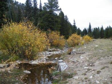
Camp Dick is the site of a Civilian Conservation Corps camp that was established in the 1930s. It is located just off the Peak to Peak Scenic Byway, on the Middle Saint Vrain Creek.
Recreation
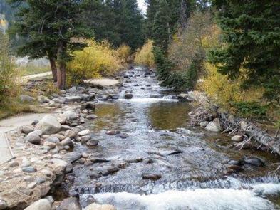
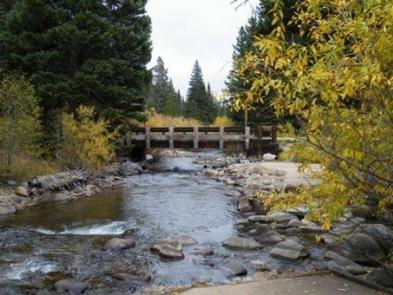
The Middle Saint Vrain Creek is a good fly-fishing stream where anglers cast for rainbow, brown and cutthroat trout.
Many trails in the vicinity are open to hiking and biking, including Sourdough and Buchanan Pass trails. The Indian Peaks Wilderness boundary is four miles from the west end of the campground.
Mountain biking is allowed on the first five miles of Buchanan Pass Trail. Bikers can ride a loop from Peaceful Valley or Camp Dick, via Buchanan Pass Trail and Middle Saint Vrain Road, or Coney Cutoff and Coney Creek Roads and Sourdough Trail.
The Middle Saint Vrain and Bunce School roads are popular among off-road vehicle enthusiasts.
Guided horseback riding is available at Peaceful Valley Lodge, which is just over a mile away.
Facilities
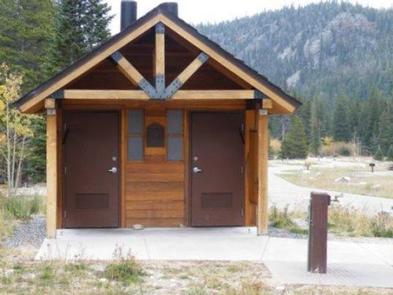
Campsites will accommodate tents and RVs. Sites includes picnic tables and campfire ring with grill. Water spigots, vault toilets, and trash services are provided at the campground. Firewood may be purchased during the peak season. There are no electrical hook-ups, dump stations, or showers. Tents must remain on tent pads.
Natural Features
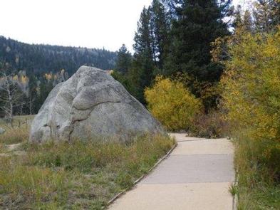
The campground is situated on the banks of the Middle Saint Vrain Creek in a glacial valley surrounded by mixed conifer and aspen forests and an open meadow.
Nearby Attractions
The town of Allenspark is less than 10 miles north of the campground, and has a restaurant and a grocery store.
Rocky Mountain National Park’s main entrance is 25 miles north of the campground, in Estes Park. With lush valleys and craggy peaks reaching elevations higher than 14,000 feet, visitors are provided opportunities for countless breathtaking experiences and adventures. Scenic driving, hiking, backpacking, fishing, horseback riding and wildlife viewing are popular activities available within the park.
Estes Park is a full-service community. Dining, shopping, rafting, fly fishing, horseback riding and golfing opportunities are available there. Lake Estes offers boating, sailboarding and fishing.