
Directions
From Moab, the fastest access (about 1 hour) to Warner Lake Campground is by driving south on Highway 191. Drive 6 miles south of Moab and turn east (left) onto Old Airport Road (sign has arrow to La Sal Loop Road, National Forest Access). Turn south (right) at the T-intersection with the Spanish Valley Drive/La Sal Mountain Loop Road (sign has arrows pointing to La Sal Mtn. Loop Rd and Ken’s Lake). Continue 13.5 miles to the Warner Lake turnoff. Turn east (right) and drive 5 miles to the campground and cabin on this gravel road.
Phone
435-636-3360
Activities
BOATING, CAMPING, FISHING, HIKING, PICNICKING, WILDLIFE VIEWING, DAY USE AREA, PHOTOGRAPHY, PADDLING, SWIMMING, KAYAKING, CANOEING, STAR GAZING, SCENIC DRIVE
Keywords
WARN,MANTI-LASAL NF -FS
Related Link(s)
Overview
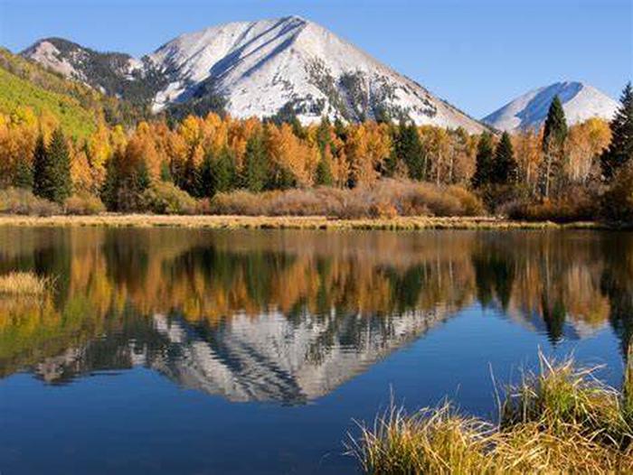
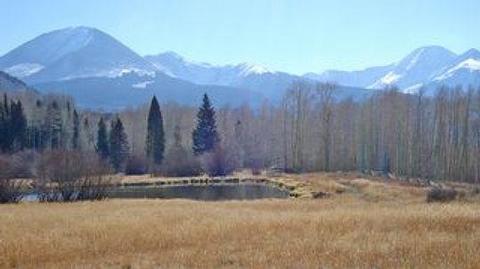
Warner Lake Campground and Cabin are located high in the La Sal Mountains at an elevation of 9,400 feet, next to beautiful Warner Lake. Visitors enjoy fishing, canoeing, kayaking and exploring many local trails.
Recreation
The lake offers rainbow trout fishing, canoeing and kayaking. An extensive trail system is located around Warner Lake, encompassing the Trans-Mountain Trail, Miners Basin Trail, Warner Lake-Oowah Lake Trail, Burro Pass Trail and Dry Fork-Beaver Basin Trail. A trailhead is located in the campground, and many others are available in the surrounding area.
Facilities
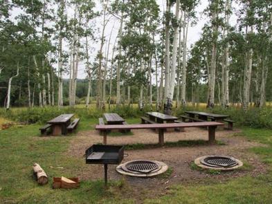
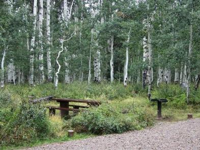
Warner Lake boasts a campground and a rustic cabin. The campground contains one group site that can accommodate up to 50 people; several single-family sites are also available. Picnic tables, campfire rings and utility tables are provided, as are vault toilets. Roads and parking spurs within the site are gravel.
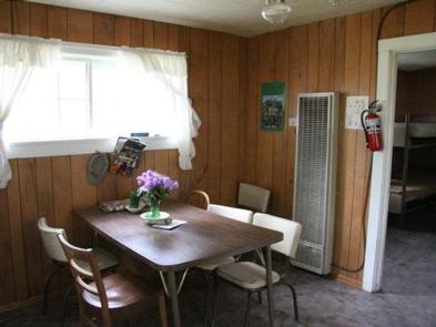
The two-room cabin can sleep four people on two sets of bunk beds with mattresses. Linens and bedding are not provided.
The kitchen is equipped with a propane stove/oven, solar powered lighting, table and chairs. and patio furniture. While the cabin has basic kitchenware, guests are encouraged to bring their own cooking supplies including basic staples and water. A picnic table, campfire ring and vault toilet are located outside the cabin.
There is a 14 day stay limit at this campground.
Natural Features
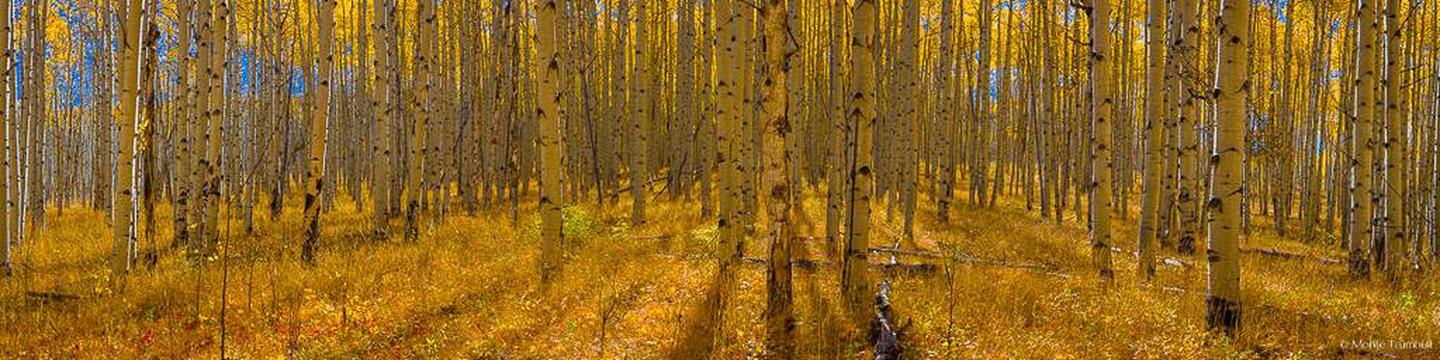
A dense forest of aspens provides partial shade and spectacular autumn color. The lake and precipitous, 11,634′ Haystack Mountain are visible from a few campsites and the front porch of the cabin. Short foot trails lead to the shore.
Nearby Attractions
Arches and Canyonlands National Parks are close enough to Warner Lake for a day trip. Both parks contain breathtaking desert scenery, natural sandstone arches and numerous hiking trails.
The town of Moab is less than 30 miles away, offering a range of dining and shopping options, galleries, grocery stores, gas stations, rafting outfitters and Jeep rentals. The drive to Moab, although 30 miles, takes about an hour to reach due to the mountainous, windy, gravel roads.