
Directions
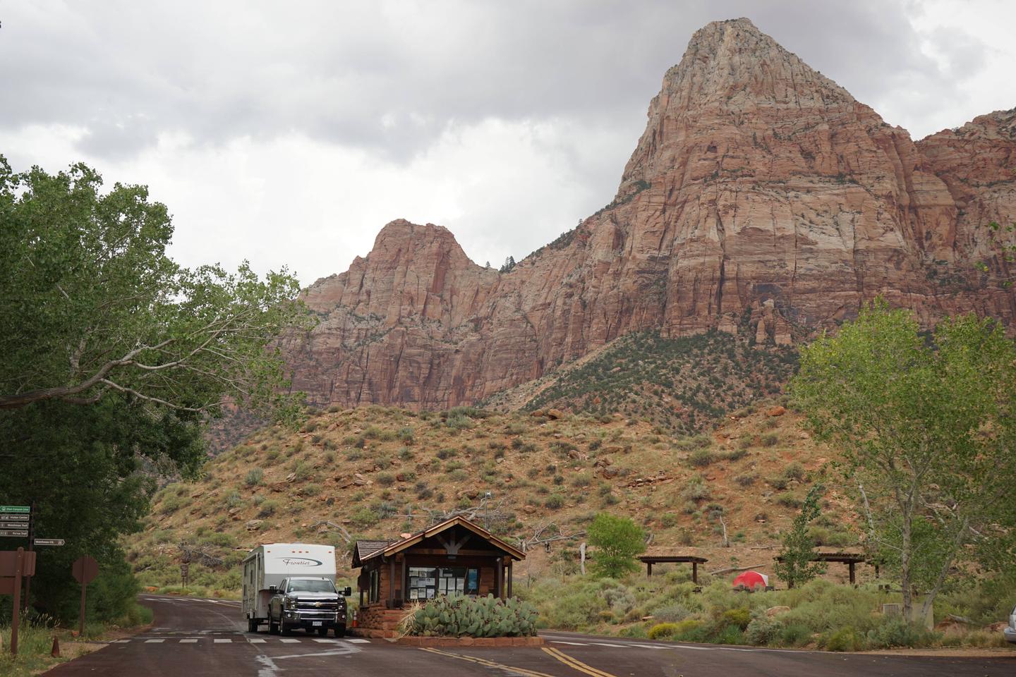
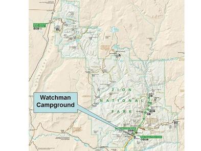
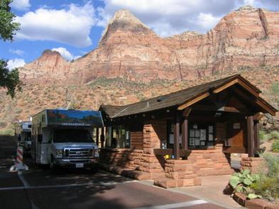
From Las Vegas, St. George or other points south on Interstate 15: Travel north to Exit 16, towards Hurricane. Follow State Route 9 east for 12 miles to La Verkin and turn right to continue on State Route 9 towards Zion National Park. After passing through Springdale, arrive at South Entrance of Zion. Take the first right after the entrance station towards the Visitor Center. After passing the Visitor Center, you will enter Watchman Campground. Stop at campground kiosk for directions to your campsite. From Salt Lake City, Interstate 70 or other points north on Interstate 15: Travel south to Exit 27, towards Toquerville. In 6.1 miles turn left onto State Route 9 towards Zion National Park. After passing through Springdale, arrive at South Entrance. Take the first right after the entrance station towards the Visitor Center. After passing the Visitor Center, you will enter Watchman Campground. Stop at campground kiosk for directions to your campsite. From Grand Canyon National Park, Lake Powell, Kanab or other points south on U.S. 89: Travel north to State Route 9. Turn left and follow State Route 9 west for 13 miles to the East Entrance of Zion National Park. Continue straight for 12 miles, then turn left at the sign for Watchman Campground and Visitor Center. Stop at campground kiosk for directions to your campsite. From Bryce Canyon National Park, Panguitch or other points north on U.S. 89: Travel south to State Route 9. Turn right and follow State Route 9 west for 13 miles to the East Entrance of Zion National Park. Continue straight for 12 miles, then turn left at the sign for Watchman Campground and Visitor Center. Stop at campground kiosk for directions to your campsite.
Phone
435-772-3837
Activities
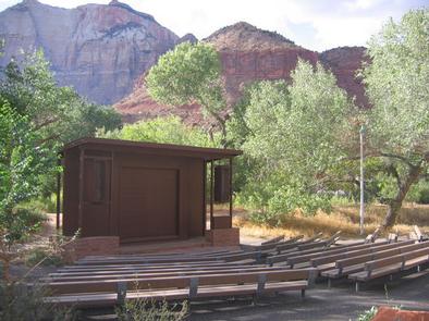
BIKING, CAMPING, INTERPRETIVE PROGRAMS, HIKING, VISITOR CENTER, SWIMMING SITE, PHOTOGRAPHY, STAR GAZING, EVENING PROGRAMS
Keywords
CG67,Zion National Park,Zions,Zions Watchman
Related Link(s)
National Park Services Concessionaire
Overview
For visitors to Zion National Park, Watchman Campground is an ideal place to stay. Located near the park’s south entrance, the campground is just a short walk from the main visitor center, the Zion Canyon Shuttle System and the adjacent town of Springdale. The canyon and most of the park’s trails are only accessible by shuttle bus from approximately March through November each year.
Season Dates: Watchman Campground is open year-round. Advance reservations are available 6 months prior for stays March through Thanksgiving weekend in November. The campground has first-come, first-served campsites available from the end of November through February.
Recreation
Hikers can access three trails directly from the facility: the Watchman Trail, a moderate trail that ascends the peak behind the campground; the Archeology Trail, which offers a light hike to an archeological site nearby; and the Pa’rus Trail, a paved walking and biking trail that runs alongside the river, and the only trail in the park that allows dogs. Although there are no rock climbing routes in the campground, many popular climbs are within a short shuttle bus ride into the main canyon. Use of OHVs and ATVs is prohibited in Zion National Park.
Facilities
Toilets, drinking water and picnic tables are provided at this facility. Tent-only (F-Loop), non-electric sites (C & D Loop) do not permit vehicles 19 feet and over or in combined length. Group sites (E-Loop) are also tent-only and can accommodate between seven and 40 people. Standard electric sites in A-Loop may be used for either tent or RV camping. However, only RVs are permitted to occupy sites in the B-Loop. There are no full-hookup campsites. Electric sites are all 30 amp, with only a handful of sites that supply 50 amp; a dump station with potable water is available at the entrance to the campground.
Natural Features
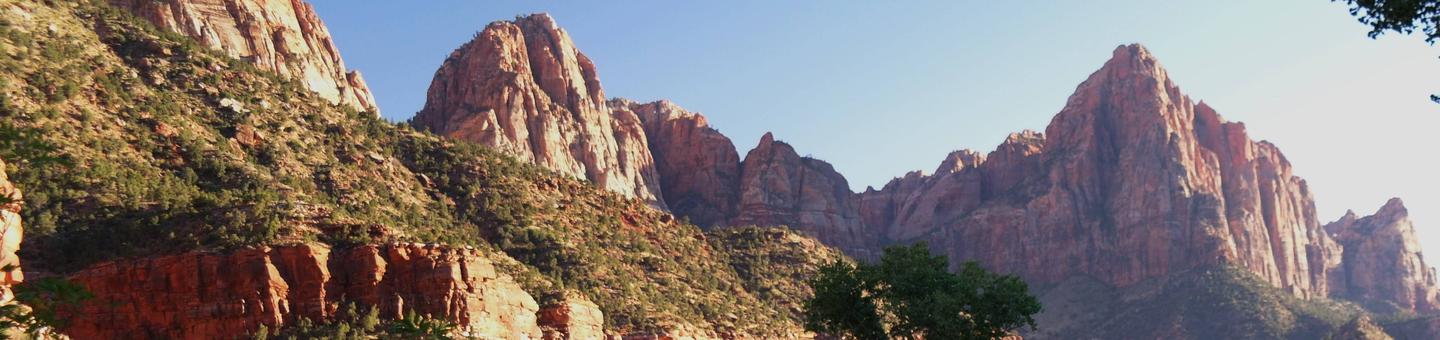
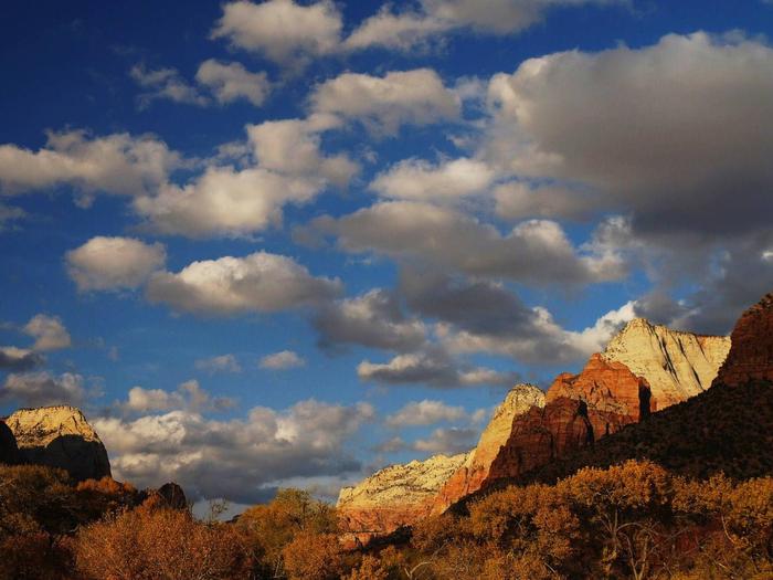
Zion is known for it’s dynamic geologic history and Watchman Campground is no exception. Named for the rocky peak that rises above it, the campground is surrounded by tall sandstone cliffs that glow red and orange during sunrise and sunset. The Virgin River, a narrow but powerful river that has carved out the canyon over time, runs adjacent to the campground. Cottonwood trees surrounding the campsite turn golden in the fall. Most of the campsites are in partial to full sun, however in the Group sites (E-Loop) and the Walk-To sites (F-Loop) visitors may receive some shade under pergulas that are constructed over the picnic tables. Visitors can also cool off in the cold river when temperatures peak during summer. Be Advised: The months of April and May bring an unusual infestation of Tent Caterpillars, which fall from trees onto tents, tables, and unsuspecting campers and can make it quite uncomfortable to sit outside. The months of July and August in particular bring a higher concentration of ants in the campsites, which seem to come out especially after the monsoons, but are present all summer long. Insecticidal treatment by visitors is not permitted.
Nearby Attractions
The town of Springdale has shopping, art galleries, restaurants, and a public library. Throughout the year, concerts, festivals, and parades are held in the town.
Charges & Cancellations
A $10.00 service fee will apply if you change your reservation. Cancellations more than 48 hours in advance of arrival date incur a $10 cancellation fee. Within 48 hours of arrival, a $10 cancellation fee and the first night’s fee are charged.