Directions
Take I-40 east from Knoxville, TN or west from Asheville, NC. Exit I-40 at NC exit 20, twenty-five miles west of Asheville (87 miles east of Knoxville). Turn right onto Cove Creek road 1/10 miles from I-40. Follow Cove Creek road approximately 11 miles to Cataloochee horse camp.
Phone
828-497-9270
Activities
HISTORIC & CULTURAL SITE, CAMPING, FISHING, HIKING, HORSEBACK RIDING, WILDLIFE VIEWING
Keywords
CG27,Great Smokey Mountains National Park,Great Smoky Mountains National Park
Related Link(s)
National Park Services Concessionaire
North Carolina State Road Conditions
Overview
Located in the scenic Cataloochee Valley, tucked in a cool and shady canopy, this campground offers the best that the Great Smoky Mountains National park has to offer, including some of the most coveted horseback riding trails in the park.
World-renowned for its diversity of plant and animal life, the beauty of its ancient mountains and the preservation of Southern Appalachian culture, the Great Smoky Mountains is America’s most visited national park.
You MUST have a HORSE to camp at Cataloochee Horse Camp!
Recreation
With access to some of the most popular trails in the area, including the Rough Fork and Caldwell Fork Trails, this site is a favorite for horseback riding enthusiasts.
Great Smoky Mountains National Park is also a hiker’s paradise. Boogerman Trail, accessed via the Caldwell Fork Trail, provides a 3.9 mile detour through a beautiful, densely forested terrain, allowing visitors to stretch their legs and explore the area.
Campers can enjoy high-quality backcountry fishing in the cool waters of the countless streams and rivers that snake through the mountains, with wild trout available in abundance.
Wildlife viewing is a popular pastime, and with around 1,500 bears living in the park, it’s not uncommon for a visitor to spot one. The Cataloochee area is also known for an elk herd that populates the valley, making for an impressive display of wildlife.
The park also holds one of the best collections of log buildings in the eastern United States. Over 90 historic structures, including houses, barns, outbuildings, churches, schools and grist mills, have been preserved or rehabilitated in the park. A handful of these buildings are nearby the campground, including the Palmer House, which offers a self-guided museum.
Facilities
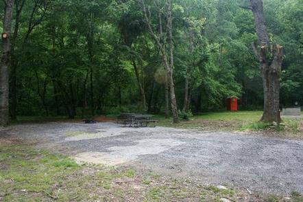
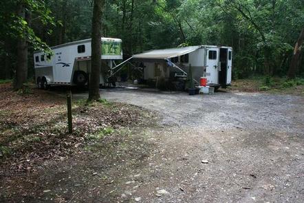
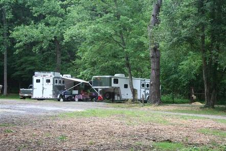
Cataloochee offers primitive-woods camping. A canopy of trees provides adequate shade, while a few open areas let in the sunlight and allow for pleasant group activities. There is no potable water provided at the campground, so visitors must bring their own.
The nearby Cataloochee Campground offers additional camping space for those visitors without horses, and the Cataloochee Group Camp provides a larger space for group trips.
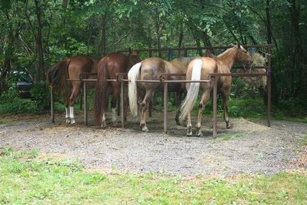
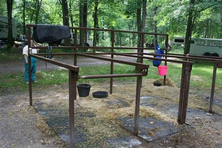
Each site at Cataloochee has four horse stalls with hitching racks.
You MUST have a HORSE to camp at Cataloochee Horse Camp!
Natural Features
Cataloochee Horse Camp sits in along the gentle waters of Cataloochee Creek in the remote Catalooche Valley, surrounded by some of the park’s most picturesque and rugged mountain ranges. Whether blanketed in wildflowers in the spring or vivid colors in the fall, the scenery at Cataloochee never disappoints.
Nearby Attractions
A number of Great Smoky’s famous historical buildings, including cabins and churches, are located close to the campground. The nearby towns of Maggie Valley or Waynesville offer groceries and other supplies.

