
Directions
Boat transportation can be arranged with Island Packers from Ventura Harbor.
Air transportation can be arranged with Channel Islands Aviation from Camarillo airport.
To park headquarters in Ventura, California: Highway 101, exit Victoria or Seaward to Ventura Harbor.
Phone
805-658-5730
Activities
BOATING, HISTORIC & CULTURAL SITE, CAMPING, INTERPRETIVE PROGRAMS, FISHING, HIKING, PICNICKING, WATER SPORTS, WILDLIFE VIEWING, WILDERNESS, INFORMATION SITE, PHOTOGRAPHY, SWIMMING, SNORKELING, RANGER STATION, SEA KAYAKING, BIRDING, WATER ACCESS, GUIDED INTERPRETIVE WALKS, SAILING
Keywords
CG11,SANTA ROSA ISLAND,CHANNEL ISLANDS,CHANNEL ISLAND,SANTA ROSA,Channel Islands National Park
Related Link(s)
California State Road Conditions
National Park Services Concessionaire
Overview
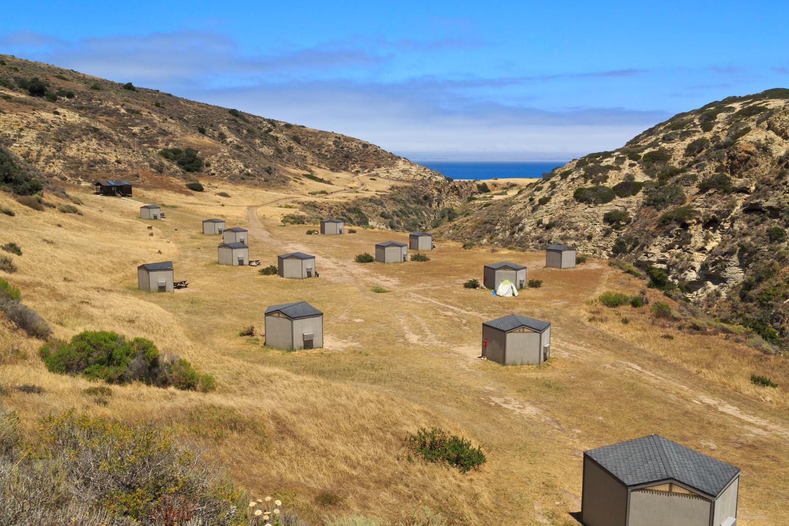
Tucked away in a canyon to protect visitors from strong northwest winds, Water Canyon Campground offers exceptional island views, access to spectacular hiking opportunities and a nearby white sand beach.
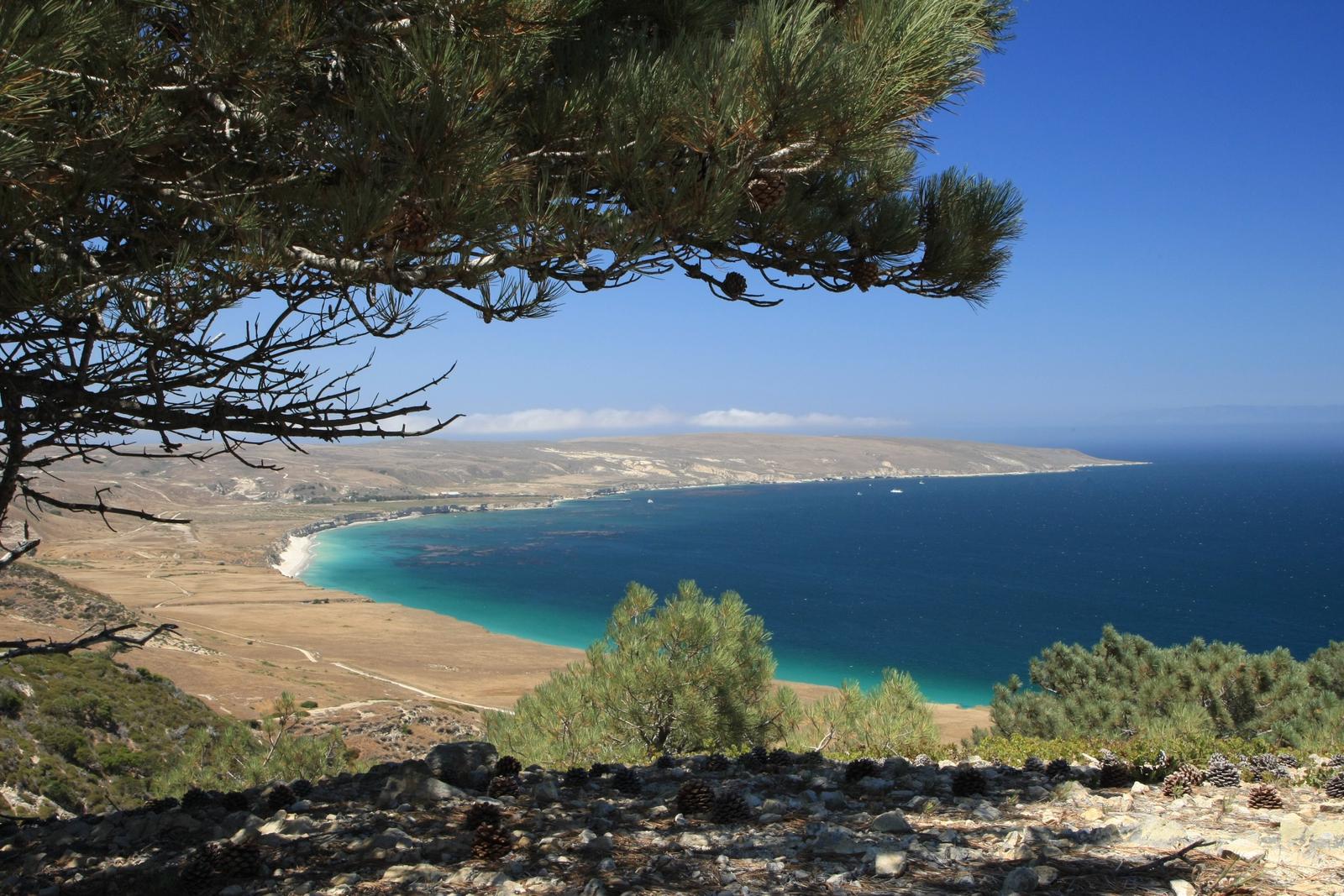
Located 40 nautical miles from the Channel Islands National Park visitor center in Ventura, Santa Rosa is the second largest island in California at approximately 53,000 acres in size. The island landforms support a diverse array of plant and animal species including six plant species found nowhere on earth but Santa Rosa Island. The island also hosts over 100 bird and three land mammal species, including the endemic island fox.
Remains of an ancient species like the pygmy mammoth have been uncovered on Santa Rosa Island. These miniature mammoths, reaching just four to six feet tall, roamed the island’s grasslands and forests during the Pleistocene Age.
The island has rich archeological resources as well. It is home to thousands of significant archeological sites of the Chumash Native Americans, who inhabited the island until 1820. Others have come to the island during more recent centuries to exploit its rich resources, sometimes making it their home. In addition to the native Chumash, European explorers, Aleut sea otter hunters, Chinese abalone fishermen, Spanish missionaries, Mexican and American ranchers, and the US military all have left their mark on the Santa Rosa landscape. Visitors can see relics of these occupations in remnants of fishing camps, water troughs and fence lines, the pier where cattle were loaded and unloaded, buildings and equipment of the historic Vail and Vickers ranch at Bechers Bay, and remains of the military installations.
Recreation
Several trails and roads traverse the island, providing visitors with spectacular hiking opportunities, including the relatively flat route to Water Canyon Beach to the rugged, mountainous path to Black Mountain.
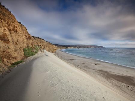
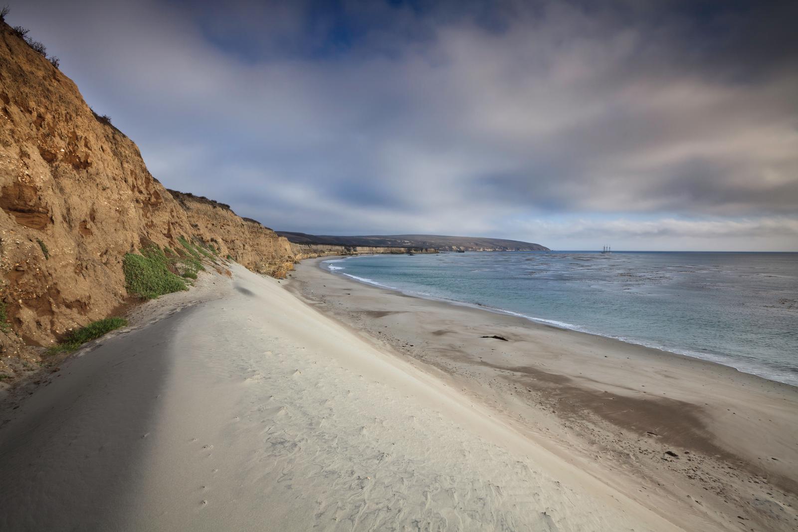
Due to the strong, persistent wind, swimming, snorkeling, diving and kayaking are limited and recommended for the experienced visitor only. Despite the wind, Santa Rosa Island offers exceptional beach walking on white sand beaches. Access to one of the best beaches, Water Canyon Beach, is just over a mile from the pier in Bechers Bay and just down canyon from the campground. Beach access is also available near the pier.
No fishing is allowed within the marine reserves located around the island. Fishing is allowed outside of these areas.
For more information about recreational activities in the park, visit https://www.nps.gov/chis/planyourvisit/index.htm.
Facilities
Primitive camping is available at Water Canyon Campground (15 sites; 5 persons per site). Picnic table, food storage box, windbreak, pit toilet and water are provided. The campground is a flat 1.5-mile hike from the pier and a 0.25-mile from the airstrip and Water Canyon Beach. Due to the boat schedule, minimum stay is generally three days.
Natural Features
Santa Rosa has a landscape of remarkable contrasts. High mountains with deeply cut canyons give way to gently rolling grass-covered hills, extensive beaches and coastal wetlands. The altitude ranges from sea level to 1,589 feet.
Nearby Attractions
Good tidepooling spots are located within Bechers Bay, including just east of the pier, the east end of Southeast Anchorage, and near East Point.
A short hike from the campground is the Santa Rosa Island Torrey pine grove. This pine is considered one of the rarest pines in the world-the last enduring members of a once widespread Pleistocene forest. Near the pier, visitors can see buildings and equipment of the historic Vail and Vickers ranch.
Access to a highly recommended beach, Water Canyon Beach, is just over a mile from the Bechers Bay pier. The sandy beach lies on the northeastern shore of the island. Bechers Bay is a destination in itself, with buildings and equipment at the historic Vail and Vickers ranch.