BUMPUS MILLS, TN Campground Reservation, Info, Images, Map, Directions

BUMPUS MILLS, Tennessee Campground Images, Info & Reservations

Directions

From Nashville, Tenn: Take I-24 west to Clarksville, TN. Follow Highway 79 South for 20 mi. to Highway 120. Follow Highway 120 for 10 mi. to Bumpus Mills, turn left onto Tobaccoport Road (Hwy. 1830) for 2.8 mi., turn left onto Oak Hill Road for . 9 mi., turn left onto Forest Trail then turn right into the campground. From I-24 East Cadiz KY: Take 68 west for 6.2mi., turn left on to HWY. 139 south for 15.3mi., continue on to TN. HWY 120 for 2.7 mi. Turn left onto Tobaccoport Road, Hwy 1830 for 2.8 mi., thurn left onto Oak Hill Road for .9 mi., turn left onto Forest Trail then into the campground.

Phone

RESOURCE MANAGERS OFFICE: (270) 362-4236, BUMPUS MILLS CAMPGROUND: (931) 232-8831

Activities

BOATING, CAMPING, FISHING, HIKING, PICNICKING, SWIMMING SITE

Keywords

BUMP,LAKE BARKLEY,BARKLEY LOCK & DAM

Related Link(s)

Rec Area Info & Images

Tennessee State Road Conditions

Tennessee State Tourism

Overview

From fishing to boating and hiking, campers and day visitors at Bumpus Mills enjoy hours of fun on the upstream section of Lake Barkley.

Many bird species reside here, including golden and bald eagles. Don’t forget to pack binoculars and a camera to take advantage of the excellent opportunities for birding and wildlife photography.

Recreation

The recreation area is ideal for hiking, fishing, swimming, picnicking and boating. Abundant wildlife includes wild turkey and deer.

Facilities

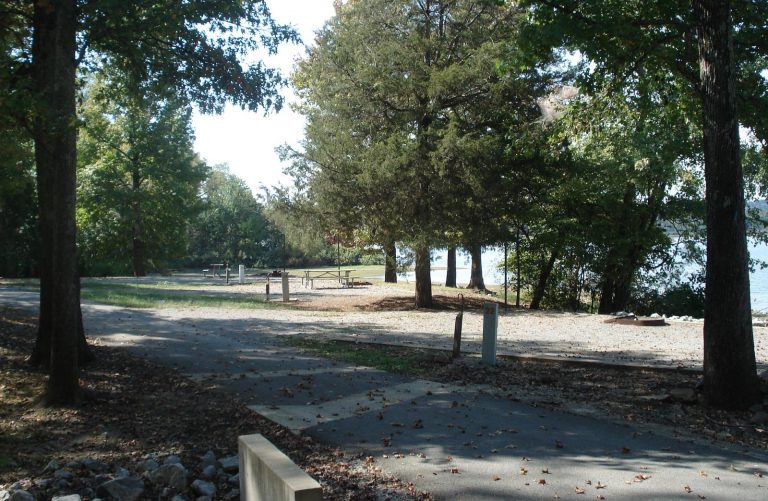
The small campground offers 15 sites with water and electric hookups. Other amenities include hot showers, a dump station, boat ramp and public marina.

Natural Features

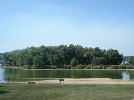
Bumpus Mills is located on scenic Lake Barkley among wooded rolling hills. Lake Barkley is the westernmost lake on the Cumberland River, which flows westward to the Ohio River.

Barkley lies parallel to Kentucky Lake, a reservoir that stems from the Tennessee River. Between both lakes is the Land Between the Lakes National Recreation Area.

Nearby Attractions

Due east is Fort Donelson National Battlefield, which marks the site of the first Union victory of the Civil War. The Bear Creek Waterfowl Management Unit is a short drive south of Bumpus Mills.

Reservation

More from CampingHiking.net:

LEIGH CREEK CAMPGROUND, Wyoming Campground Images, Info & Reservations

Directions From Ten Sleep, WY, drive 7.5 miles on Hwy 16 to FSR 018 (WY Hwy 436). Bear right and travel nearly 1 more mile to the campground. Phone 406-587-9054 Activities BIKING, BOATING, CLIMBING, FISHING, HIKING, WILDLIFE VIEWING, HOTEL/LODGE/RESORT PRIVATELY OWNED, OFF ROAD VEHICLE TRAILS, KAYAKING, STAR GAZING, BIRDING, NON-MOTORIZED

Howell Run Picnic Area, West Virginia Campground Images, Info & Reservations

Directions From Cumberland, MD, take US 220 south to US 50W, go west to WV 42N, go north to WV 46E. Follow the signs to the Howell Run Picnic Area. Phone 304 355-2346 Activities BOATING, CAMPING, FISHING, HIKING, PICNICKING, SWIMMING SITE, OTHER RECREATION CONCESSION SITE Keywords Jennings Randolph Lake,Picnic Area

MT. TIMPANOGOS, Utah Campground Images, Info & Reservations

Directions From I-15, take exit 272 for 800 north toward Orem and proceed east on Highway 52 to the mouth of Provo Canyon. Go east on Highway 189 for 7 miles to the Sundance Resort turnoff. Take Highway 92 for 6 miles. Campground will be on your right, past Sundance

SOUTH SHORE CAMPGROUND, California Campground Images, Info & Reservations

Directions From Pioneer, CA, take State Route 88 east 21.9 miles to Bear River Lake Resort sign. Turn left at the sign and go 3.4 miles to campground on right side of the road. Phone 209-295-4360 Activities BIKING, BOATING, CAMPING, FISHING, SWIMMING SITE Keywords SOSH,BEAR RIVER RESERVOIR SO.SHORE,ELDORADO NF –

DEVILS ELBOW CABIN, Alaska Campground Images, Info & Reservations

Directions Access is by boat (66 miles from Petersburg or 26 miles from Kake) or float plane (44 miles from Petersburg). A 16-foot tide is required for direct float plane access to the cabin. Arrival at lower tides will require a half-mile walk on the tide flat. Refer to USGS