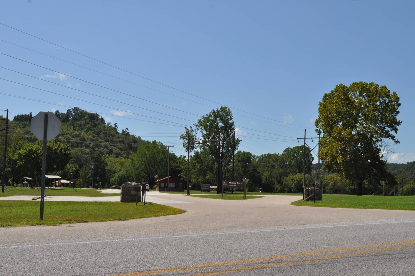
DAM - QUARRY, AR Campground Reservation, Info, Images, Map, Directions

DAM – QUARRY, Arkansas Campground Images, Info & Reservations

Directions

From Mountain Home, AR, take State Route 5 south 14 miles to Salesville, then turn left on State Route 177 for 2 miles. Park is located below Norfolk Dam. Follow signs into the campground.

Phone

870-499-7216

Activities

BOATING, CAMPING, SWIMMING SITE

Keywords

DAMQ,NORFORK LAKE,DAM QUARRY,NORFORK LAKE

Related Link(s)

Rec Area Info & Images

Arkansas State Road Conditions

Arkansas State Tourism

Overview

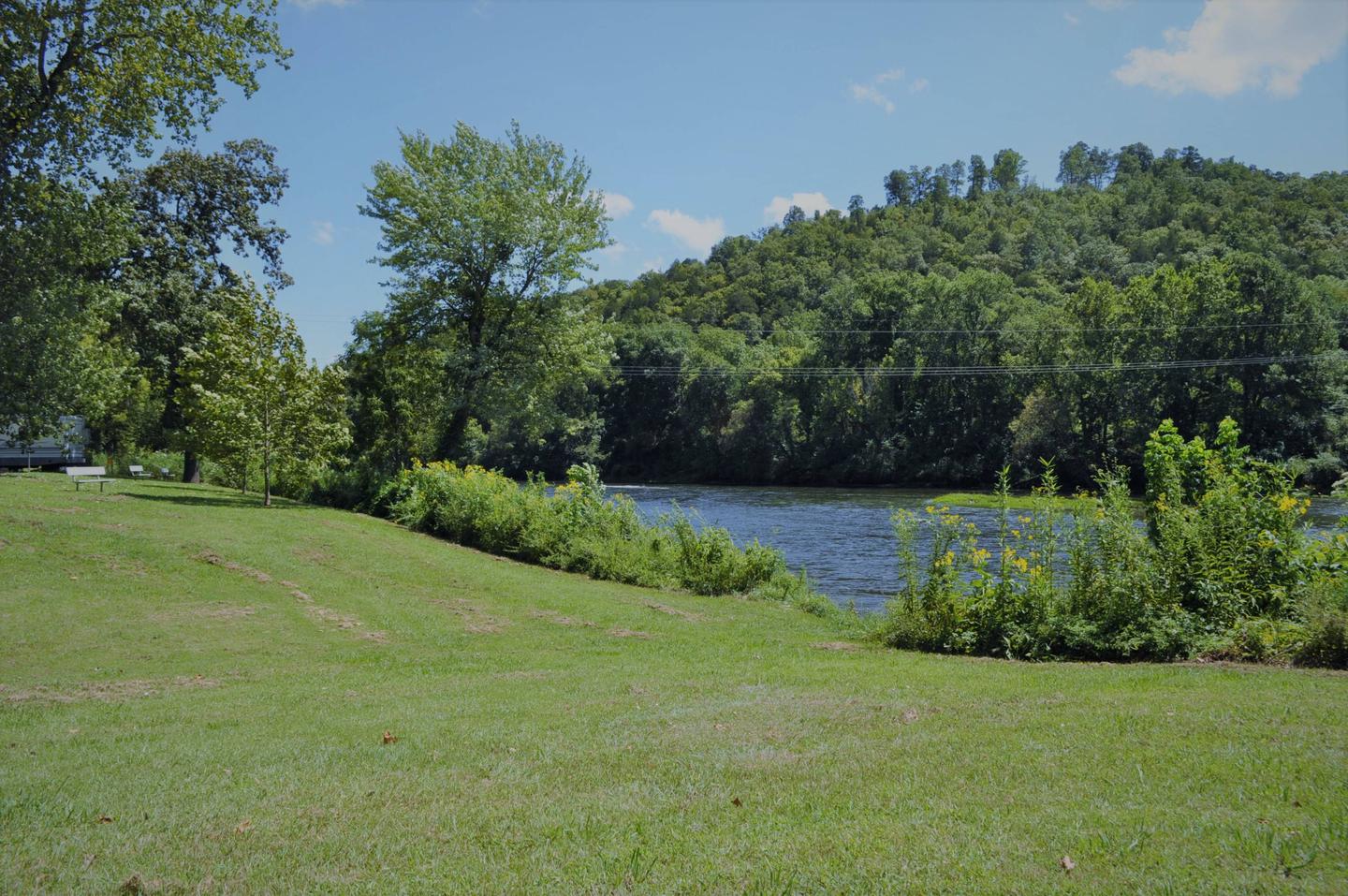
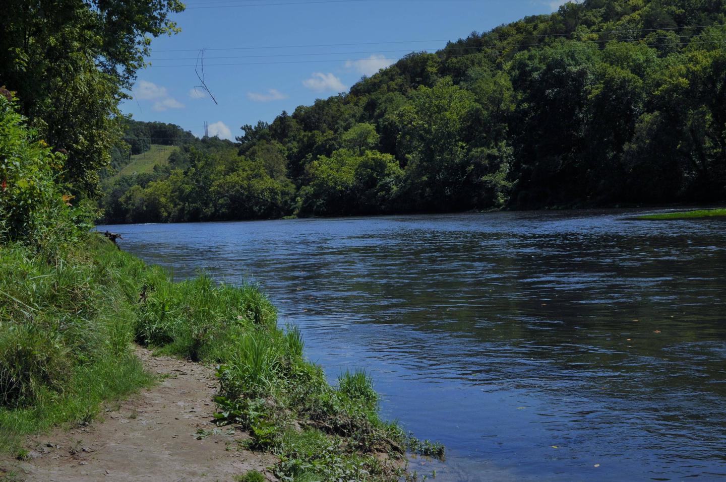
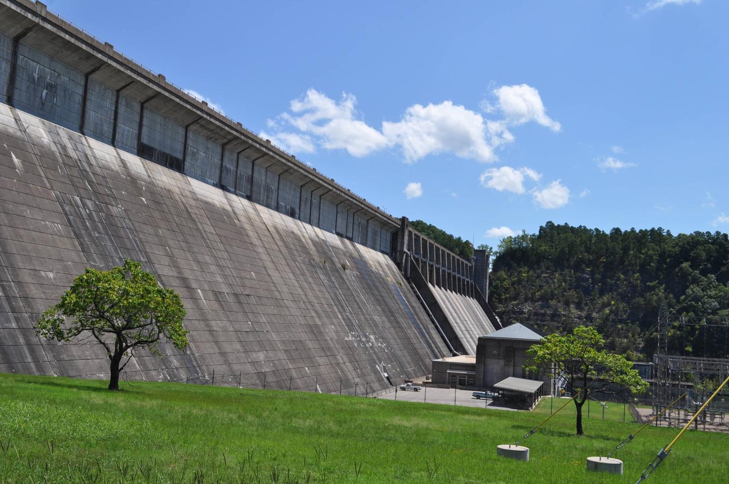
Dam Quarry Campground is an angler’s paradise. Located in northern Arkansas, just downstream of the Norfork Dam, the campground is renowned for its world-class trout fishing.

The Norfork Lake region was one of the state’s first water recreation areas with opportunities like water skiing, canoeing, scuba diving, and of course, fishing.

Recreation

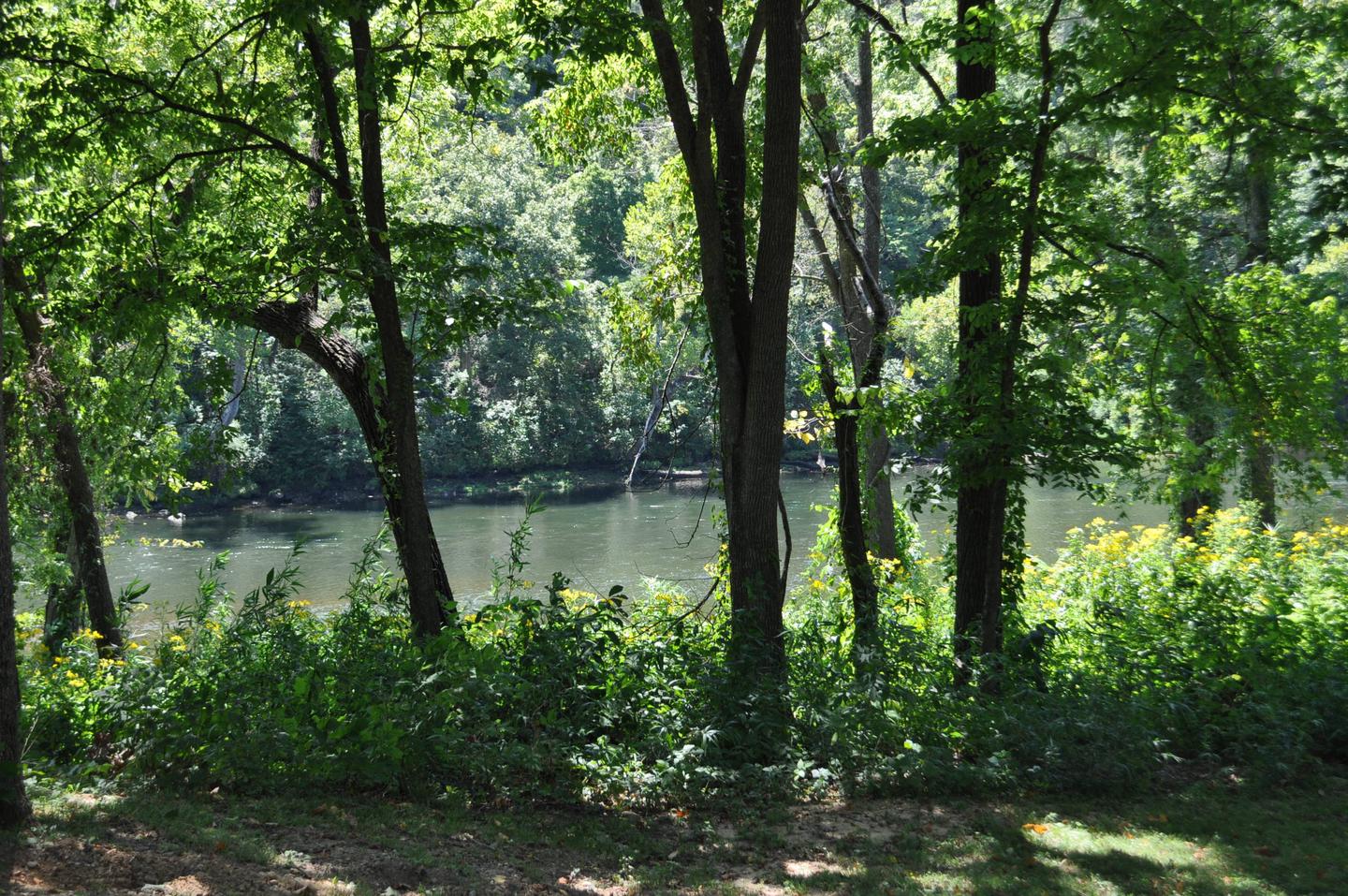
While fishing is the top-rated activity in the lower river area, kayaking, birding and hiking are also very popular.

The public land around Norfork keeps hunters busy with white-tailed deer, wild turkey, squirrel, rabbit and quail.

Facilities

Kids will enjoy the playground and everyone will find fun in the water. A boat ramp is on-site and a marina is located just above the dam. Everything but the group sites have electric hookups.

Natural Features

The campground sits at the banks of the North Fork River and Dry Run Creek. The river feeds the popular 22,000-acre Norfork Lake, which is just upstream from Dam Quarry. The site has beautiful views of the forested hills and hollows of the Ozarks.

Nearby Attractions

A short drive south takes visitors to the Ozark National Forest for sightseeing and wildlife spotting. The campground is also just three miles northeast of the small town of Norfork.

Reservation

More from CampingHiking.net:

COLORADO CAMPGROUND, Colorado Campground Images, Info & Reservations

Directions From the I-25 and Highway 24 intersection in Colorado Springs, travel west on Highway 24 for about 18 miles to the intersection with Highway 67 in Woodland Park. Turn right (north) on Highway 67 and drive about 6.7 miles to Colorado Campground. The campground is on the right side

WATAUGA POINT RECREATION AREA, Tennessee Campground Images, Info & Reservations

Directions From Elizabethton, take US 19E/321 south for five miles to Hampton. Turn left on US 321/TN 67 south for six miles, then turn left into Watauga Point.  Phone 423-735-1500 Activities BOATING, FISHING, HIKING, KAYAKING, CANOEING, STAR GAZING, NON-MOTORIZED BOATING, WATER ACCESS, SCENIC DRIVE Keywords WATAUGA POINT RECREATION AREA PAVILION

KUYKENDALL GROUP CAMP, North Carolina Campground Images, Info & Reservations

Directions From Asheville, take State Highway 280 south to Brevard. At the junction of U.S. Highway 276/64/280, follow Highway 64 west through Brevard to Cathy’s Creek Road/Forest Road 471. Take a right and go 1.25 miles to campground entrance. Phone (828) 552-8040 Activities BIKING, CAMPING, FISHING, HIKING, WATER SPORTS, SWIMMING

SHERIDAN, Montana Campground Images, Info & Reservations

Directions From U.S. Highway 212, turn off at Eastside Road and go 2 miles to the campground. The entrance is on the left. Phone 406-587-9054 Activities BIKING, BOATING, CAMPING, FISHING, HIKING Keywords SHDN,CUSTER NF – FS,SHERIDAN Related Link(s) Rec Area Info & Images Overview Sheridan Campground is located seven miles