EUREKA, KY Campground Reservation, Info, Images, Map, Directions

EUREKA, Kentucky Campground Images, Info & Reservations

Directions

From Nashville, Tennessee take I-24 West to Exit 40. Turn left onto Highway 62 West for 2.9 miles then turn left onto Highway 810. Go 0.7 miles then turn right onto State Route 1271. Continue onto 1271 for 1.8 miles. The road leads directly into the campground.

Phone

270-388-9459

Activities

BIKING, BOATING, CAMPING, FISHING, WATER SPORTS, SWIMMING SITE

Keywords

EURE,LAKE BARKLEY,BARKLEY LOCK & DAM

Related Link(s)

Rec Area Info & Images

Kentucky State Tourism

Kentucky State Road Conditions

Overview

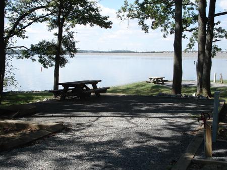
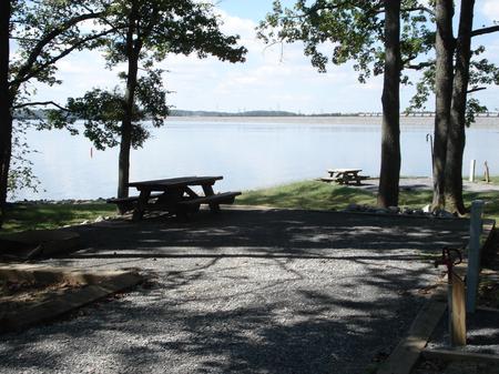
Eureka Campground sits on Lake Barkley among wooded rolling hills and abundant wildlife. Fishing is a well-loved sport here; Kentucky’s largest yellow bass was caught in these waters, and anglers flock with hopes of breaking the record.

Recreation

Hikers and bikers are fans of the 2.5 mile Chestnut Oaks Trail that starts here. Other activities include boating, fishing and swimming.

Facilities

The campground offers 26 sites with water and electric hookups. Additional amenities include hot showers, playground, boat ramp and swimming area. A picnic shelter is available for groups up to 100 guests. Electric hookups are available.

Natural Features

Lake Barkley, the western-most lake on the Cumberland River is connected by a canal to Kentucky Lake, forming one of the nation’s greatest freshwater recreation complexes. Between the two lakes is Land Between the Lakes National Recreation Area, featuring miles of hiking trails and opportunities for off-road vehicle riding.

Nearby Attractions

Visit Fort Donelson National Battlefield, where the Union Army won their first battle of the Civil War. Another great destination in the Land Between the Lakes National Recreation Area, with more than 170,000 acres of public land to explore.

Reservation

More from CampingHiking.net:

PICNIC POINT (WI), Wisconsin Campground Images, Info & Reservations

Directions From Medford, take State Highway 13 north 4 miles. Turn left (west) onto County Highway M for about 7 miles. Turn right (north) onto County Highway E and continue for about 8 miles. Turn right (east) onto Forest Road 1563 and continue for 1 mile, then turn right (south)

LAZY BEND, Oregon Campground Images, Info & Reservations

Directions From Estacada, travel east on Highway 224 for just over 10 miles to the campground. Phone 503-630-5721 Activities BOATING, CAMPING, FISHING, WATER SPORTS Keywords LAZY,MT. HOOD NF – FS Related Link(s) Rec Area Info & Images Oregon State Tourism Forest Service Concessionaire Oregon State Road Conditions Overview Lazy Bend

VAN HOOK GLADE, North Carolina Campground Images, Info & Reservations

Directions From Highlands, North Carolina, follow Highway 64 west approximately 4.5 miles. The campground entrance is on the right. Phone 828-526-5918 Activities CAMPING, FISHING, HIKING, SWIMMING SITE Keywords VANH,HIGHLANDS,NFs IN NORTH CAROLINA – FS Related Link(s) Rec Area Info & Images Forest Service Concessionaire North Carolina State Tourism North Carolina

DOGWOOD DAY USE, Utah Campground Images, Info & Reservations

Directions Take exit 301 off I-15. Turn east and travel 6 miles on 7200 South to the mouth of Big Cottonwood Canyon. Travel 2 miles up Big Cottonwood Canyon to picnic area. Phone SALT LAKE RANGER DISTRICT OFFICE 801-733-2660 OR UTAH RECREATION COMPANY 385-273-1100 Activities BIKING, CLIMBING, CAMPING, FISHING, HIKING,

SPRING CANYON GROUP SITE, Washington Campground Images, Info & Reservations

Directions Take Highway 2 west of Spokane for 65 miles to the town of Wilbur, Washington. Turn north on Highway 174 (follow road signs). Travel 19 miles and turn right at the sign for Spring Canyon Campground. Phone 509-754-7889 Activities BIKING, BOATING, HISTORIC & CULTURAL SITE, CAMPING, INTERPRETIVE PROGRAMS, FISHING,