
Directions
From Somerset, Kentucky, take Highway 80 west for 5 miles. Turn right on East Highway 1248 and continue for 2 miles. The recreation area entrance will be on the left side of the road at the bottom of the hill.
Phone
606-679-5174
Activities
BOATING, CAMPING, FISHING
Keywords
FISH,LAKE CUMBERLAND,WOLF CREEK DAM
Related Link(s)
Kentucky State Road Conditions
Overview
Fishing Creek Campground is located at 1598 E. Highway 1248 just west of Somerset, Kentucky. Fishing Creek is part of beautiful Lake Cumberland, where visitors enjoy boating, fishing and hunting.
Click here for the Lake Cumberland virtual tour.
Recreation
Lake Cumberland is the largest man-made lake east of the Mississippi River. Its large surface acreage and over 1,200 miles of shoreline provide a myriad of recreational activities.
The lake has an abundance of largemouth, smallmouth, white and Kentucky bass, bluegill, crappie, rockfish and walleye, making it a favorite among anglers.
Facilities
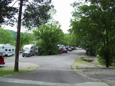
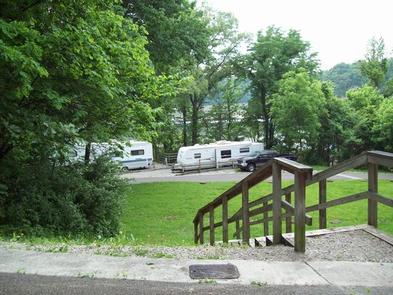
The campground offers 26 RV sites and 20 tent-only sites, all with water and electric hookups and picnic table, fire pit/grill and lantern post.
Amenities include flush toilets, showers, drinking water, washer/dryer, boat ramp and a dump station.
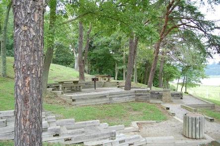
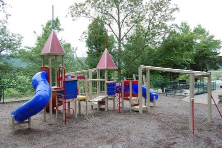
Fishing Creek also has a day-use area, picnic sites and a playground, making it an ideal spot for large parties and family functions.
Natural Features
The campground is situated above the shore of Fishing Creek on Lake Cumberland. Dense stands of mature hardwoods forest the site, offering scenic views, pleasant shade and wildlife habitat.
Because of the temperate climate and relatively long recreation season, the lake provides varied outdoor recreational opportunities for millions of visitors each year.
Nearby Attractions
Lee’s Ford Resort Marina is less than 10 minutes from the campground. It offers boat rentals, a general store, restaurant and lodging.
The Mill Springs Battlefield Park is just a 15-minute drive from Fishing Creek. This historic Civil War site offers interpretive exhibits, a gift shop and driving tour. Special events are held throughout the year, including educational programs and a thrilling reenactment.