
Directions
From Waco or Corsicana, Texas, take State Highway 31 to Dawson, turn north onto FM 709 and travel about 4 miles to the park entrance. Please note that if you are coming from the direction of Waco, you will pass FM 709 before you get to Dawson. Do not turn at the first intersection with FM 709; instead proceed into Dawson and turn left at the second intersection with FM 709.
Phone
254-578-1431
Activities
BOATING, CAMPING, FISHING, WILDLIFE VIEWING, SWIMMING SITE
Keywords
LIBE,NAVARRO MILLS LAKE,NAVARRO MILLS LAKE
Related Link(s)
Overview
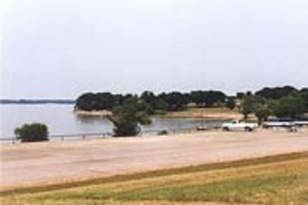
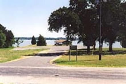
Liberty Hill Park is located on the southern shore of Navarro Mills Lake in central Texas.
Visitors can enjoy a view of the lake from the facility and participate in popular outdoor actives like camping, boating, fishing and picnicking. The lake area provides the perfect setting to get away from it all, especially for city-dwellers from the nearby Dallas-Fort Worth metro area.
Recreation
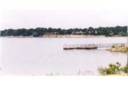
Birdwatching is a favorite year-round pastime for lake guests. Many species of songbirds, hawks, great blue herons, ducks, geese, other shorebirds and even an occasional bald eagle visit the area. Fishing is also popular at Navarro Mills, and the lake holds the current state record for white crappie. Fishermen come from near and far to sample some of the best crappie fishing anywhere. 2 multi-lane boat ramps, a fishing pier, and marina are available within Liberty Hill Park. There are also healthy populations of channel and yellow catfish, and hefty hybrid stripers are often caught below the dam when water is being released. Swimming is available at the designated swim beach from April 1- September 30 for day users and year round for registered campers. No lifeguard on duty and swimming is at your own risk. Life Jackets are available to borrow from the gatehouse.
Facilities
Liberty Hill has just over 100 campsites, most of which have electric and water hookups and several have sewer hookups. Five sites have screened in shelters that include sinks. A marina, two multi-lane boat ramps, fishing pier, swim beach, playground, group shelter and dump stations are provided within the facility.
Natural Features
Liberty Hill is also a favorite viewing area for wildflowers. The brilliant array of native flowers draws visitors from all over to the lake area during the spring. Bluebonnets, paintbrushes and a myriad of other native plants transform the often-bleak winter landscape into an incredible palette of colors. A wide variety of habitat provides a home and abundant food supply to diverse wildlife. Visitors might stumble across squirrels, rabbits, coyotes, foxes, bobcats, white-tailed deer, raccoon or armadillo.