LONE BRANCH, TN Campground Reservation, Info, Images, Map, Directions

LONE BRANCH, Tennessee Campground Images, Info & Reservations

Directions

From Nashville, TN, take I-40 East to exit 229-B/Golden Bear Gateway. Continue straight on Golden Bear Gateway for approximately 9 miles. Entrance to the recreation area will be on your left just passed Cedar Creek Club. * Golden Bear Gateway turns into Benders Ferry Road at the US-70/Lebanon Road intersection.

Phone

(615) 822-4846

Activities

BOATING, PICNICKING, DAY USE AREA

Keywords

LONE,OLD HICKORY LAKE,OLD HICKORY LAKE

Related Link(s)

Rec Area Info & Images

Tennessee State Tourism

Tennessee State Road Conditions

Overview

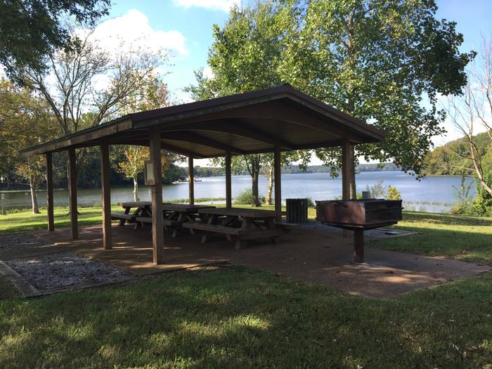
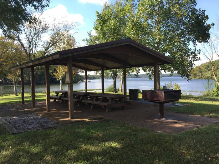
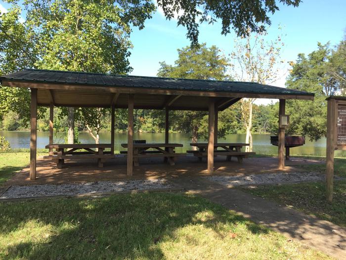
Lone Branch offers all the amenities visitors need for a peaceful Tennessee getaway. Plenty of trees to provide shade, grassy open areas to run around, grills for barbequing and a boat ramp.

Recreation

Boating and fishing are generally the main attractions for lake-goers, with anglers often catching black bass, crappie and catfish.

Facilities

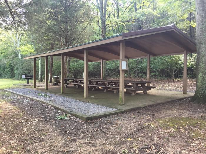
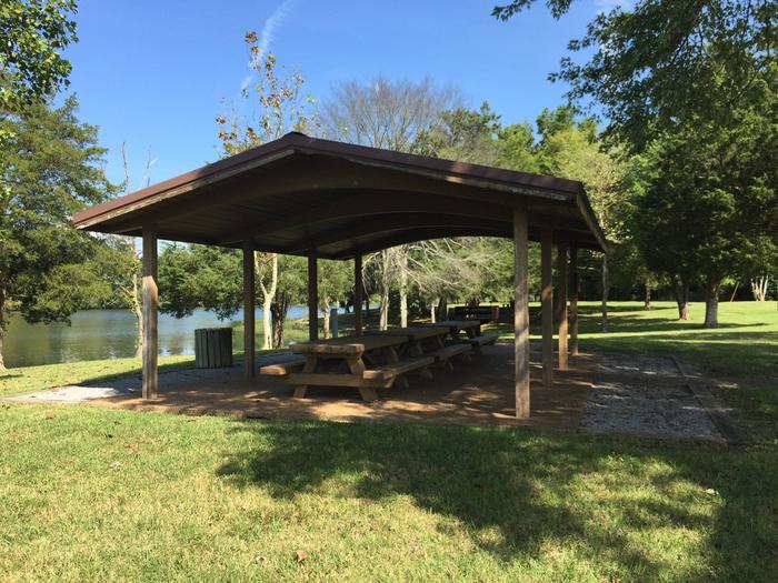
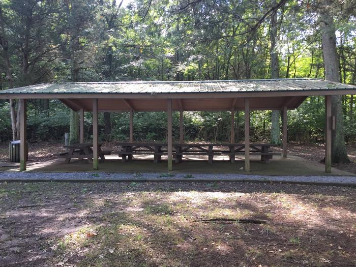
Both group picnic shelters have electric hookups and grills, and each holds up to 50 guests; however, parking may be limited. A boat ramp is also available for use.

Natural Features

Old Hickory Lake is a reservoir in north-central Tennessee created by the Old Hickory Lock and Dam.

The lake spans 22,500 acres and receives its primary inflow from the Cumberland River.

Nearby Attractions

Lone Branch is just beyond the Nashville metropolitan area. Head to the “Music City” to tour the Country Music Hall of Fame or explore former President, Andrew Jackson’s early 19th century home, The Hermitage– a National Historic Landmark.

Charges & Cancellations

If a customer cancels a group day use facility (shelter) reservation within 14 days of the scheduled arrival date, they will forfeit the total day use fee with no service fee charge.

Reservation

More from CampingHiking.net:

KUYKENDALL GROUP CAMP, North Carolina Campground Images, Info & Reservations

Directions From Asheville, take State Highway 280 south to Brevard. At the junction of U.S. Highway 276/64/280, follow Highway 64 west through Brevard to Cathy’s Creek Road/Forest Road 471. Take a right and go 1.25 miles to campground entrance. Phone (828) 552-8040 Activities BIKING, CAMPING, FISHING, HIKING, WATER SPORTS, SWIMMING

LITTCARR CAMPGROUND, Kentucky Campground Images, Info & Reservations

Directions From I-75, take Exit 38 (SR-192) east to Daniel Boone Parkway to SR-15. Travel SR-15 south to SR-160, turn north and follow for 4 miles. Campground is on the east side of SR-160. Phone 606-642-3052 Activities BOATING, CAMPING, FISHING, HUNTING, DAY USE AREA, SWIMMING SITE Keywords LITT,CARR CREEK CAMPGROUND,CARR

HANKS CREEK, Texas Campground Images, Info & Reservations

Directions From Zavalla, TX, take State Hwy 147 northeast for 1/4 mile, then turn north on FM 2109, go 8 miles to FM 2801. Turn right (east) on FM 2801 and go 2 miles to the park entrance. Follow signs into the campground. Phone 409-384-5716 Activities BIKING, BOATING, CAMPING, FISHING,

FORT SPOKANE GROUP SITE, Washington Campground Images, Info & Reservations

Directions Take State Highway 2 west of Spokane for 32 miles. Turn north on State Highway 25 at the town of Davenport and travel 24 miles. Follow the signs to the campground. Phone 509-754-7889 Activities BOATING, HISTORIC & CULTURAL SITE, CAMPING, INTERPRETIVE PROGRAMS, FISHING, HIKING, PICNICKING, VISITOR CENTER, WATER SPORTS,