WHITTEN PARK, MS Campground Reservation, Info, Images, Map, Directions

WHITTEN PARK, Mississippi Campground Images, Info & Reservations

Directions

From Interstate 22 , take Highway 25 (exit 104). Then turn left at the first red light, then turn left onto Access Road at the next traffic light. Go north 4 miles. Campground is on the left side of the road within the Jamie L. Whitten Historical Center Park.

Phone

(662) 862-7070

Activities

CAMPING, FISHING, HIKING, VISITOR CENTER, SWIMMING SITE, DISC GOLF

Keywords

WHTT,TENNESSE-TOMBIGBEE WATERWAY,TENN-TOM,FULTON CAMPGROUND,TENNESSEE-TOMBIGBE

Related Link(s)

Rec Area Info & Images

Mississippi State Road Conditions

Mississippi State Tourism

Overview

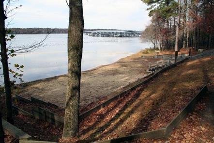
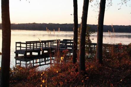
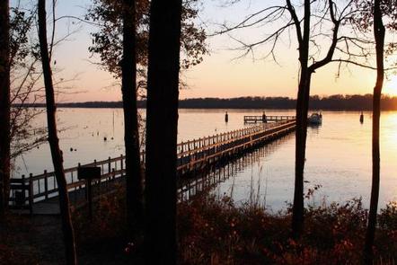
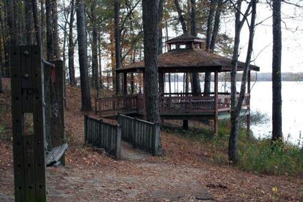
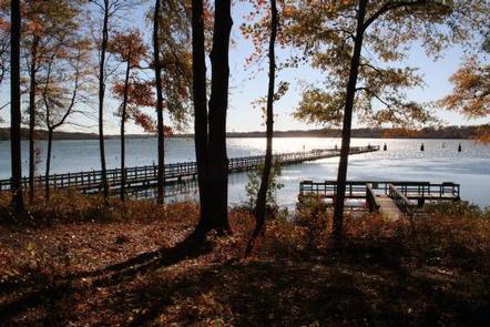
Whitten Park Campground attracts thousands of outdoor enthusiasts for picnicking, fishing and swimming on the Tennessee-Tombigbee Waterway. Easy access to three boat docks, nature trails and a sandy swimming beach with a gazebo overlooking the waterway, make Whitten Park a welcoming destination for campers.

Whitten Park is also referred to as Fulton Campground because of its location in Fulton, Mississippi.

Recreation

Anglers can try their luck on the fishing dock or go off-shore in search of bass and crappie. Hikers will enjoy many nature trails, which weave through wooded wildlife habitats.

Facilities

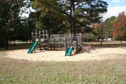
The campground offers 60 sites with electric and water hookups. The three camp loops provide easy access to playgrounds, laundry facilities and showers.

Natural Features

The Tennessee-Tombigbee Waterway extends 234 miles from the Tennessee River to the junction of the Tombigbee River in Alabama. The man-made waterway connects the nation’s midsection of commercial water transportation with the Gulf of Mexico. Features include ten lock and dams, Gainesville Lake, Aliceville Lake, Columbus Lake and Aberdeen Lake.

Nearby Attractions

Tupelo, Mississippi, known as the birthplace of Elvis Presley, is 15 miles west.

Reservation

More from CampingHiking.net:

HOUSTON SHELTER, Alabama Campground Images, Info & Reservations

Directions About 50 miles southwest of Decatur, take Highway 278 east from Double Springs for 8 miles. Turn south on County Road 63 and continue for 4 miles. Turn right onto Forest Service Road 118 and travel a mile to the campground. Phone 205-489-5111 Activities BOATING, FISHING, HIKING, WILDERNESS, DAY

HOGBACK HOMESTEAD, Montana Campground Images, Info & Reservations

Directions From Missoula, Montana, travel east on Interstate 90 for about 20 miles to exit 126. Drive south on Rock Creek Road for about 29 miles. Rock Creek Road is a hardened surface for 12 miles and the remainder is a gravel, single-lane road, with intermittent pull-outs. It is not

SOFTUK BAR CABIN, Alaska Campground Images, Info & Reservations

Directions Access to the cabin is by wheel plane only at low tide, typically a 25-minute flight from Cordova. Click here for local tide tables. Refer to USGS topographic map Cordova A-2. Phone 1 (907) 424-7661 Activities CAMPING, FISHING, HIKING, HUNTING, WILDLIFE VIEWING Keywords SOF1,CHUGACH NF – FS Related Link(s)

The Ledge Group Sites, Utah Campground Images, Info & Reservations

Directions From Moab, drive 10 miles on the Kane Creek Road. The group site is on the left hand side of the road. Phone 435-259-2100 Activities CAMPING, HIKING, PHOTOGRAPHY, MOUNTAIN BIKING, SCENIC DRIVE Keywords Related Link(s) Rec Area Info & Images Utah State Tourism Utah State Road Conditions Overview The

NORTH BEACH CABIN, Alaska Campground Images, Info & Reservations

Directions Accessible year round, weather permitting. Located 20 air miles northwest of Sitka, on the western shore of Kruzof Island. Access by boat, 45 minutes from Sitka to Mud Bay on the east side of Kruzof Island, then 7.5 mile hike or off-highway vehicle ride on old logging roads to