
Directions
From U.S. Highway 212, turn off at Rock Creek Road (Forest Road 2421). Go 0.3 miles to the campground entrance on the right.
Phone
406-587-9054
Activities
BIKING, BOATING, CAMPING, FISHING, HIKING
Keywords
PKSD,CUSTER NF – FS
Related Link(s)
Overview
Parkside Campground is located 12 miles south of Red Lodge, Montana, just off the scenic Beartooth Highway. The area is a popular location for fishing, hiking and scenic driving. Greenough Lake less than a mile away. Glacier Lake, Hellroaring and Lake Fork Trailheads are nearby. The administering organization is Gallatin Canyon Campgrounds; e-mail: gccampgrounds13@gmail.com
Recreation
The Main Fork of Rock Creek and nearby 5-acre Greenough Lake offer rainbow trout fishing. The lake is also open to canoeing and kayaking.
The Beartooth Wilderness can be accessed via the Hellroaring and Lake Fork Trailheads, both nearby. Visitors also enjoy mountain biking and hiking on the Parkside National Recreation Trail. Hellroaring Road is open to off-road vehicles.
Facilities
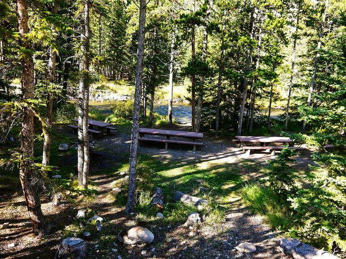
The campground offers two group sites and several single-family sites, three of which are accessible. Picnic tables and campfire rings are provided, as are accessible vault toilets and drinking water. Trash can be deposited at the Greenough Lake Campground.
Natural Features
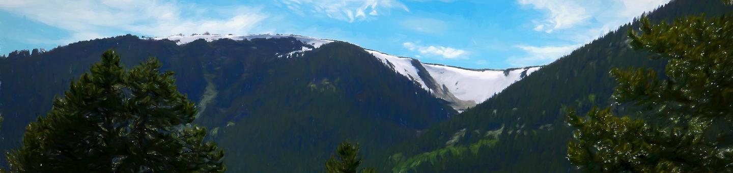
The campground sits in the shadow of the Beartooth Range on the banks of Rock Creek. A forest of aspen and pine covers the area. A variety of wildlife, including grizzly bear, deer and elk, make their home in the surrounding area.
Nearby Attractions
The charming town of Red Lodge, Montana offers a variety of dining and lodging options, galleries, shops and summer events. The Home of Champions Rodeo is held on the Fourth of July weekend, Beartooth Bike Rally and Iron Horse Rodeo in mid-July, Mountain Man Rendezvous in late July and the Festival of Nations in early August.
The Beartooth Highway was deemed “the most beautiful drive in America” by the late Charles Kuralt. It snakes across the rugged Beartooth Mountains from Red Lodge to Cooke City, Montana, and is the highest elevation highway in the Northern Rockies. Along the way, visitors are treated to sweeping views and plentiful outdoor recreation opportunities.
Yellowstone National Park’s Northeast Entrance is 55 miles from the campground via the Beartooth Highway. The park offers unparalleled wildlife viewing opportunities, as well as breathtaking scenery and unique geological features.
Charges & Cancellations
Refunds: Refund requests made through www.recreation.gov will be charged a $10 processing fee. This cancellation processing fee is retained by the reservation service contractor along with the non-refundable reservation fee. All requests for the return of the non-refundable reservation fee and the cancellation processing fee will be declined by the campground concessionaire as they did not receive these fees (these are the fees retained by the reservation contractor, a different entity).