

Directions
Travel approximately 13 miles northwest of Sisters on Highway 20/126. Turn left onto Forest Road 2070/Suttle Lake Campgrounds. Travel less than 1/2 mile to Blue Bay entrance on the right to Link Creek.
Phone
541-323-1746
Activities
BOATING, CAMPING, FISHING
Keywords
LINK,SUTTLE LAKE CAMPGROUND,DESCHUTES NF – FS
Related Link(s)
Overview
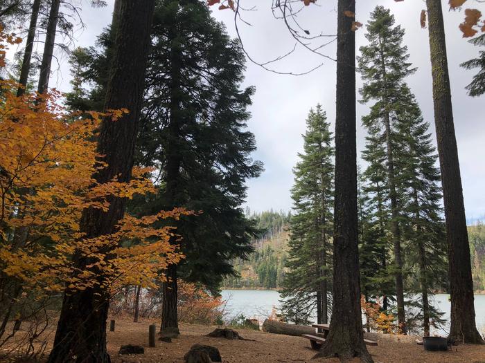
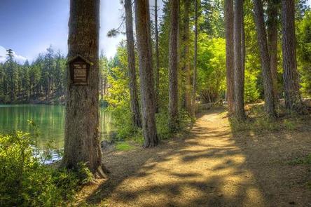
Link Creek Campground is situated on the shores of Suttle Lake in the Deschutes National Forest. Visitors enjoy boating, fishing, hiking and biking in summer, and cross-country skiing and snowshoeing in winter.
Recreation
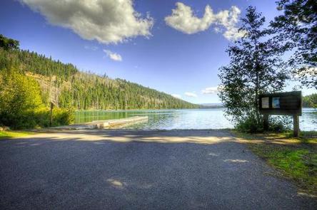
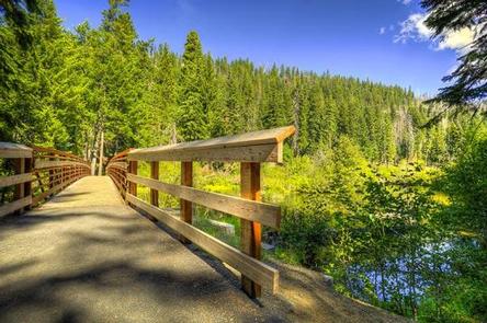
Popular activities in the area include hiking, fishing and motorized boating in the summer months, and cross-country skiing and snowshoeing in winter months. Numerous hiking mountain biking trails are accessible from the campground and in the surrounding area. The 3.2 mile Suttle Lake Loop Trail meanders through the developed recreation areas on Suttle Lake. The trail is relatively flat and follows the wooded shoreline of the lake, providing opportunities for fishing or picnicking along the way. A boat ramp is located within the campground. Motorized and non-motorized boats are allowed on Suttle Lake.
Facilities
Link Creek Campground offers tent and RV campsites, as well as yurts. Campsites are equipped with tables and campfire rings with grills. Vault toilets and drinking water are provided. Electrical hookups are not available.While the campsites are pet-friendly, unfortunately pets are not permitted within the yurts.
The yurts are available for reservation year-round. Each is equipped with a bunkbed with one double and one single mattress, double futon, table and chairs and a wood stove. Visitors need to bring their own linens, lantern and eating essentials. No electricity is available.
Natural Features
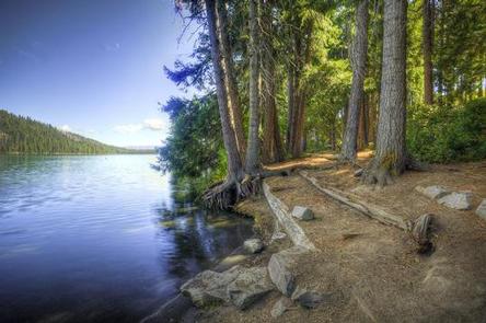
Suttle Lake is surrounded by a mixed conifer forest. The lake is deep and clear. The lake covers an area of 253 acres and has an average depth of 44 feet. It sustains an excellent population of naturally reproducing kokanee, brown trout, whitefish, and crayfish.
Link Creek, which empties into Suttle Lake, is shallow and clear enough to view spawning fish. Lake Creek flows eastward from Suttle Lake and eventually joins the Metolius River.
In autumn, the local vine maple trees display brilliant orange, red and yellow foliage.
Nearby Attractions
Visitors can explore wilderness areas, rivers, lakes and reservoirs, and approximately 1,600 miles of trails that comprise nearly 2.5 million acres within the Deschutes National Forest and the adjacent Ochoco National Forest.
Visitors enjoy traveling the Cascade Lakes Scenic Byway, known as Oregon’s Highway in the Sky, which climbs into the clouds on a 66-mile drive through the Cascade Range, weaving past snow-capped peaks and alpine lakes.