WISHON, CA Campground Reservation, Info, Images, Map, Directions

WISHON, California Campground Images, Info & Reservations

Directions

From Highway 99, turn east on 190. Travel on 190 through Springville to Wishon Drive/M208. Turn left on Wishon Drive and travel about 4 miles. The entrance to Wishon Campground is on the right as the road curves to Doyle Springs.

Phone

559-539-5230

Activities

CAMPING, FISHING, HIKING

Keywords

WISO,WISHON Sequoia Nat l Forest,SEQUOIA NF – FS

Related Link(s)

Rec Area Info & Images

Forest Service Concessionaire

California State Tourism

California State Road Conditions

Overview

Wishon Campground straddles two forks of the Tule River in the Sequoia National Forest, sitting at an elevation of 4,000 feet. A creek runs through the site into the Tule River, which originates in the Golden Trout Wilderness.

Recreation

There are many hiking and fishing opportunities in the area, including the Rose Grave Trailhead. Visitors can wade in the river at Wishon Fork.

Facilities

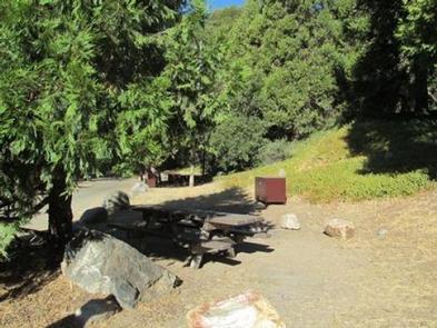
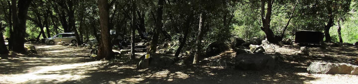
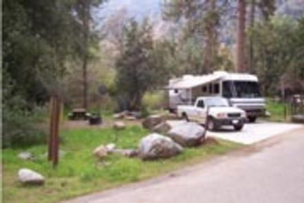
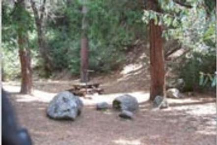
This year-round campground is configured around several loops and offers about 27 reservable campsites. Vault toilets, picnic areas and campfire rings are provided.

This facility is operated by Sequoia Recreation, a division of California Land Management and comments are welcome; comment forms are available from campground hosts or online.

Natural Features

The Sequoia National Forest, located at the southern end of the Sierra Nevada in central California, takes its name from the giant sequoia, the world’s largest tree, which grows in more than 30 groves on the Forest’s lower slopes.

The Forest comprises about 1.1 million acres, and elevations range from about 1,000 to 12,000 feet, creating precipitous canyons and mountain streams with spectacular waterfalls such as Salmon Creek Falls and Grizzly Falls.

Nearby Attractions

There are six small remnant giant sequoia groves in the area, including Wishon, Silver Creek, Burro, Maggie Mountain, Middle Tule and Upper Tule Groves.

Reservation

More from CampingHiking.net:

BIG ELK, Idaho Campground Images, Info & Reservations

Directions From Idaho Falls, Idaho, travel approximately 56 miles on Highway 26 to Palisades Dam. Once at the dam, continue 6 miles east on Highway 26, then turn left onto Forest Road 262 (Big Elk Creek Road) and travel 2 miles to the campground. Phone (208) 270-0150 OR 541-351-1182 Activities

SANDY BEACH PICNIC AREA, Wyoming Campground Images, Info & Reservations

Directions From U.S. 191 in Pinedale, Wyoming, travel north onto Skyline Drive. After 2.5 miles, turn left onto Forest Service Road 749. Follow the road to the left at the "Y" intersection, and continue for a half-mile to the entrance of Sandy Beach. Phone 307-367-4326 Activities BOATING, CAMPING, FISHING, SWIMMING

JOE GRAHAM HORSE CAMPGROUND, Oregon Campground Images, Info & Reservations

Directions From Sandy, travel east on Highway 26 for approximately 40 miles to Skyline Road (Road 42). Turn right onto Skyline Road and travel south for 9 miles to the campground. Phone 503-630-5721 Activities BOATING, HISTORIC & CULTURAL SITE, CAMPING, FISHING, HIKING, WILDLIFE VIEWING, SWIMMING SITE Keywords JOE1,MT. HOOD NF

RIVERSIDE CAMPGROUND (MT), Montana Campground Images, Info & Reservations

Directions From Martin City, Montana, turn off Highway 2 and continue on the main road through the town heading south. This road becomes the East Side Reservoir Road and is paved for the first 3 miles. Continue for about 20 miles to the campground. Phone 406-752-7924 FOR RESERVATIONS CALL: 1-877-444-6777

SHIRTTAIL CREEK, California Campground Images, Info & Reservations

Directions From either east bound or west bound Interstate 80 take exit 121, Auburn Ravine Road to Foresthill. Continue east for 17 miles, to Foresthill. Travel through town, about 9 miles, to Forest Road 10/Sugar Pine Road. Turn left and continue 9 miles to the Sugar Pine Campgrounds road (approximately

MAGEE RANGERS CABIN, Idaho Campground Images, Info & Reservations

Directions Access #1: From I-90, take Exit #43 (Kingston) and drive 24 miles north on Forest Highway 9 (two lane paved highway) to the Prichard Junction. Continue on Forest Road 208 for 28 miles to the end of the pavement and the start of Forest Road 6310 (a gravel road