REDWOOD MEADOW, CA Campground Reservation, Info, Images, Map, Directions

REDWOOD MEADOW, California Campground Images, Info & Reservations

Directions

From Highway 99 turn east on J22. Travel on J22 through California Hot Springs to the "T" intersection and turn left on M50. Travel on M50, 10 miles. Turn left at M107 and travel approximately 4 more miles to the campground entrance on the right.

Phone

559-539-5230

Activities

CAMPING, HIKING, PICNICKING

Keywords

REDW,GIANT SEQUOIA NATIONAL MONUMEN,SEQUOIA NF – FS

Related Link(s)

Rec Area Info & Images

California State Road Conditions

California State Tourism

Overview

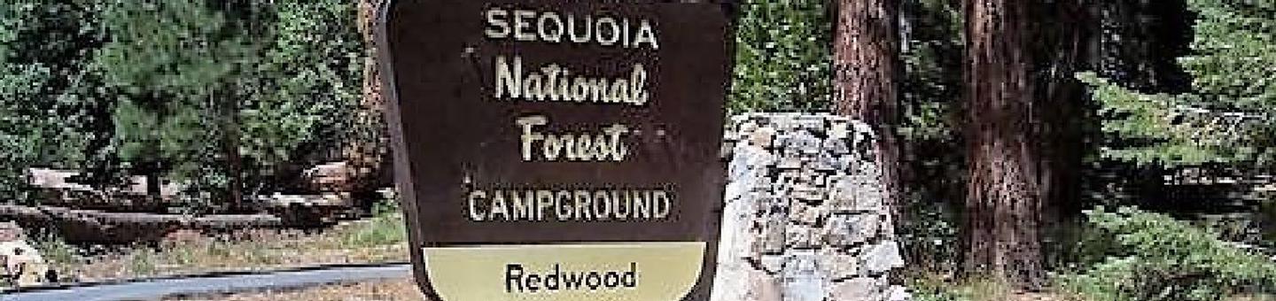
Redwood Meadow Campground located within Sequoia National Forest, in the southern portion of Giant Sequoia National Monument. The area is named for the giant sequoia, the world’s largest tree, which grows in more than 30 groves on the forest’s lower slopes.

Recreation

Touring the Sequoia National Monument is the area’s most popular activity. Hikers enjoy the Trail of a Hundred Giants as it wanders through the ong Meadow Giant Sequoia Grove. Other points of interest within the sourthern section include the Belknap Grove and the Freeman Grove.

Facilities

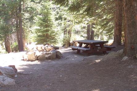
Redwood Meadow offers 6 singles sites and 6 yurts which can accommodate up to 6 people. No hookups or water available. Vault toilets are provided. This facility is operated by Sequoia Recration, a division of California Land Management and comments are welcome; comment forms are available from campground hosts or online.

Natural Features

Sequoiia National Forest comprises about 1.1 million acres. Elevations range from about 1,000 to 12,000 feet, creating precipitous canyons and mountain streams with spectacular waterfalls such as Salmon Creek Falls and Grizzly Falls. The campground sits at an evelvation of 6,400 feet, near trails that wind through gian sequoia groves, climb up mountains and meander along wild rivers.

Nearby Attractions

Trail of a Hundred Giants

Reservation

More from CampingHiking.net:

TOLLGATE, Oregon Campground Images, Info & Reservations

Directions From Portland, travel southeast on Highway 26 for about 32 miles. Phone 503-630-5721 Activities BIKING, HISTORIC & CULTURAL SITE, CAMPING, FISHING, HIKING Keywords TOLL,MT. HOOD NF – FS Related Link(s) Rec Area Info & Images Forest Service Concessionaire Oregon State Road Conditions Oregon State Tourism Overview Tollgate Campground is

Lone Mesa Group Sites, Utah Campground Images, Info & Reservations

Directions From Moab, drive nine miles north on Hwy 191 to the intersection with Hwy 313. Turn west on Hwy 313 and drive eight miles then turn right on the Dubinky Road and go approximately 200 yards to the campground entrance road. Turn right and proceed up a small hill

POSEY LAKE CAMPGROUND, Utah Campground Images, Info & Reservations

Directions From Highway 12 in Escalante, turn north at 300 East at the elementary school at the Posey Lake/Hell’s Backbone sign. Travel 14 miles to junction of Forest Roads 153 and 154, keep left and travel 2 miles to Posey Lake Campground. Site access can be difficult; about 14 miles

RIVER FOREST GROUP SITE, Florida Campground Images, Info & Reservations

Directions From Deland, Florida, drive west on State Route 44 to the first intersection after crossing the St. Johns River. Turn right on County Road 42, and the entrance to the campground is on the right. Phone 352-625-2520 Activities CAMPING, FISHING, HIKING Keywords RFGS,NFs IN FLORIDA – FS Related Link(s)

POINT CAMPGROUND, Idaho Campground Images, Info & Reservations

Directions Take State Highway 75 south from Stanley, Idaho, for 6 miles. Go west on Forest Road 214 for approximately 1.7 miles. Turn right onto Forest Route 213, drive a short distance and turn at Point Campground entrance. Phone 928-537-8888 Activities BIKING, BOATING, CAMPING, FISHING, HIKING, HORSEBACK RIDING, WATER SPORTS,