GIANT GAP, CA Campground Reservation, Info, Images, Map, Directions

GIANT GAP, California Campground Images, Info & Reservations

Directions

From Interstate 80, take the Auburn/Ravine Road exit. Continue east for 17 miles to Foresthill. Travel through town, about 9 miles, to Forest Road 10/Sugar Pine Road. Turn left and drive 9 miles, crossing a boat ramp and the dam, to the Sugar Pine Campground. Turn right and continue over a mile to the campground.

Phone

530-367-2224

Activities

BIKING, BOATING, CAMPING, FISHING, HIKING, SWIMMING SITE

Keywords

GIGA,Sugar Pine Reservoir,TAHOE NF – FS

Related Link(s)

Rec Area Info & Images

California State Road Conditions

California State Tourism

Overview

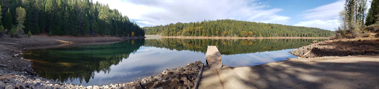
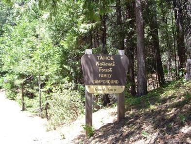
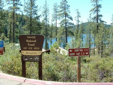
Giant Gap Campground is located on the north shore of Sugar Pine Reservoir, in the Tahoe National Forest. It is just 15 miles from Foresthill. Visitors enjoy the surrounding area for its fishing, canoeing,  OHV and hiking opportunities.

Recreation

Fishing, canoeing, swimming and boating are popular activities on the reservoir. A paved, non-motorized trail circles the campground and connects to the day use area and Shirttail Creek Campground.

The North Fork of the American River is nearby, with additional fishing and swimming. Many miles of hiking and off-road vehicle trails are in the surrounding area.

Facilities

The campground offers several single- and double-family campsites, a few of which are accessible. Picnic tables, campfire rings and grills are provided, as are vault toilets and drinking water. Firewood is available for purchase from the host.

Natural Features

The campground and the adjacent 160-acre Sugar Pine Reservoir are situated at an elevation of 3,600 feet. The campground is situated in stands of cedar and ponderosa pine trees. Summertime temperatures are hot during the day and cool at night.

Reservation

More from CampingHiking.net:

JUMBO ROCKS CAMPGROUND, California Campground Images, Info & Reservations

Directions Take Interstate 10 to State Highway 62. Turn south on Park Blvd. Continue 5 miles to the West Entrance; Jumbo Rocks is approximately 18 miles from the entrance. If coming from the east, taking Interstate10, take the Desert Center exit north onto State Highway 177. Continue on State Highway

ANCHOR PASS CABIN, Alaska Campground Images, Info & Reservations

Directions The cabin is approximately 50 air miles north of Ketchikan, located on the mainland shore of Anchor Pass across from the east end of Bell Island. It is accessible by floatplane or by boat. A mooring buoy is provided at the site on a first come-first serve basis. Refer

PINE FLATS (ID), Idaho Campground Images, Info & Reservations

Directions From Boise, Idaho, take Highway 55 to Banks. Turn east and travel on the Banks-Lowman Highway for 28 miles to the campground. Phone 208-259-3361 Activities BIKING, BOATING, HISTORIC & CULTURAL SITE, CAMPING, FISHING, HIKING, HUNTING, VISITOR CENTER, WILDLIFE VIEWING Keywords PINF,BOISE NF – FS Related Link(s) Rec Area Info

GRAHAM CORRAL HORSE CAMPGROUND, Oregon Campground Images, Info & Reservations

Directions From Sisters, OR: Travel 4.2 miles west on Highway 242 (McKenzie Pass Highway), then 2.0 miles north on Forest Road 1012, and then 0.8 miles northwest on Forest Road 1012 300. Phone 541-323-1746 Activities CAMPING, HORSEBACK RIDING, HORSE CAMPING Keywords Related Link(s) Rec Area Info & Images Oregon State

OLD HIGHWAY 25, Arkansas Campground Images, Info & Reservations

Directions From Heber Springs, AR, take SR-25 6.25 miles north to SR-25S. Travel SR-25S 3 miles west and follow signs to campground. Phone 501-250-0483 Activities CAMPING, SWIMMING SITE Keywords OH25,GREERS FERRY LAKE,OLD 25,TUMBLING SHOALS,HEBER SPRINGS,GREERS FERRY LAKE Related Link(s) Rec Area Info & Images Arkansas State Road Conditions Arkansas State