

Directions
Access to the cabin is by floatplane or canoe/kayak with portage. It is about a 45-minute flight from Juneau. By canoe and portage, it is about 6.5 miles from Mole Harbor. Refer to USGS topographic map Sitka C-1, C-2. Click here for information about reaching Forest Service cabins.
Phone
907-586-8800
Activities
BOATING, CAMPING, FISHING, HIKING, WILDLIFE VIEWING
Keywords
LADE,TONGASS NF – FS
Related Link(s)
Overview
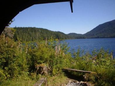
Lake Alexander Cabin offers recreation, relaxation and a unique wilderness lodging experience in Tongass National Forest, on the northwest end of Lake Alexander, a part of the Admiralty Island Canoe Route. The remote site offers a scenic setting for hiking, fishing, canoeing and wildlife viewing.
Access to the cabin is via floatplane or canoe/kayak with portage. Visitors are responsible for their own travel arrangements and safety, and must bring several of their own amenities.
Recreation
Anglers will find Lake Alexander to be a scenic setting for catching cutthroat trout and Dolly Varden. Visitors are welcome to use the skiff with oars available at the cabin, and may choose to bring a small outboard motor. The motor must be less than 10 horsepower due to wilderness regulations. Visitors must bring personal floatation devices.
Originally built by the Civilian Conservation Corps (CCC) in the 1930s, the Admiralty Island Canoe Route features portages of varying difficulty linking seven mountain lakes in the heart of Admiralty Island’s Kootznoowoo Wilderness between Angoon and Seymour Canal. Several trails are accessible by boat along the route, offering access to pristine wilderness settings.
From the cabin, a 2.4-mile trail from the east end of the lake goes to Mole Harbor. A paddle through Lake Alexander to the west end of the Beaver Lake leads to a .25 mile trail to Hasselborg Lake.
Facilities
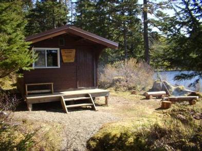
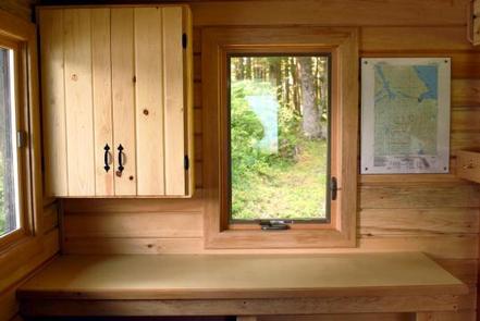
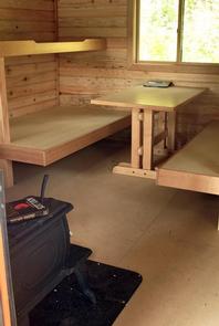
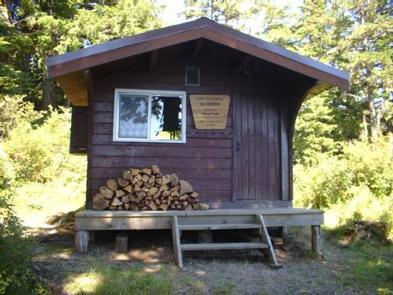
The primitive, pre-cut cedar, pan-abode style log cabin sleeps up to six people on wooden bunkbeds without mattresses. The cabin is equipped with a table, benches, a wood stove for heat and an outside toilet. Firewood is generally stacked in a woodshed near the cabin, but it is not guaranteed. The cabin does not have running water or electricity. Visitors must bring their own food, water, sleeping bags, sleeping pads, cook stoves, matches, cooking gear/utensils, light source, toilet paper, first aid kit and garbage bags. Water from any natural site must be filtered, boiled or chemically treated before drinking. Click here for more cabin details.
Natural Features
The cabin is situated under a canopy of old-growth forest, overlooking scenic Lake Alexander at an elevation of 350 feet.
The cabin is located in the Kootznoowoo Wilderness which encompasses 956,255 acres of the island. Dense spruce and hemlock forests, lakes and muskeg define the landscape, while distant rocky peaks tower along the island’s high crest, reaching elevations of over 3,000 feet.
Wildlife in the area abounds. Sitka black-tailed deer find habitat in the dense forest and bald eagles perch in treetops along most beaches. Brown bear frequent the area as well.
Nearby Attractions
Admiralty Island has a rich cultural heritage, which is evident in the traditional native village of Angoon, the island’s only permanent settlement.