

Directions
Access to Admiralty Cove Cabin is by floatplane or boat with anchor. Admiralty Cove is a small, open cove within Young Bay, on the north end of Admiralty Island. Upon arrival, look for a large pruned opening in the beach fringe visible from the water while approaching the east side of the little island in Admiralty Cove. This cabin is in a designated Wilderness area, and access by helicopter is illegal. One-way flight time from Juneau is 15 minutes, and by boat it is 20 miles. Tides affect access to the cabin (click here for local tide tables). Refer to USGS topographic map Juneau A-2. Click here for information about reaching Forest Service Cabins.
Cabin users need to be aware of the large tide flat in Admiralty Cove. Much of the cove will go dry as the tide recedes, therefore boat and float plane access is effectively restricted to a 15-foot or higher incoming tide. Better anchorage exists to the west of the little island in Admiralty Cove. Anchorage in this location may require the use of hip waders to cross Admiralty Creek to reach the cabin.
Phone
907-586-8800
Activities
BOATING, CAMPING, FISHING, HIKING, WILDLIFE VIEWING
Keywords
ADOE,TONGASS NF – FS
Related Link(s)
Overview
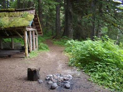
Admiralty Cove Cabin offers guests recreation, relaxation and a unique wilderness lodging experience on the northern tip of Admiralty Island in the Tongass National Forest. The remote site offers a scenic setting for hiking, beachcoming, berry picking, and wildlife viewing, all within the vicinity of the cabin.
Access to the cabin is float plane or boat. Visitors are responsible for their own travel arrangements and safety, and must bring several of their own amenities.
Recreation
Fishing is available in the stream adjacent to the cabin, as well as at nearby Young Bay, where cutthroat trout, Dolly Varden and coho salmon may be found.
Several primitive trails extend from the cabin into the forest. The 4.5-mile Admiralty Cove-Young Lake trailhead is at the cabin’s doorstep, and heads from the cabin to the North Young Lake cabin. It is a relatively flat trail and follows the creek at each end of the trail. The round-trip hike can be fairly strenuous when conditions are rainy and wet.
Beachcoming is another pastime for visitors in the spring, as winter storms wash up Japanese fishing floats, shells, bottles, and other wave-swept treasures from the open ocean.
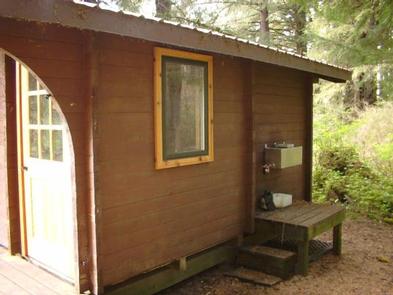
Facilities
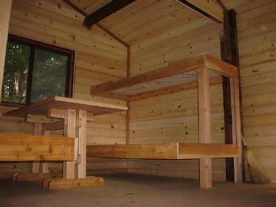
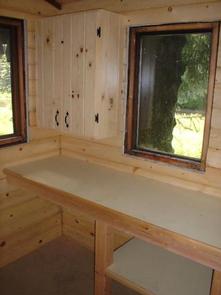
The primitive, log cabin (pan-abode style) is furnished with wooden bunks, without mattresses, and can accommodate up to six people. It is also equipped with a table, benches, an oil stove for heat and an outside toilet. Other amenities include cooking counters, shelves, cupboard space and a broom. A campfire ring is located outside the cabin.
The cabin does not have running water or electricity, and guests must bring their own water, food, sleeping bags, sleeping pads, cook stoves, matches, cooking gear/utensils, light source, No.1 stove oil (anticipate five to 10 gallons for a week), toilet paper, first aid kit and garbage bags.
Click here for more cabin details.
Natural Features
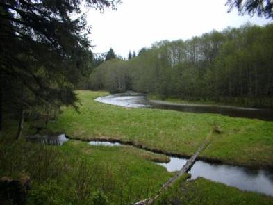
The cabin rests on a level, forested bench overlooking Admiralty Creek and a large grassy tidal meadow. It is located approximately a quarter-mile from a saltwater beach in Admiralty Cove within Young Bay. Dense spruce and hemlock forests, glacier-fed streams, lakes and muskeg openings define the landscape, while rocky spires rise along the island’s high crest in the distance.
Sitka black-tailed deer stay well hidden in the dense forest but bald eagles are easily found in treetops along most beaches. Harbor Seals, Steller sea lions, and Humpback whales feed near rafts of waterfowl, and brown bears are abundant in the area (learn more about bear safety).